

Covering about 3.4 million acres, Death Valley is the largest national park in the continental United States. We spent five days there and saw a lot — a temporary return of an ancient lake, sculpted badlands, sand dunes, and volcanic hills streaked with color, along with a ghost town, abandoned mines, and the Racetrack Playa, where rocks move across the surface on their own.
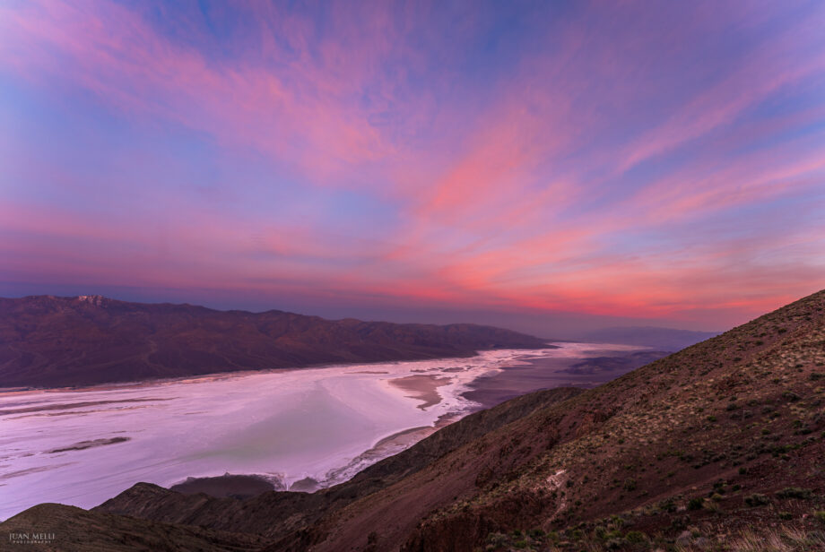
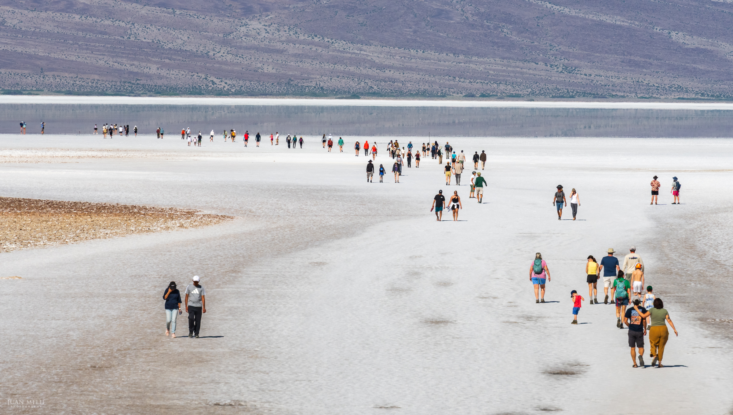
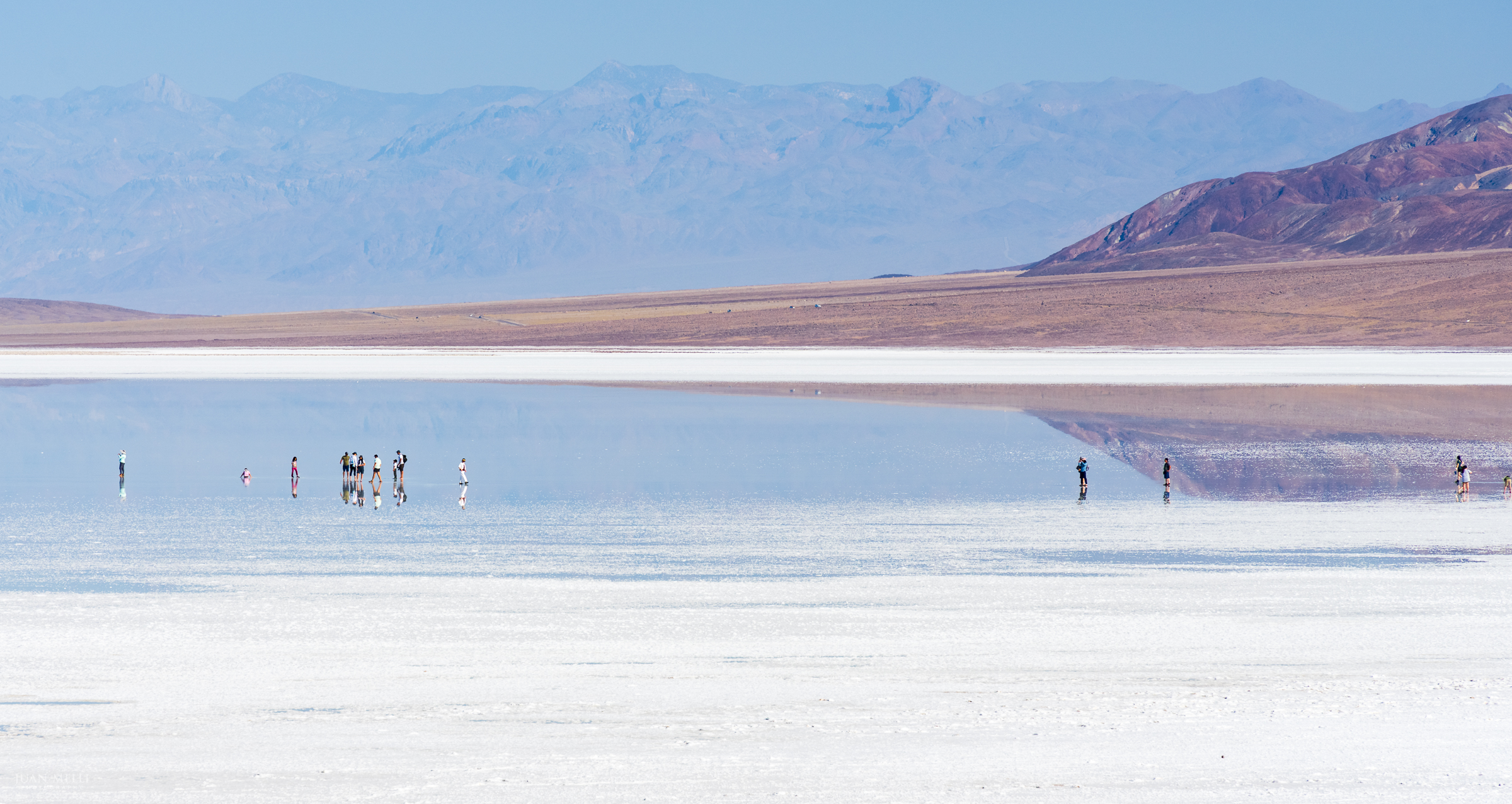
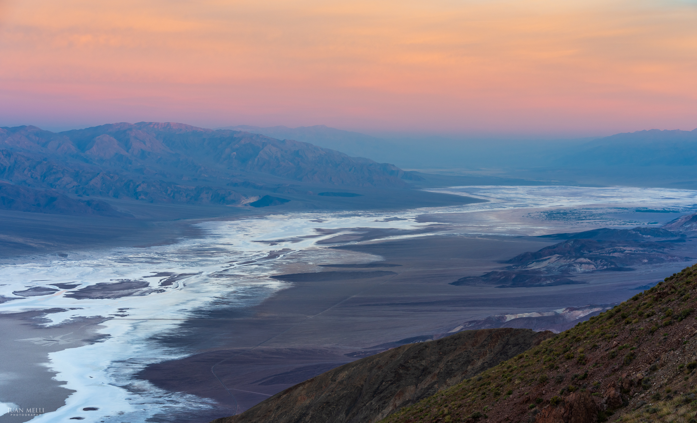
Lake Manly at Badwater Basin
After the wettest fall on record in 2025, Badwater Basin — the lowest point in North America at 282 feet below sea level — briefly filled again, creating a rare modern return of Lake Manly, an ancient lake that vanished thousands of years ago.
The water was still there when we arrived in late March, only weeks before it fully evaporated.
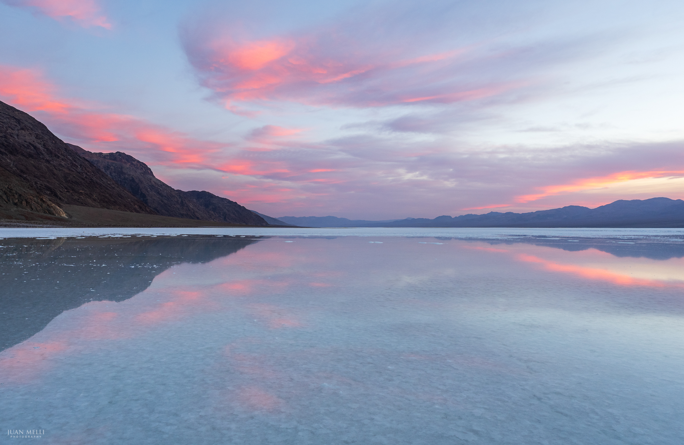
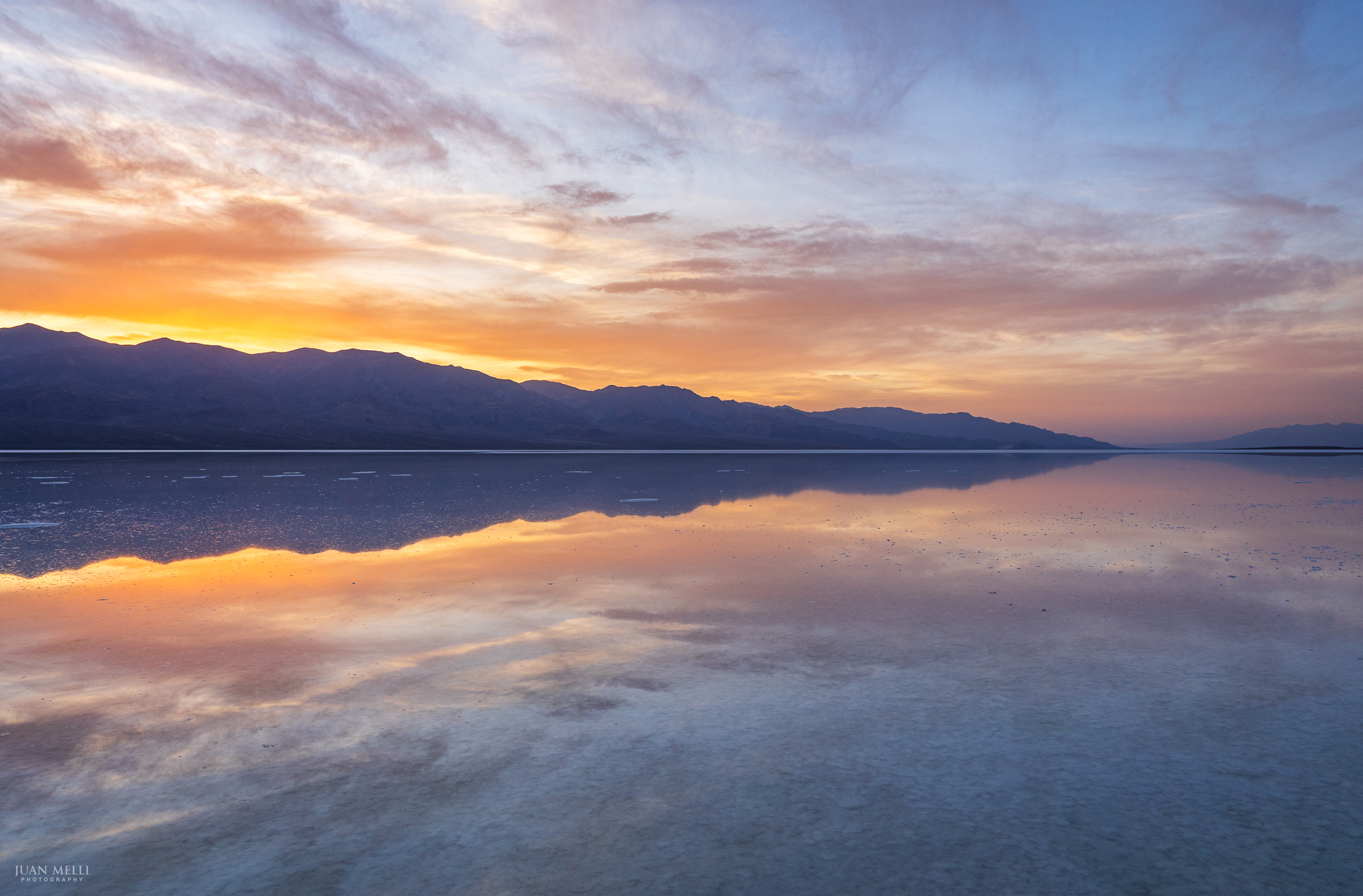
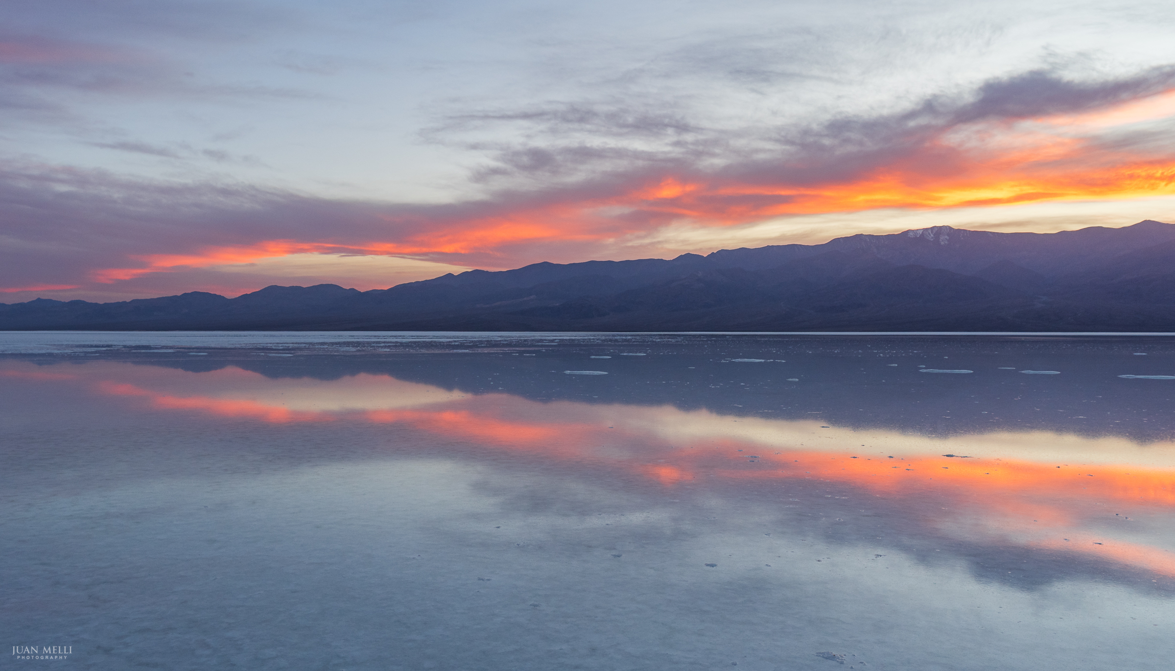
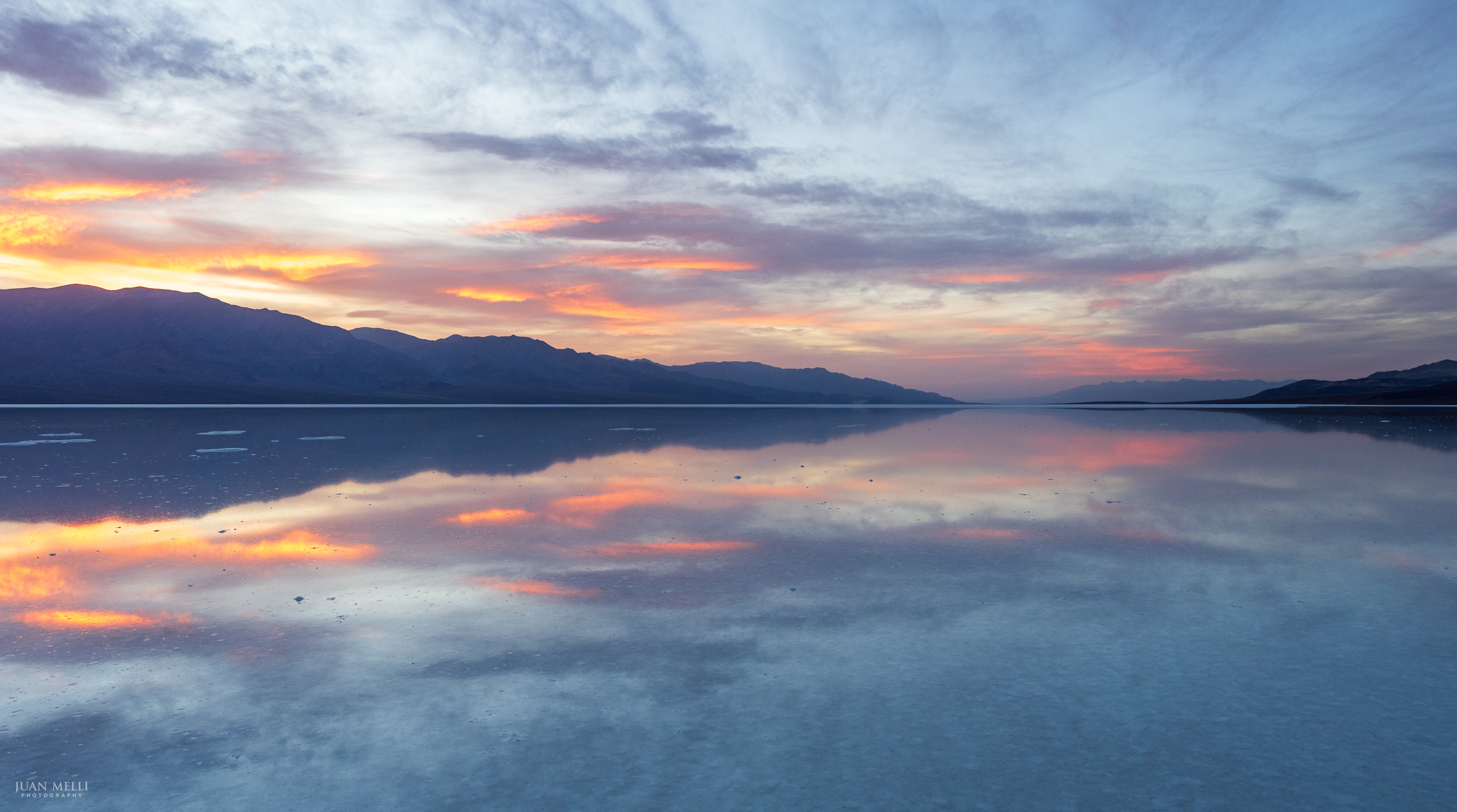
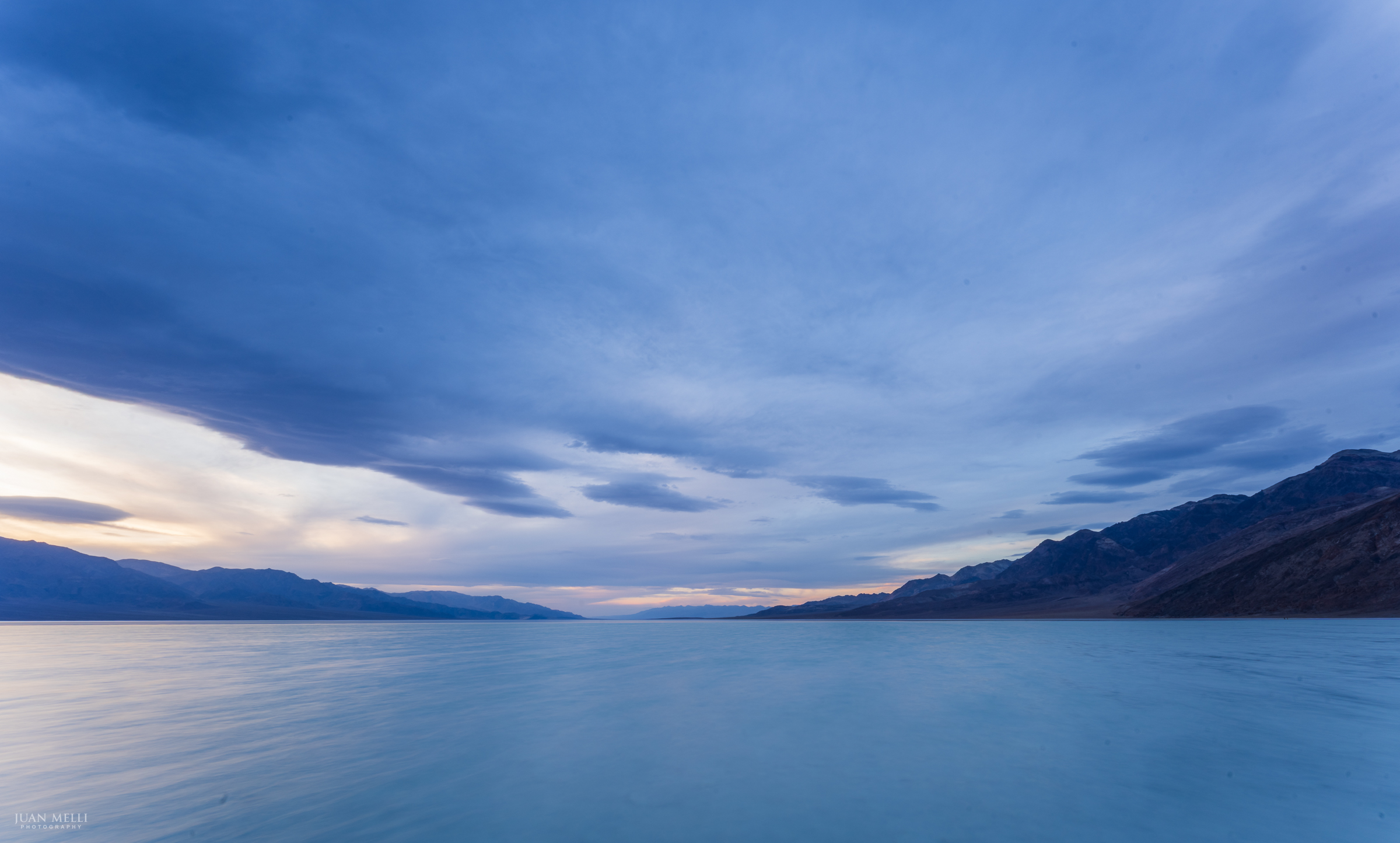
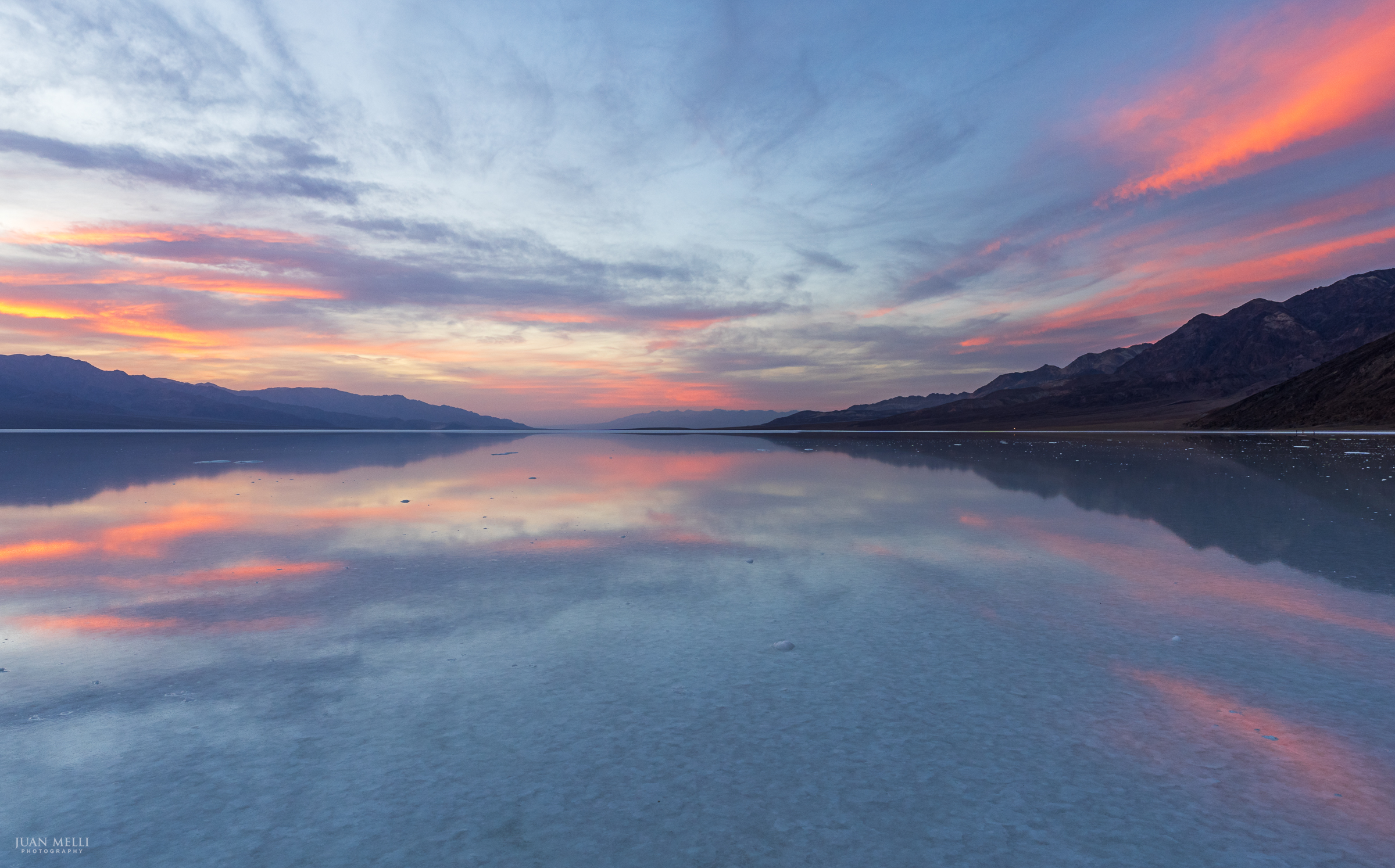
These photos were taken at sunset, standing about a mile into the lake, where it was about 2-3 inches deep. I wore muck boots to spare my shoes from the extremely salty water.
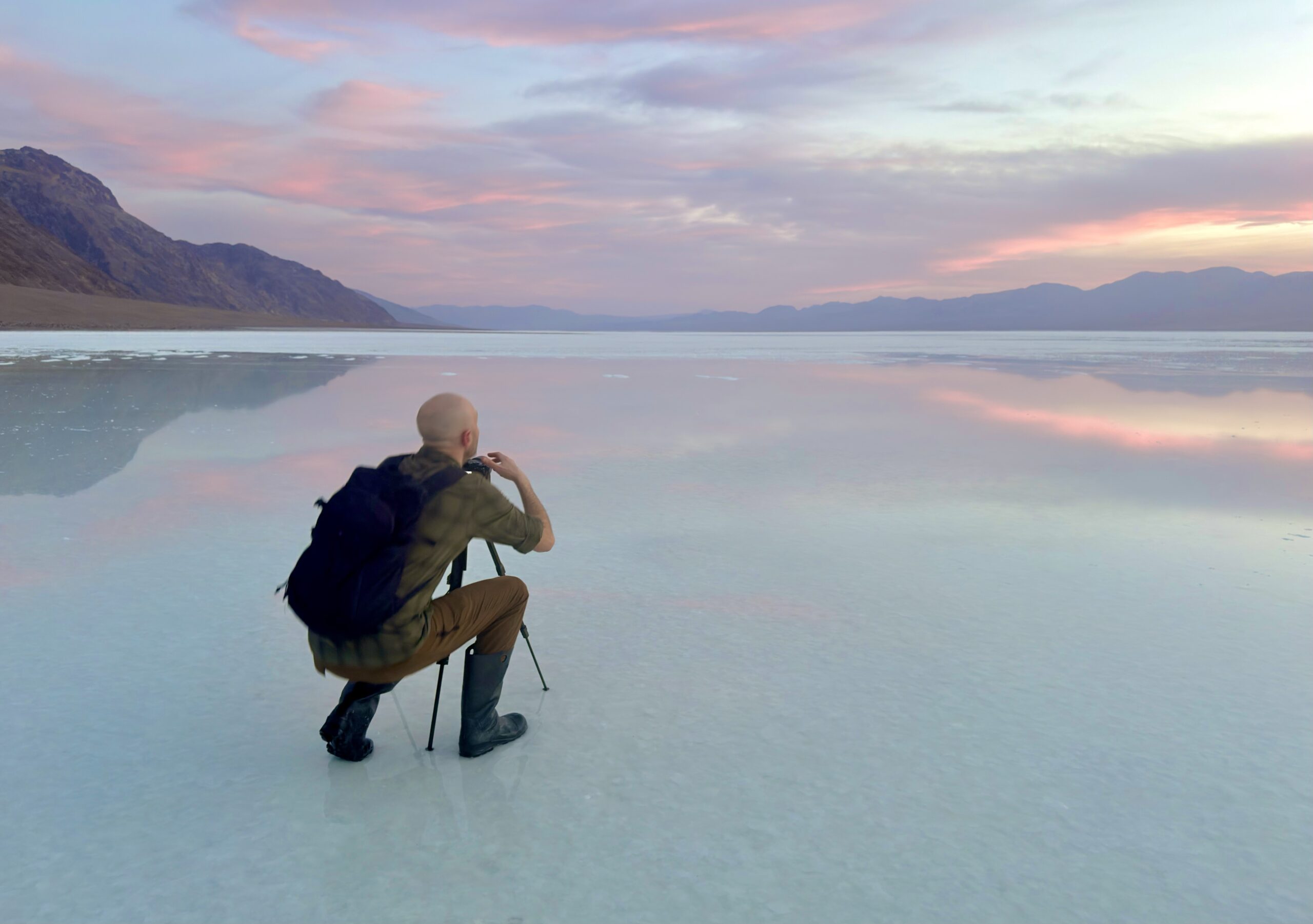
Even when it’s not flooded, Badwater Basin, an otherworldly site of salt flats, is the most popular attraction in the park.
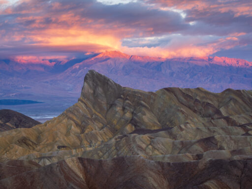
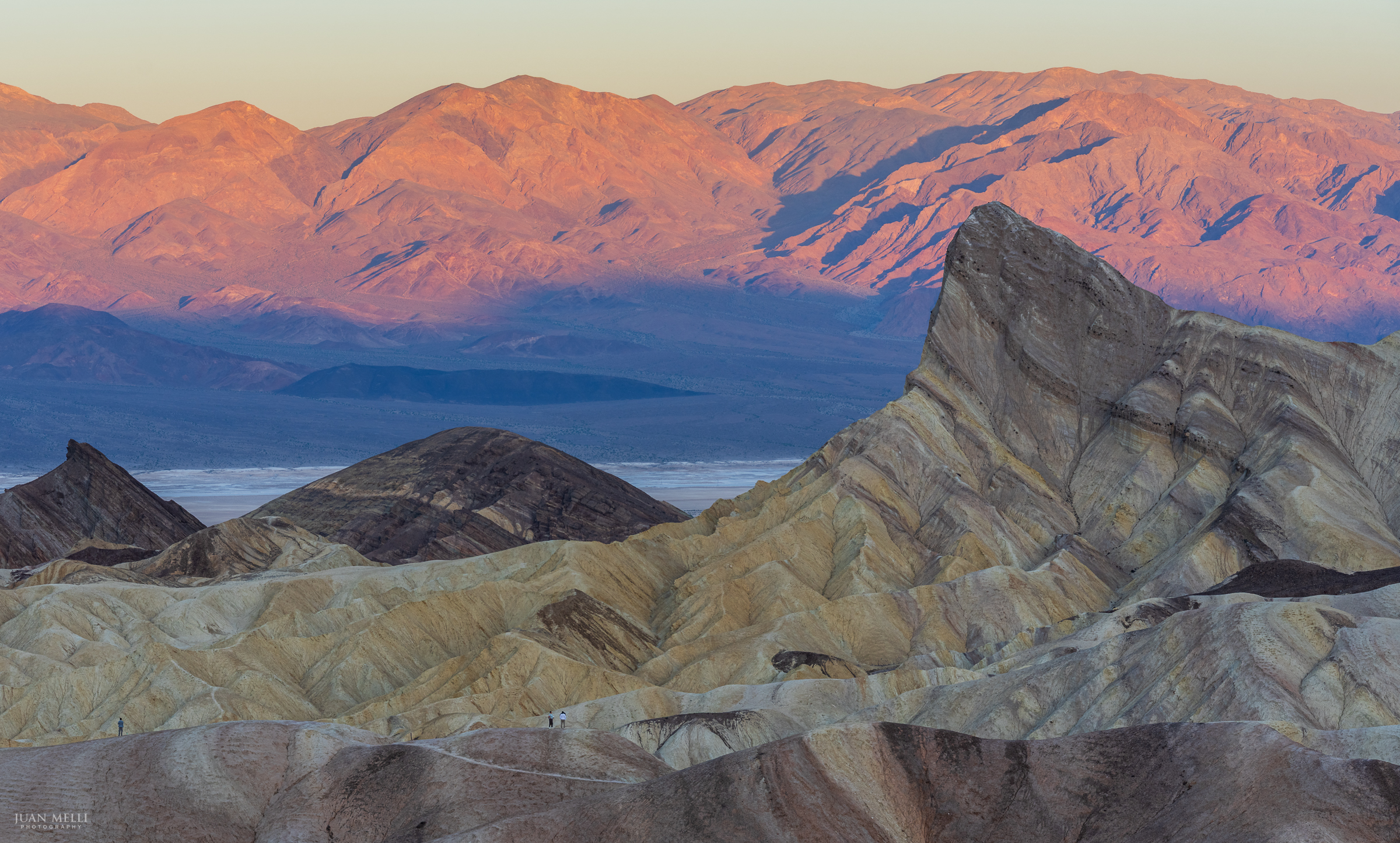
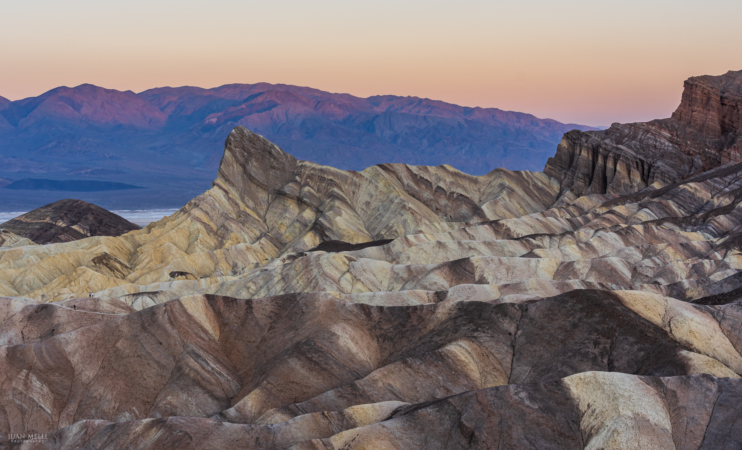
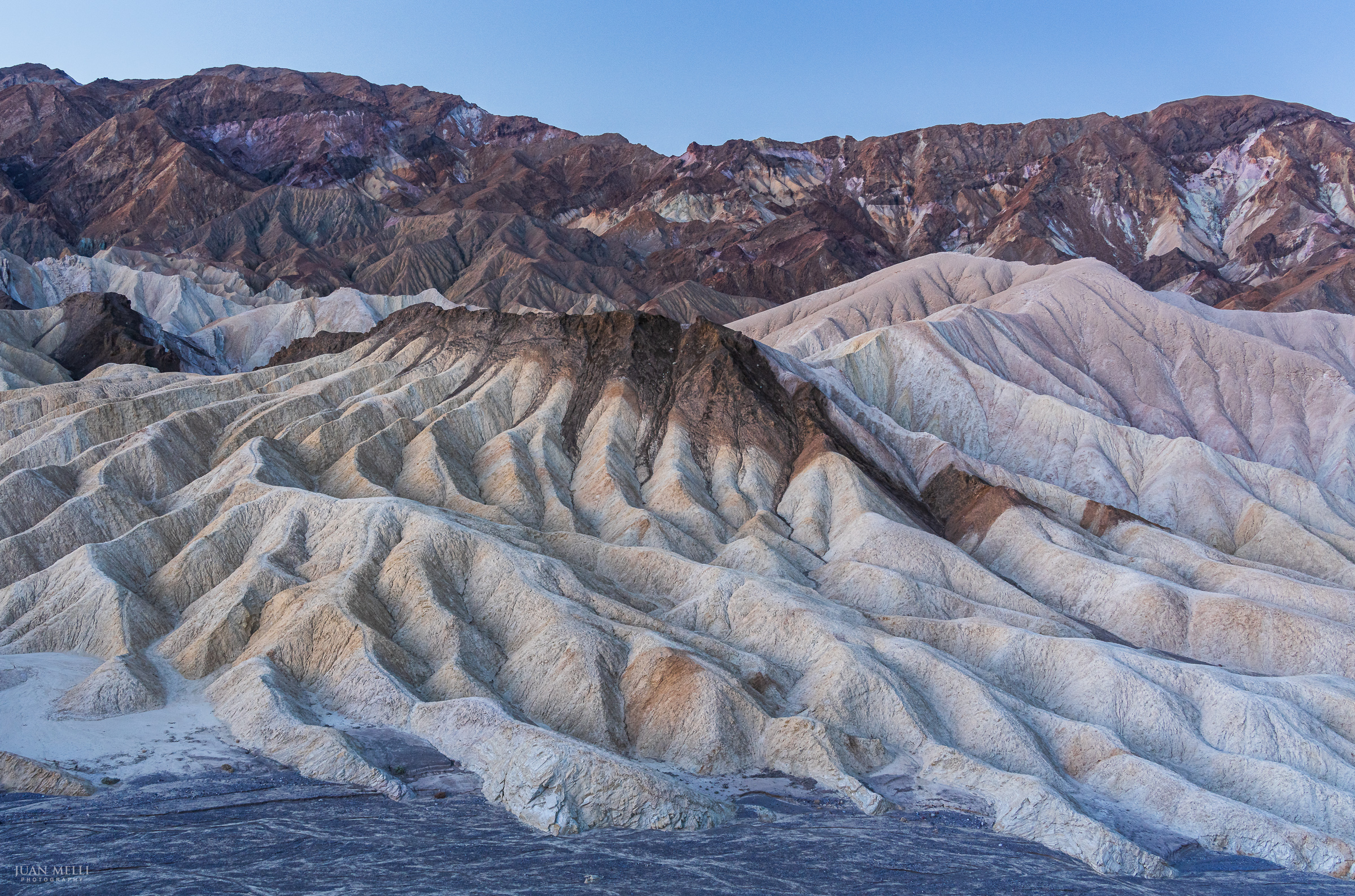
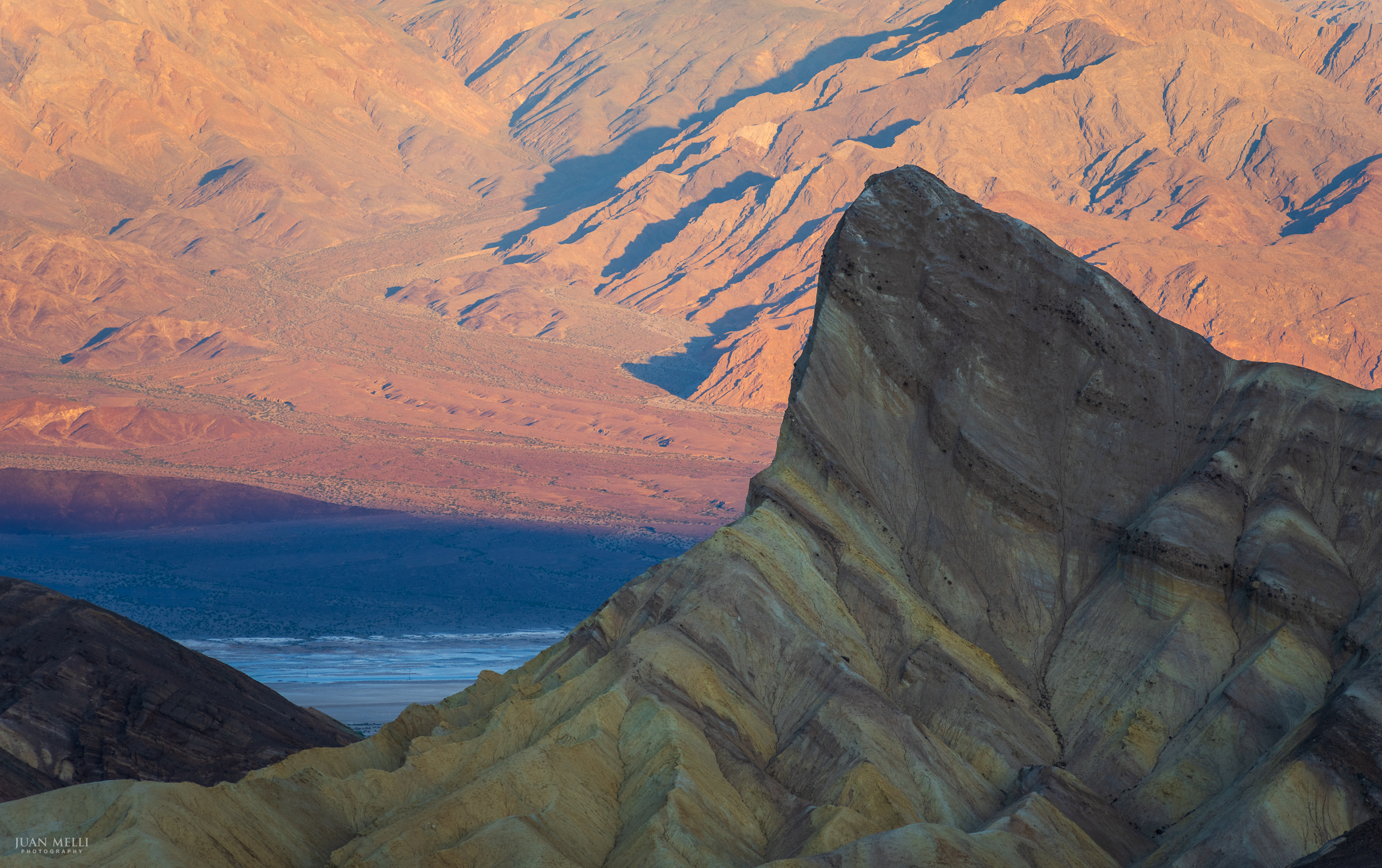
Zabriskie Point
The eroded badlands at Zabriskie Point are a great spot to catch the sunrise. With the sun catching the Panamints in the distance first, then harshly lighting up the foreground, it can be a challenge to photograph the quickly changing scene. The variety of compositions is endless and it’s a real delight to shoot the scene.


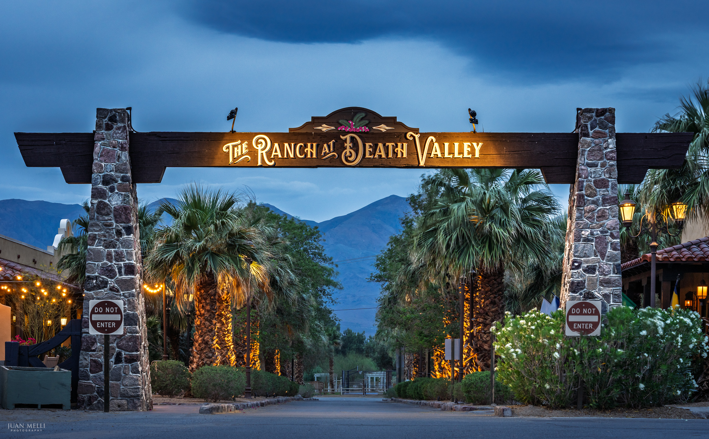
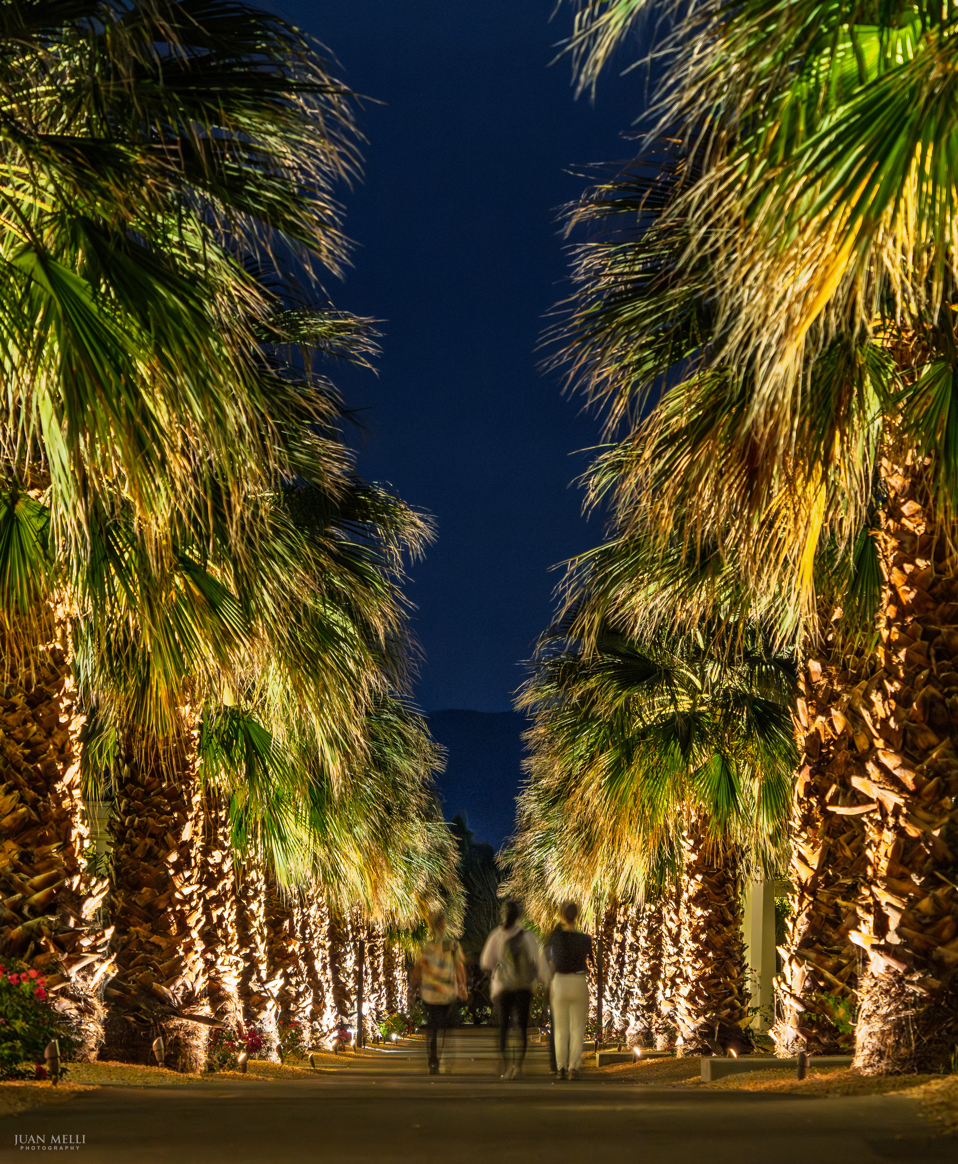
The Ranch
The Ranch at Death Valley is a desert oasis with palm trees, water, ice cream parlor, hotels, restaurants, and even a golf course. If sunrise at Zabriskie Point is on your itinerary, staying at The Ranch makes it easy – it’s only a 5-10 minute drive away.
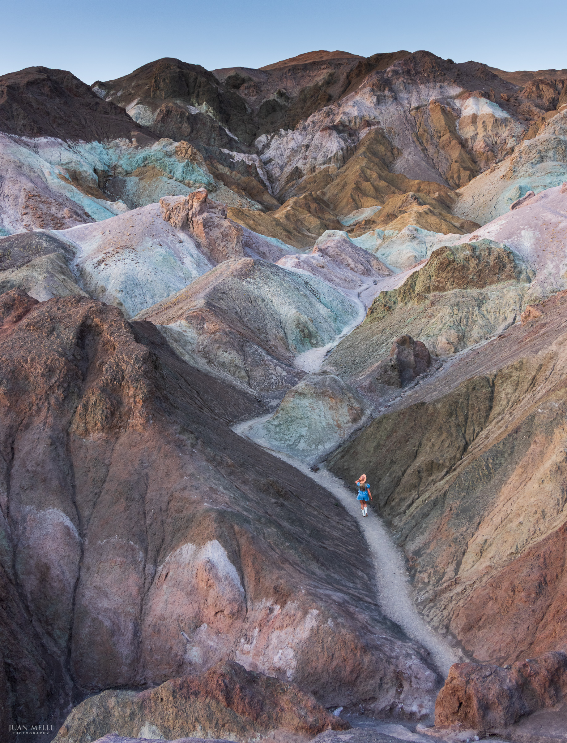
Artists Palette
Artists Palette is a section of the Black Mountains where volcanic rock creates bands of color – iron oxides (reds, pinks, and yellows), manganese (purples), and chlorite and other minerals (greens).
I went at sunset, when the lower light brings out the colors instead of washing them out. On the way in, I passed a woman in a wide-brimmed hat, denim outfit, and bright white cowboy boots. I knew exactly what this was – an IG influencer.
It’s a popular spot, and getting a clean frame isn’t easy. She and her partner kept moving through the composition while posing for shots. I did ultimately get photos without anyone in them, but in the end I kept her in for scale.
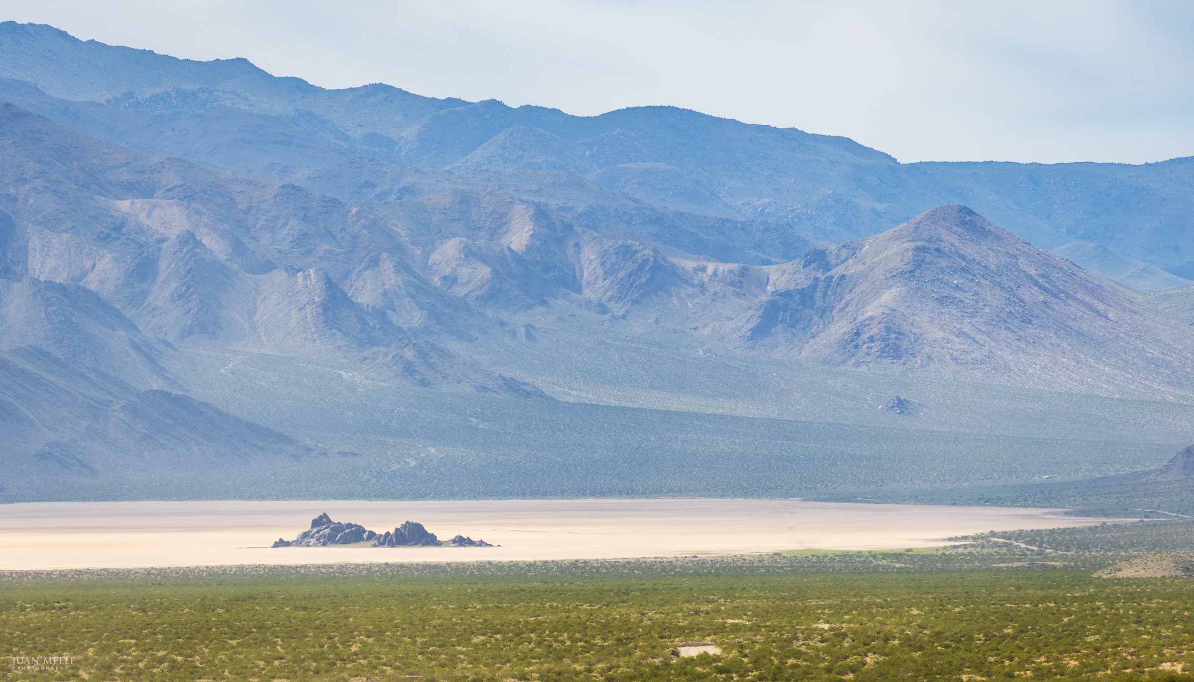
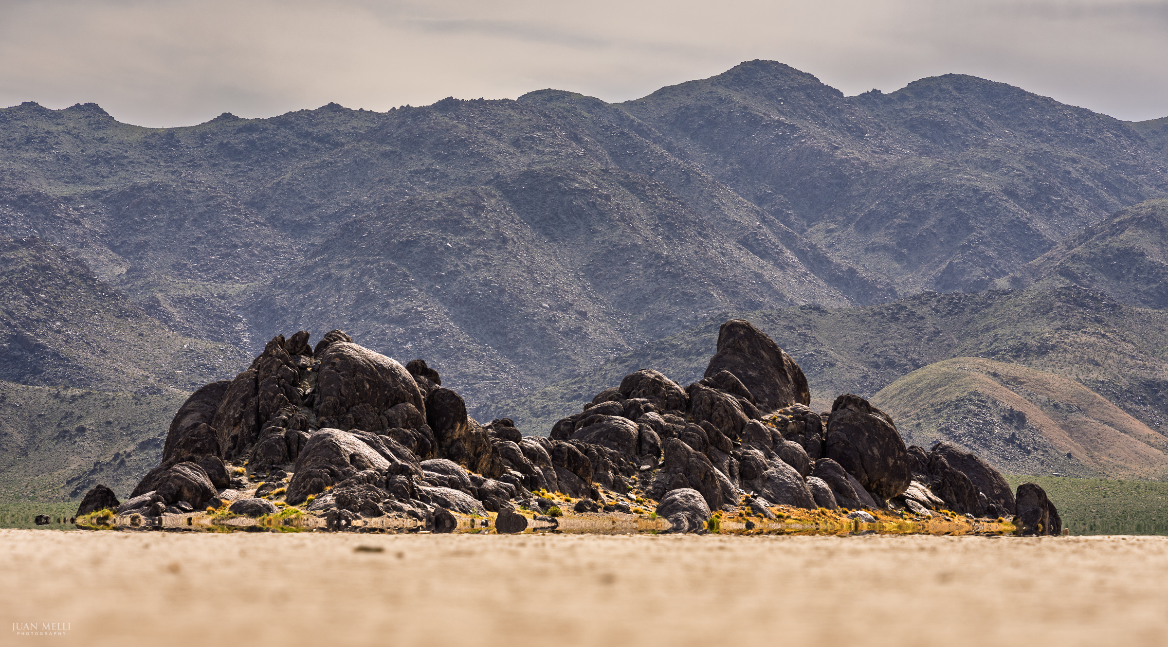
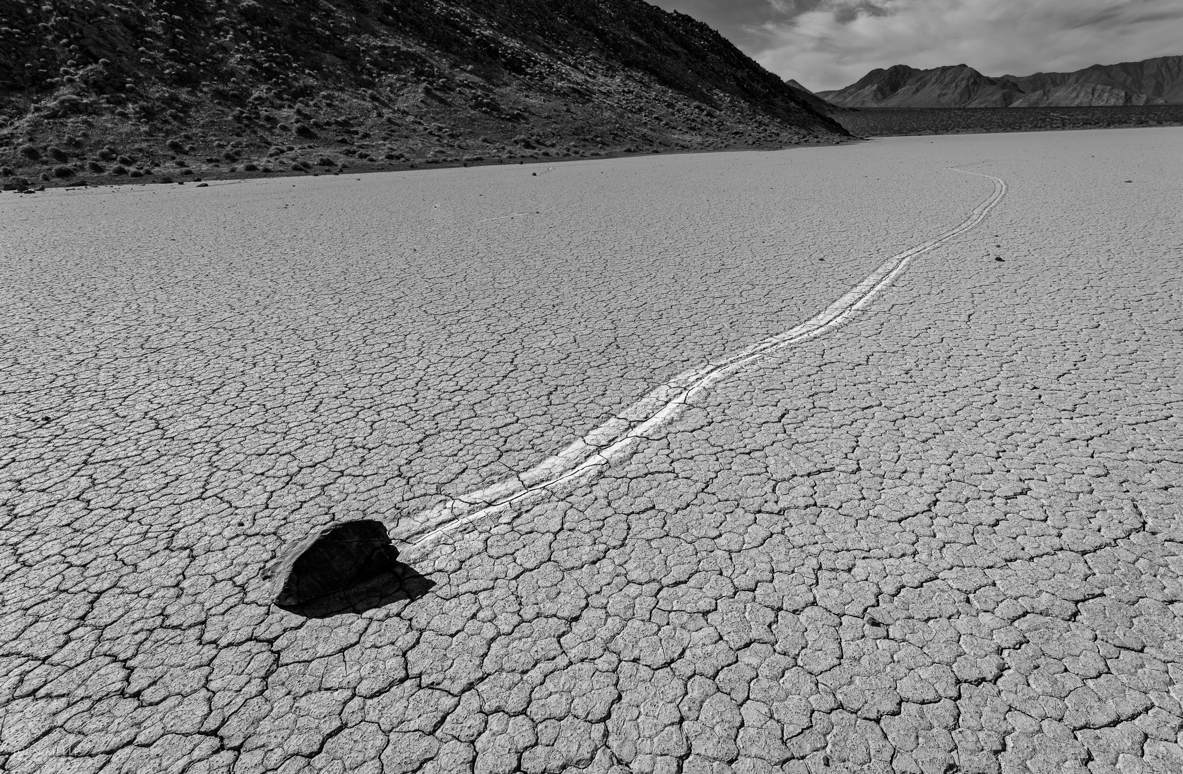
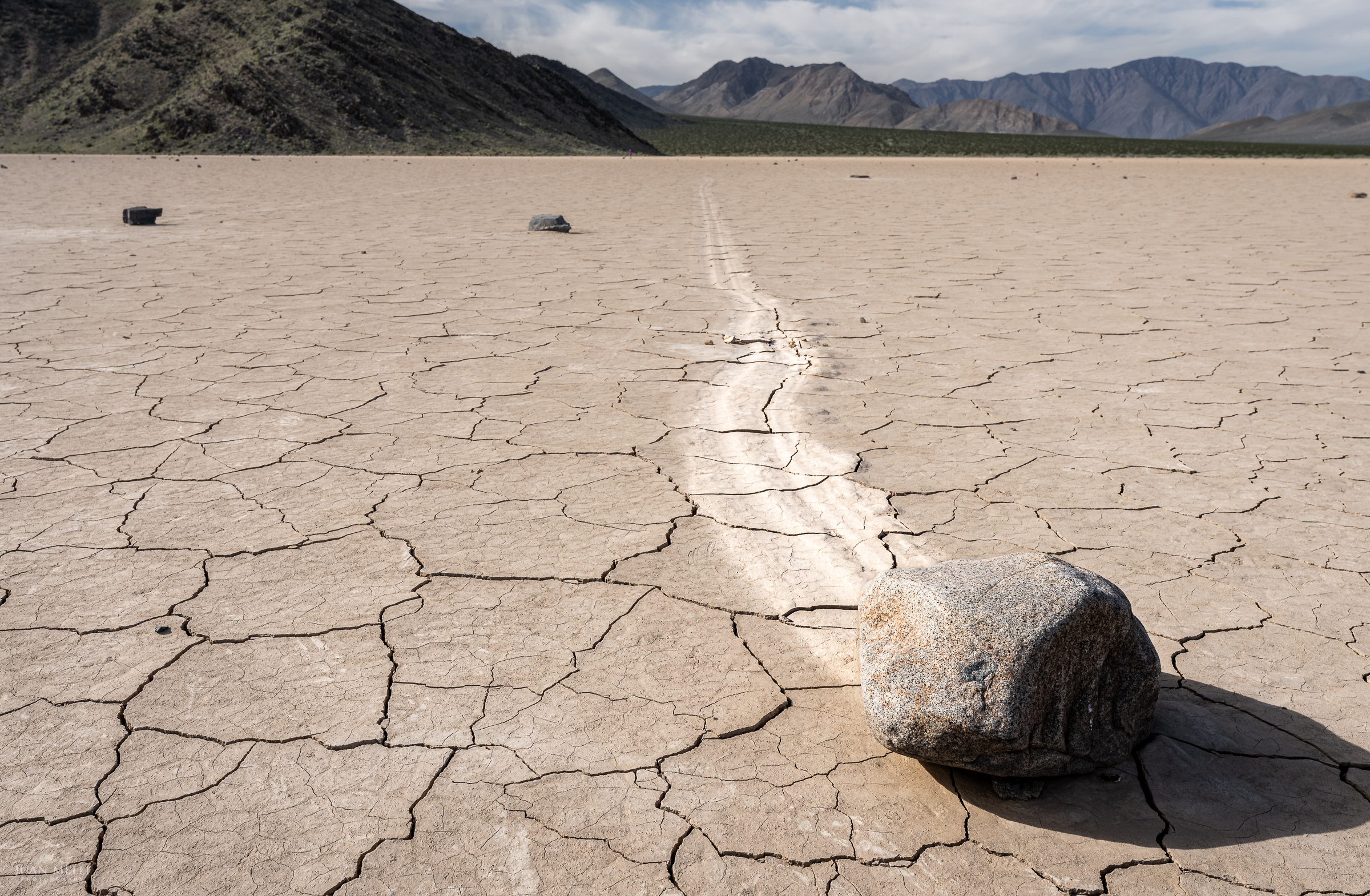
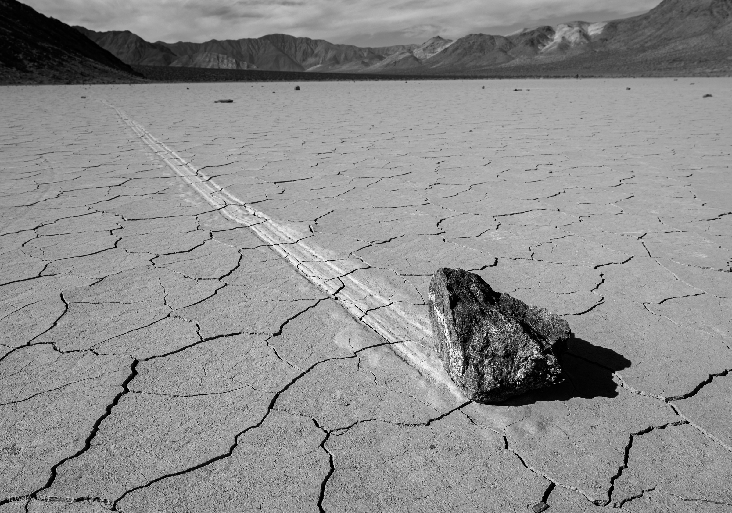
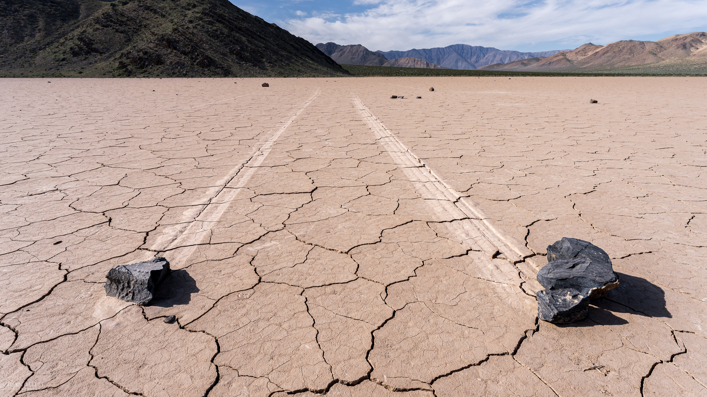
Racetrack Playa
Racetrack Playa is one of the flattest surfaces in North America, where rocks that fall from the surrounding mountains become “sailing stones” – they move across the desert floor leaving tracks behind. At the northwest end of Racetrack Playa is the Grandstand – a dark monolith that is the only feature of the playa other than the moving rocks.
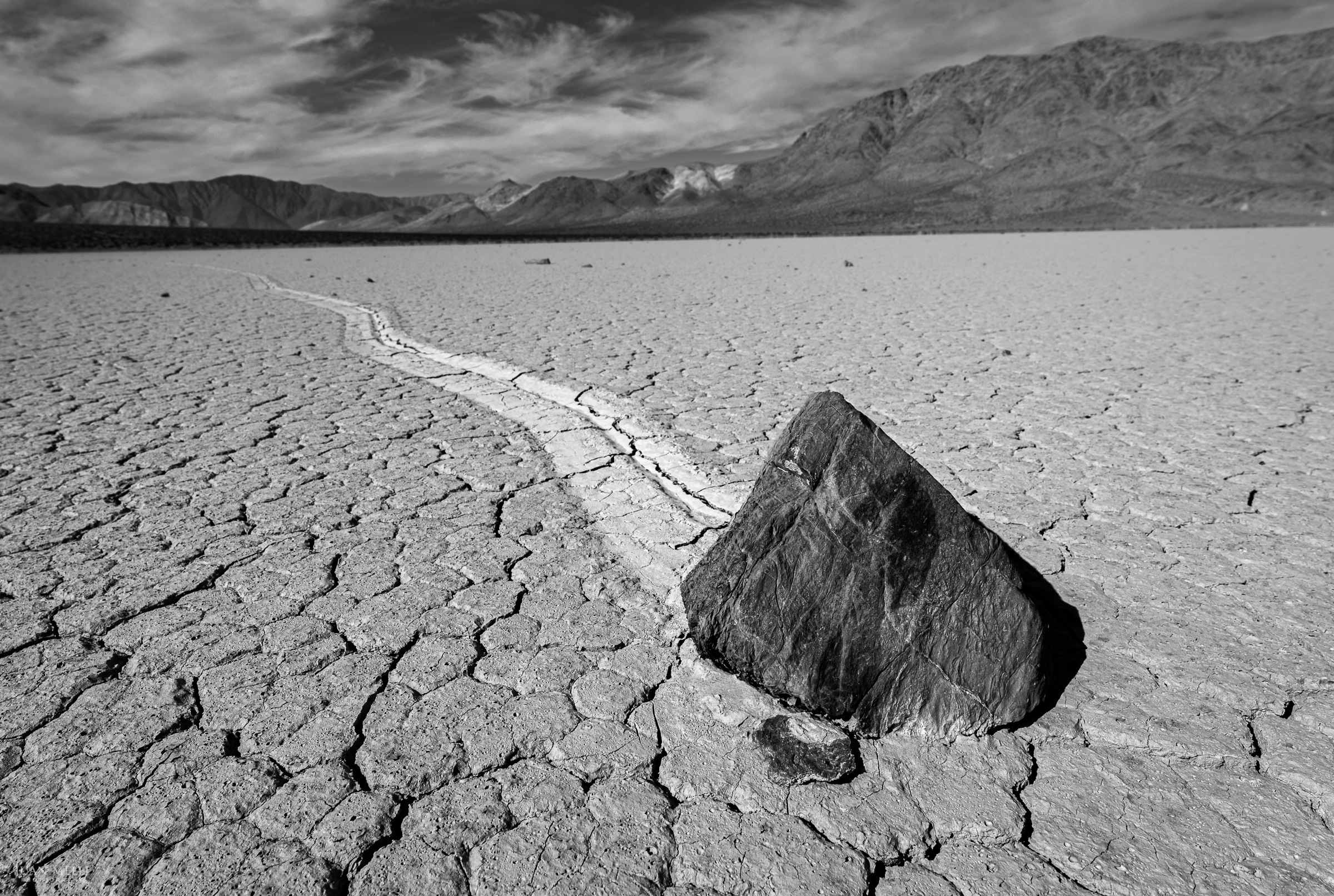
The mystery of how they move was only recently solved. It happens during a rare alignment of conditions: rain turns the playa into a slick, shallow lake, cold nights freeze it into thin sheets of ice, and then light winds push those ice panels, slowly shoving the rocks across the mud. The motion is so slow it’s nearly impossible to see in real time, but over multiple events some stones travel hundreds of feet, carving long paths across the desert.
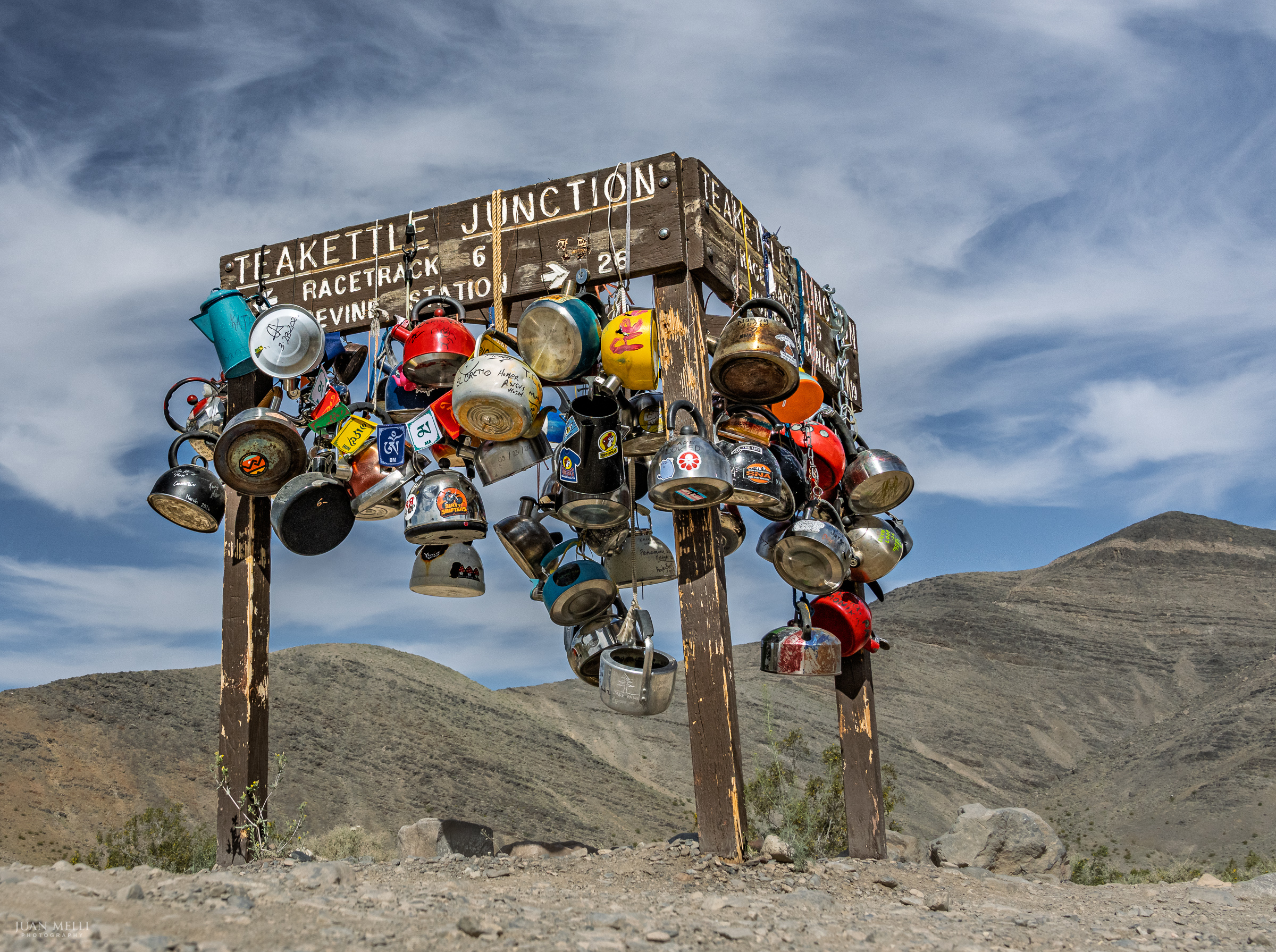
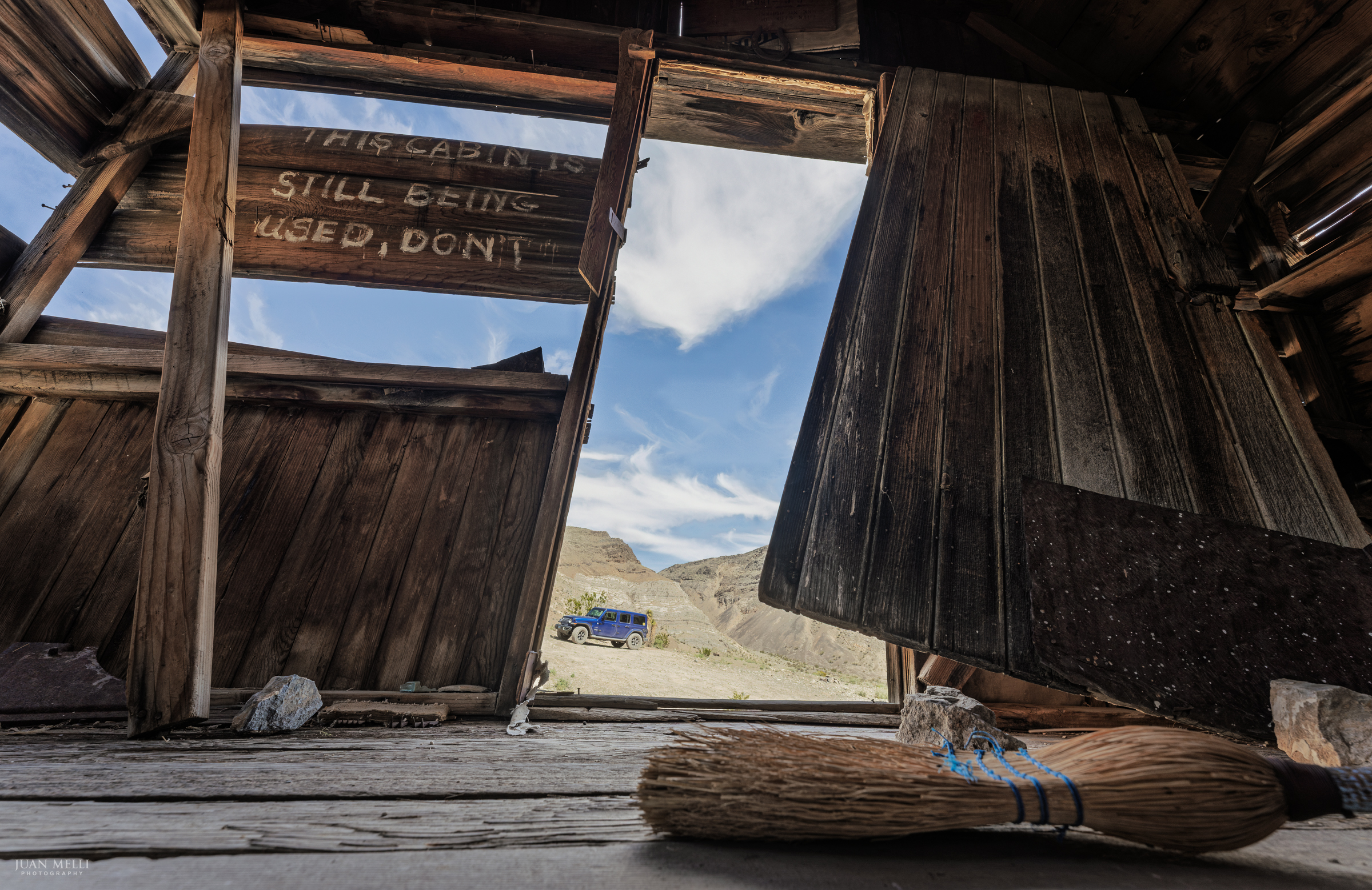
Lost Burro Mine
On the drive to Racetrack Playa, you’ll pass the famous Teakettle Junction, where it’s become a tradition to hang tea kettles from the sign. Continuing southwest along Racetrack Valley Road for 6 miles leads to the Racetrack. Turning southeast on Hunter Mountain Road, you’ll soon reach a sign for the well-preserved Lost Burro Mine.
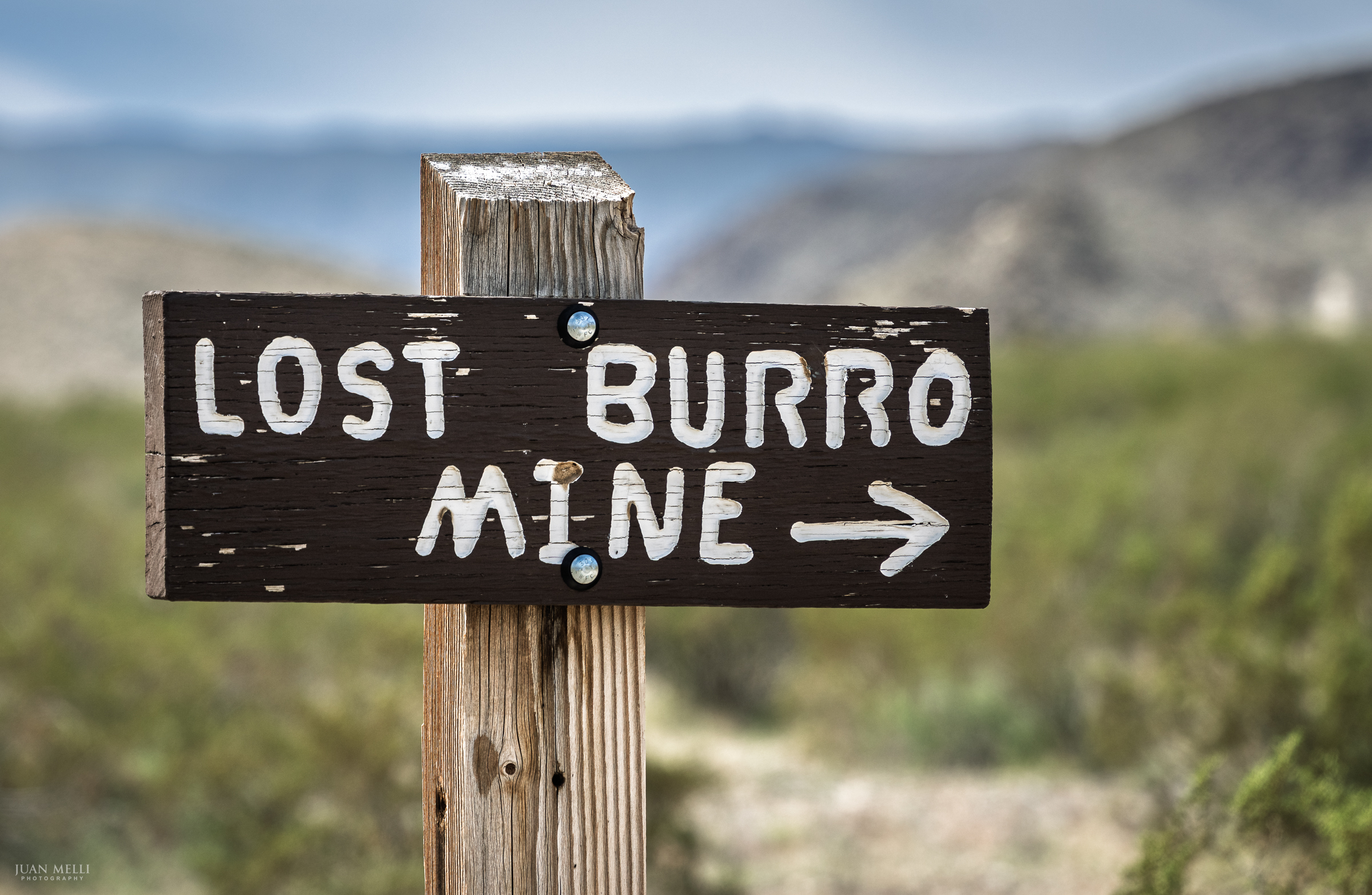
Following the road a short distance, you’ll reach Lost Burro Mine, as well as an old cabin and other structures.
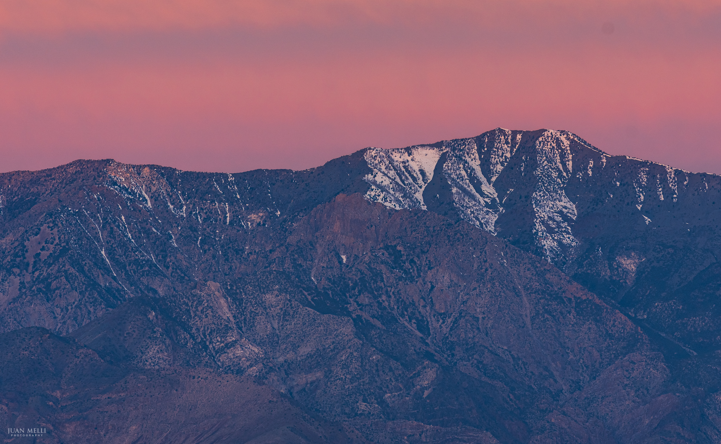
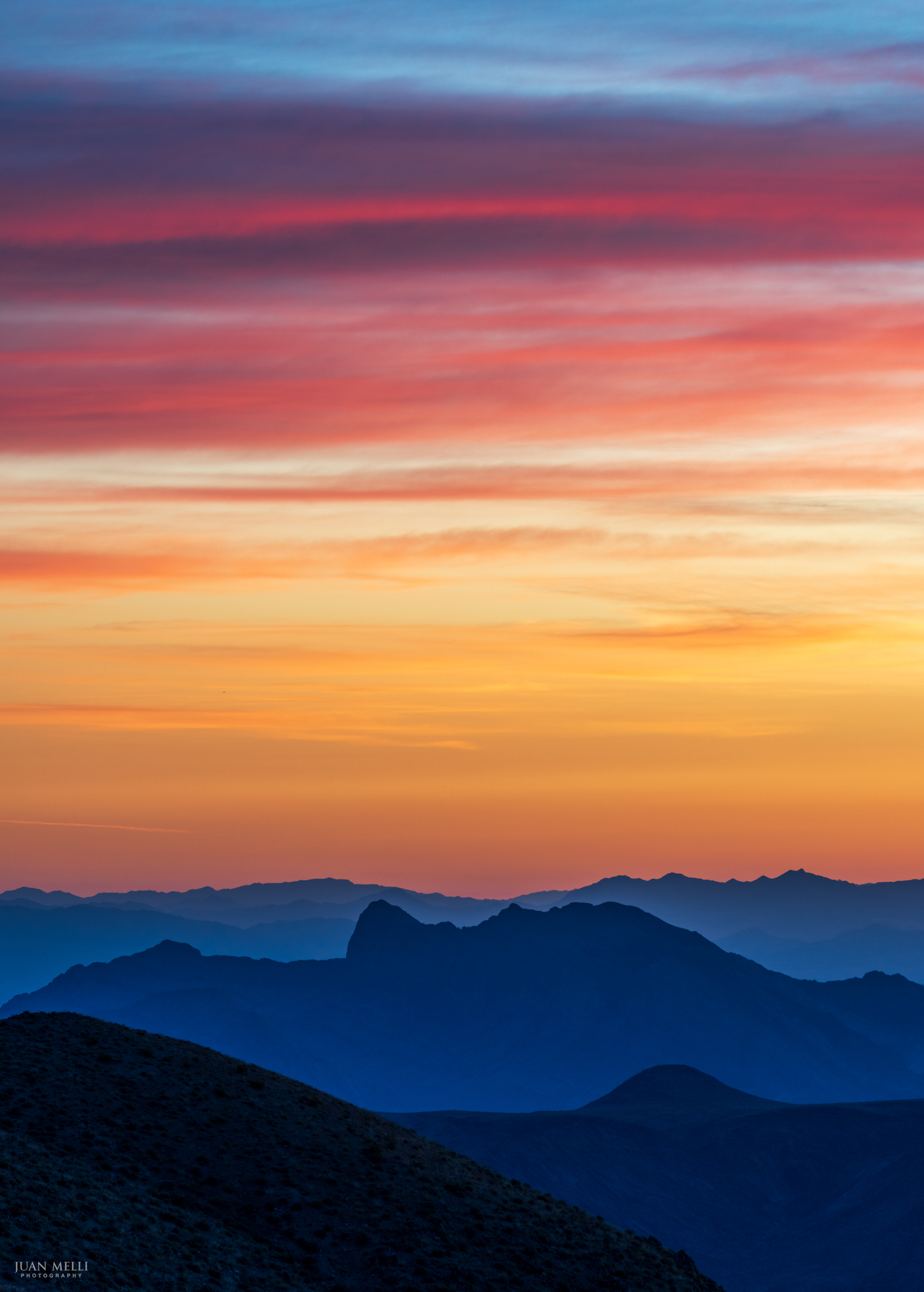
Dante’s View
Dante’s View (5,476 ft), at about 16 miles south of Furnace Creek, overlooks the salt flats of Badwater Basin, with the Panamint Range to the west and the Funeral Mountains to the north. The view was used in Star Wars as a stand-in for Tatooine.
Last time I visited, I came to Dante’s View at sunset, when you’re shooting into the sun and the light tends to be harsher. This time, at sunrise, the Panamints picked up a soft alpenglow and the sky filled with cotton candy clouds.

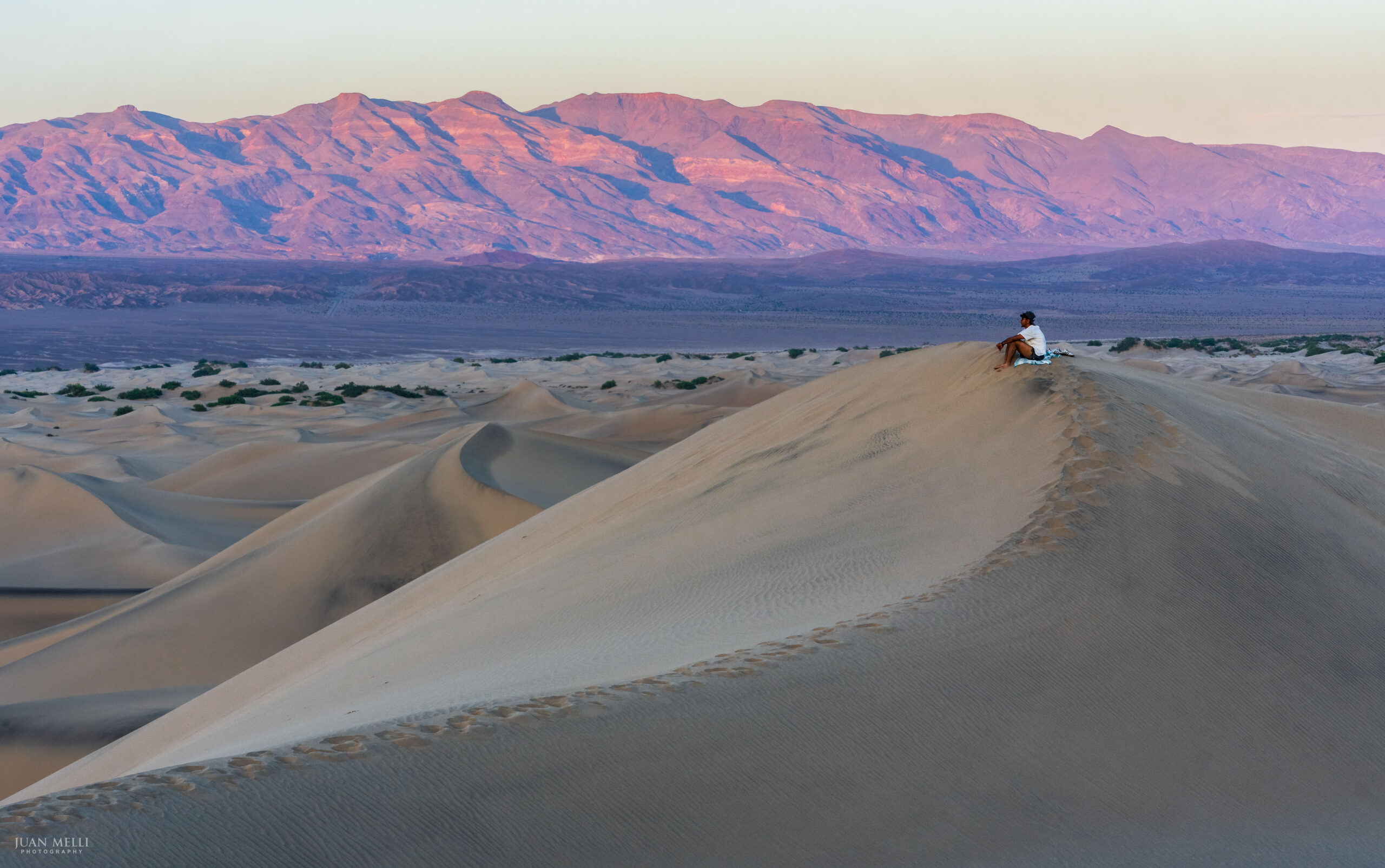
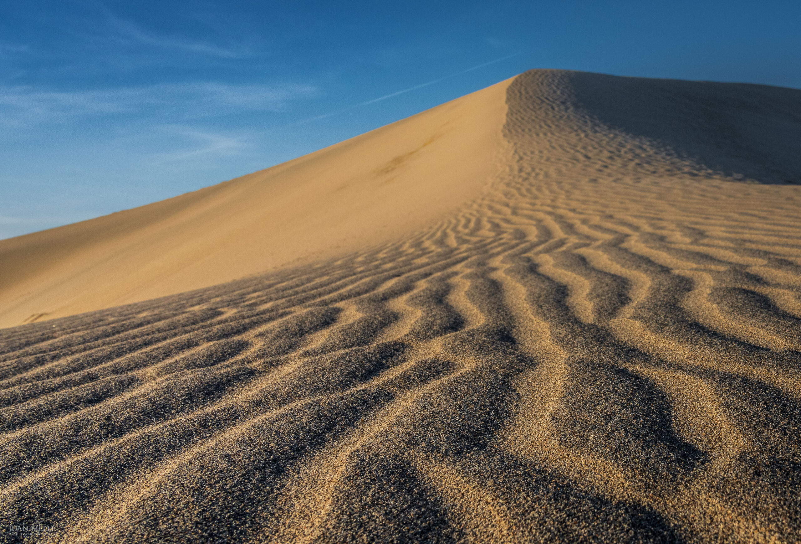
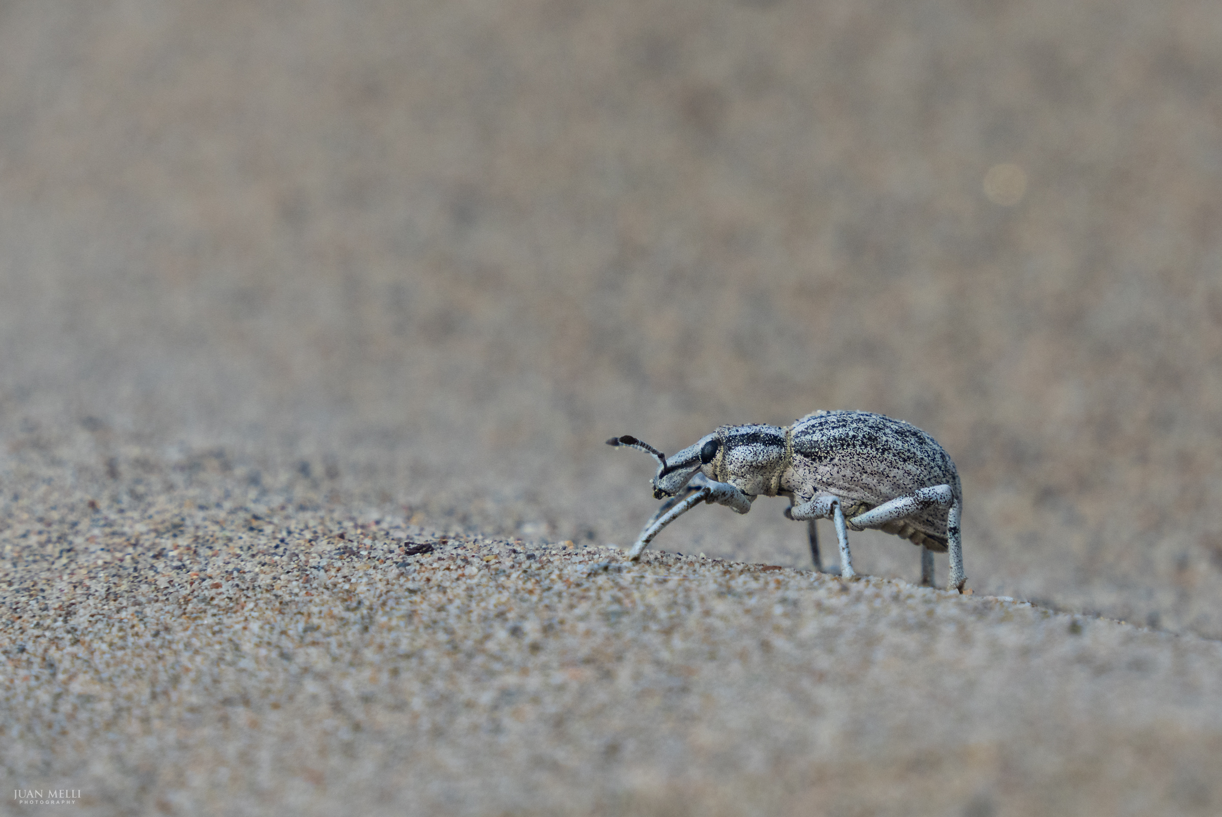
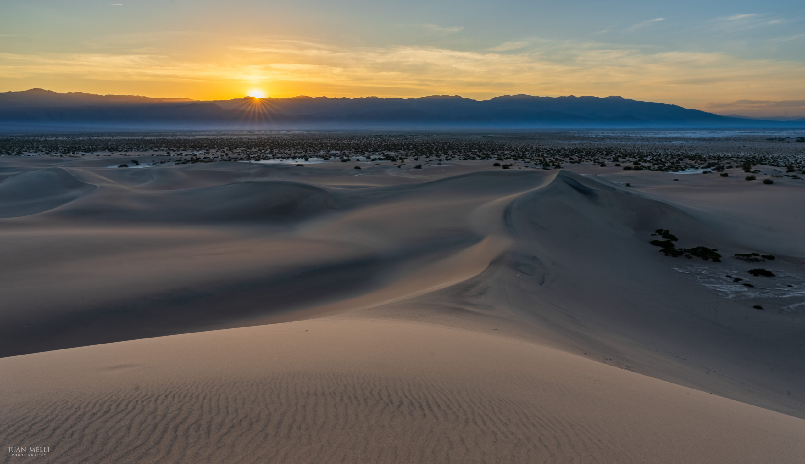
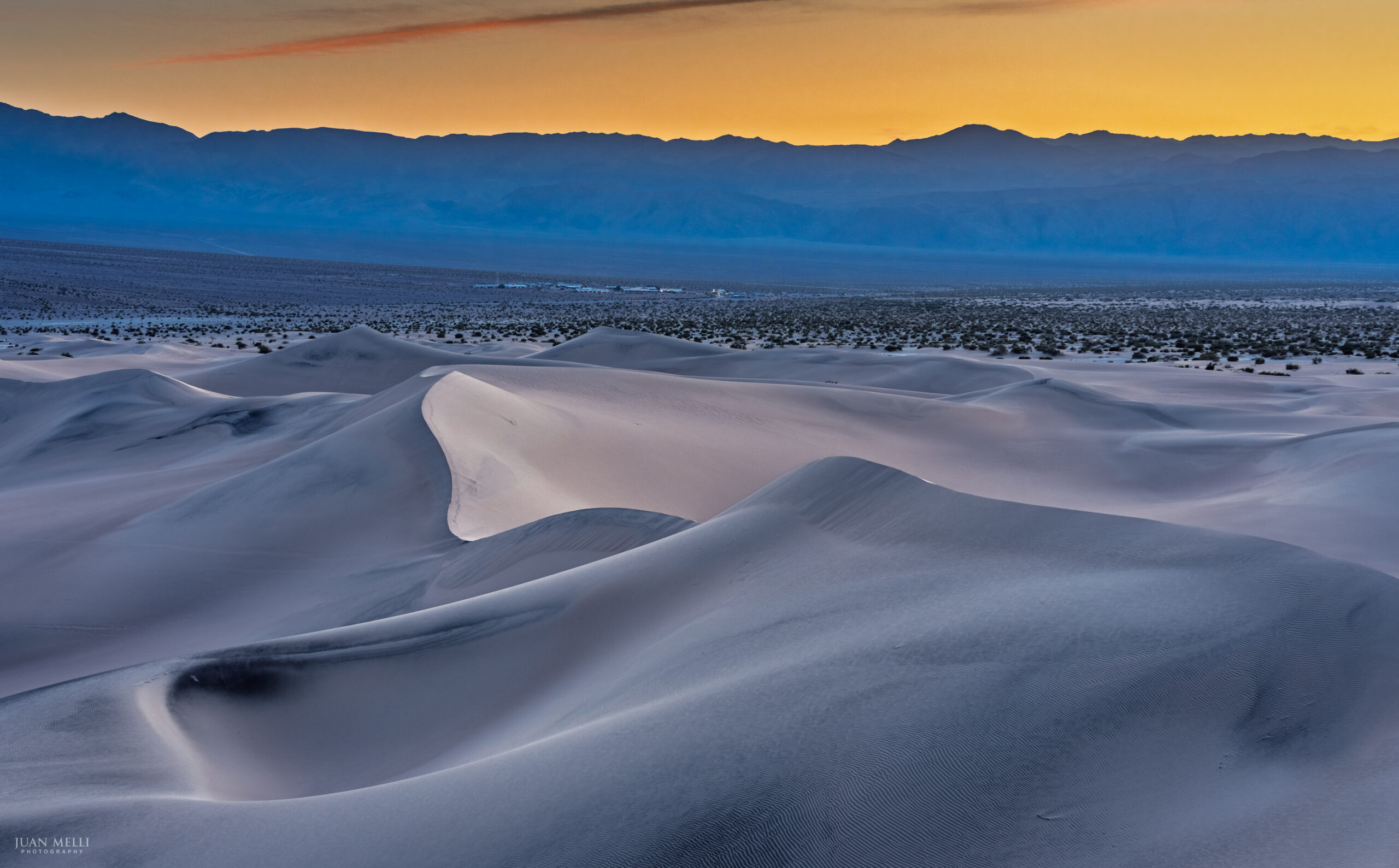
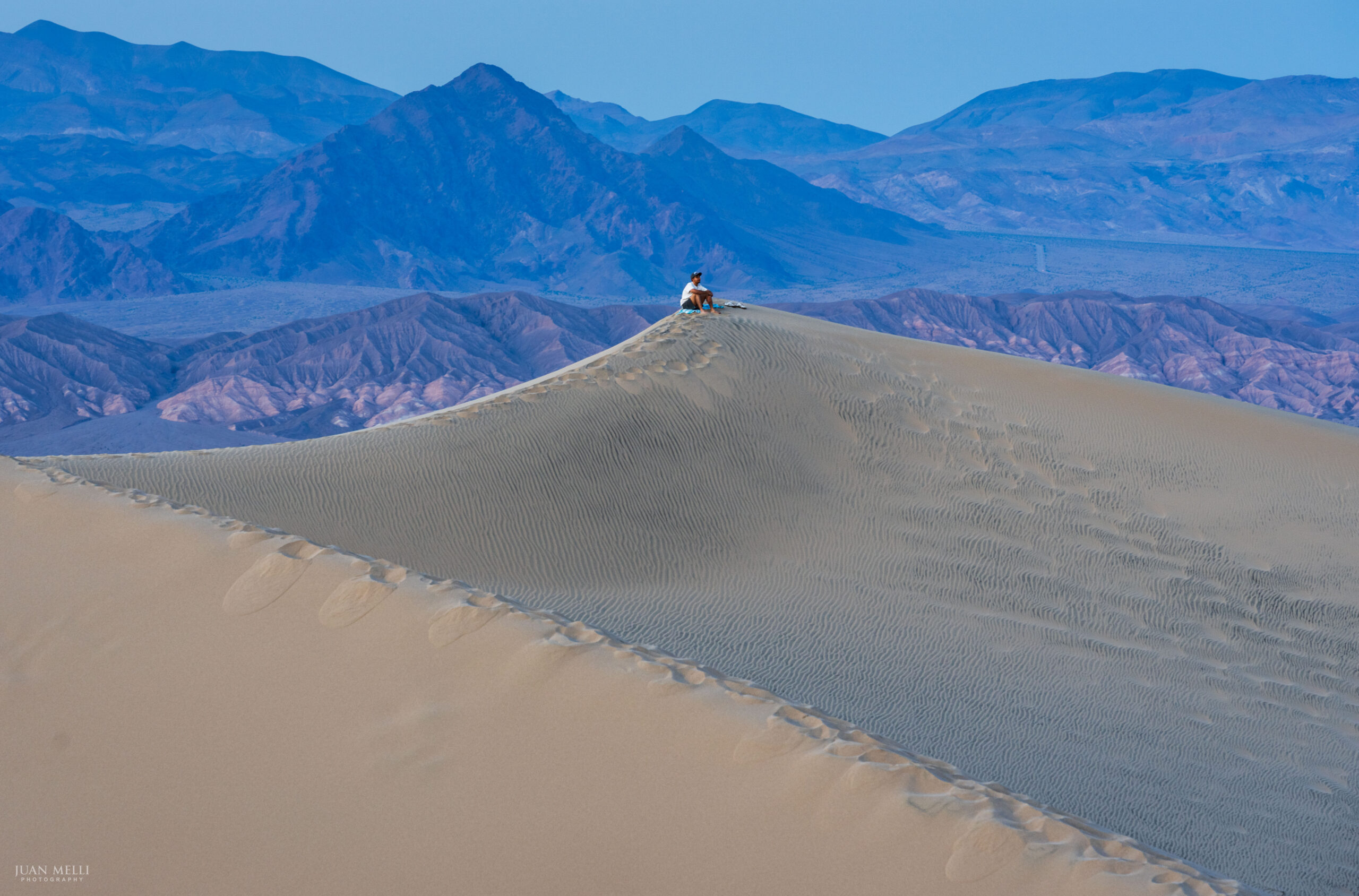
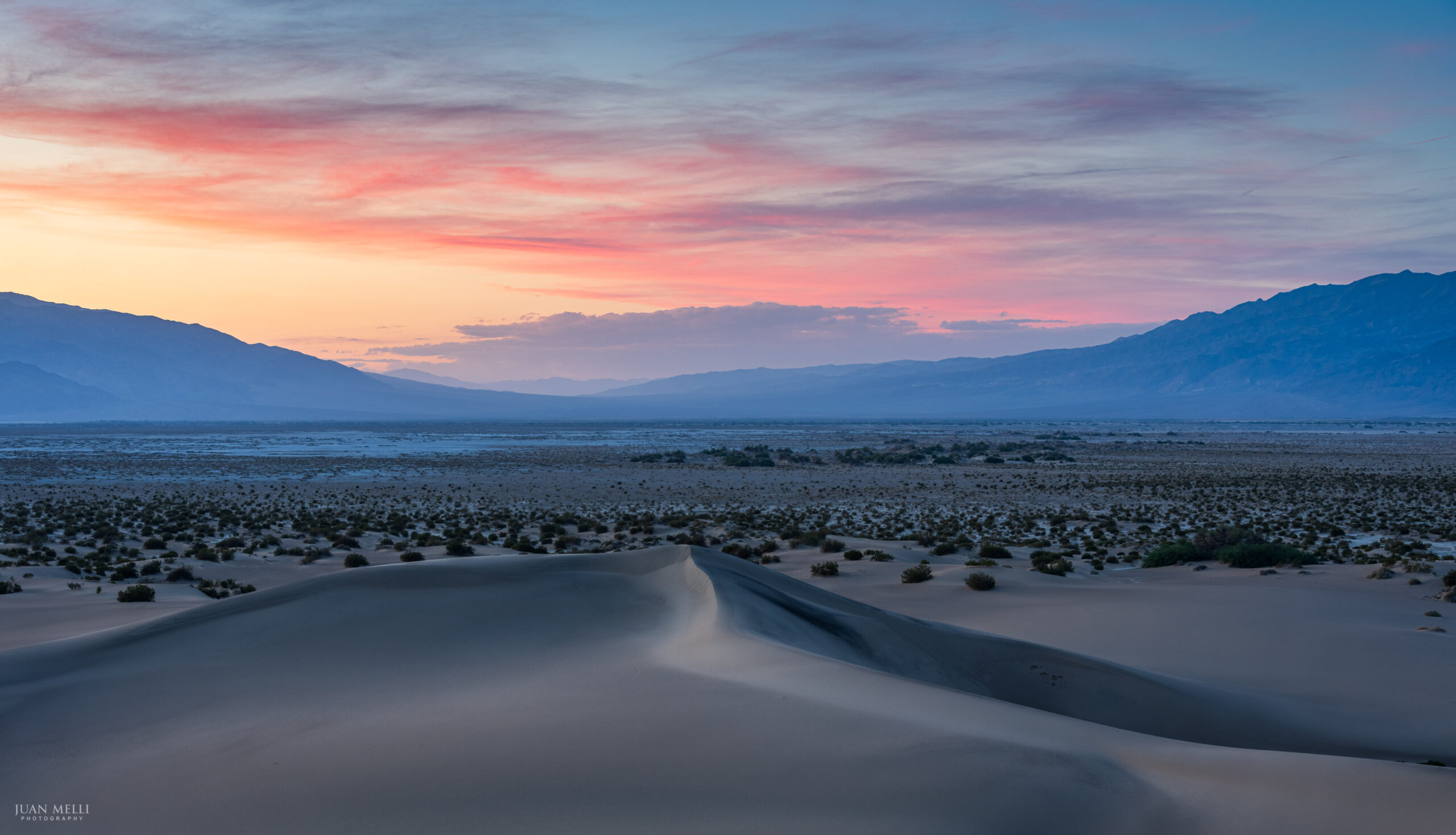
Mesquite Flat Sand Dunes
Named for the mesquite tree which grows in the area, the most accessible sand dunes in Death Valley are the Mesquite Flat Sand Dunes, just minutes from the tiny settlement of Stovepipe Wells.
Before sunset, I made my way to one of the tallest dunes and waited for the light to change, capturing the shadows, textures, lighting on the mountains, and colorful sky.
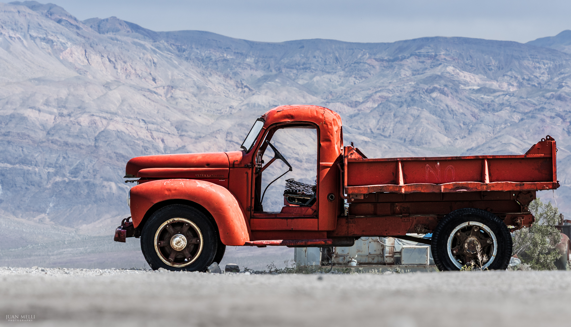
Panamint Springs
Panamint Springs Resort sits at about 1,926 feet on the western edge of Panamint Valley along CA-190, a small outpost of fuel, food, and lodging in an otherwise empty stretch of desert. The Panamint Range lies behind this old pickup truck parked near the gas station and general store.
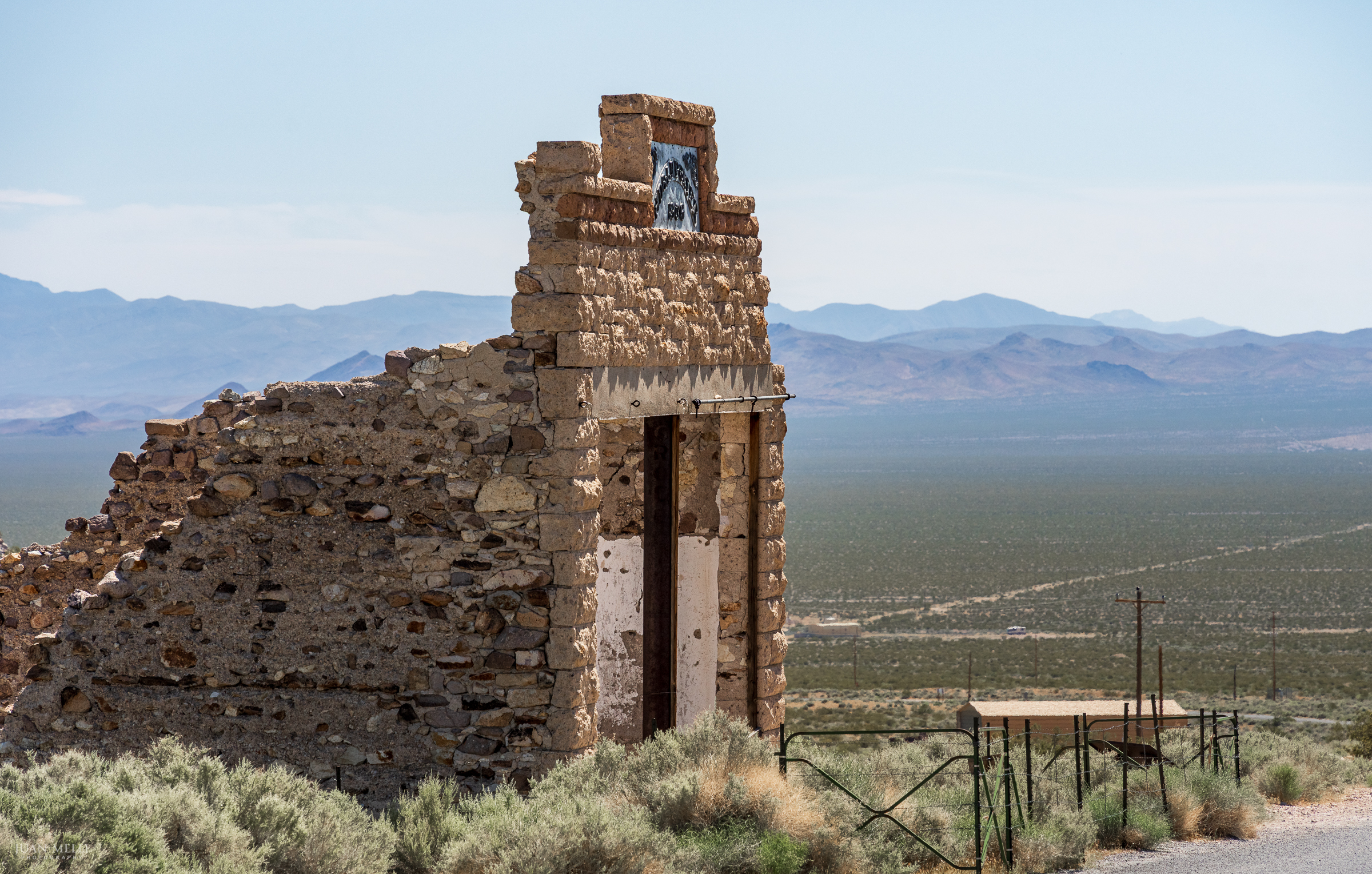
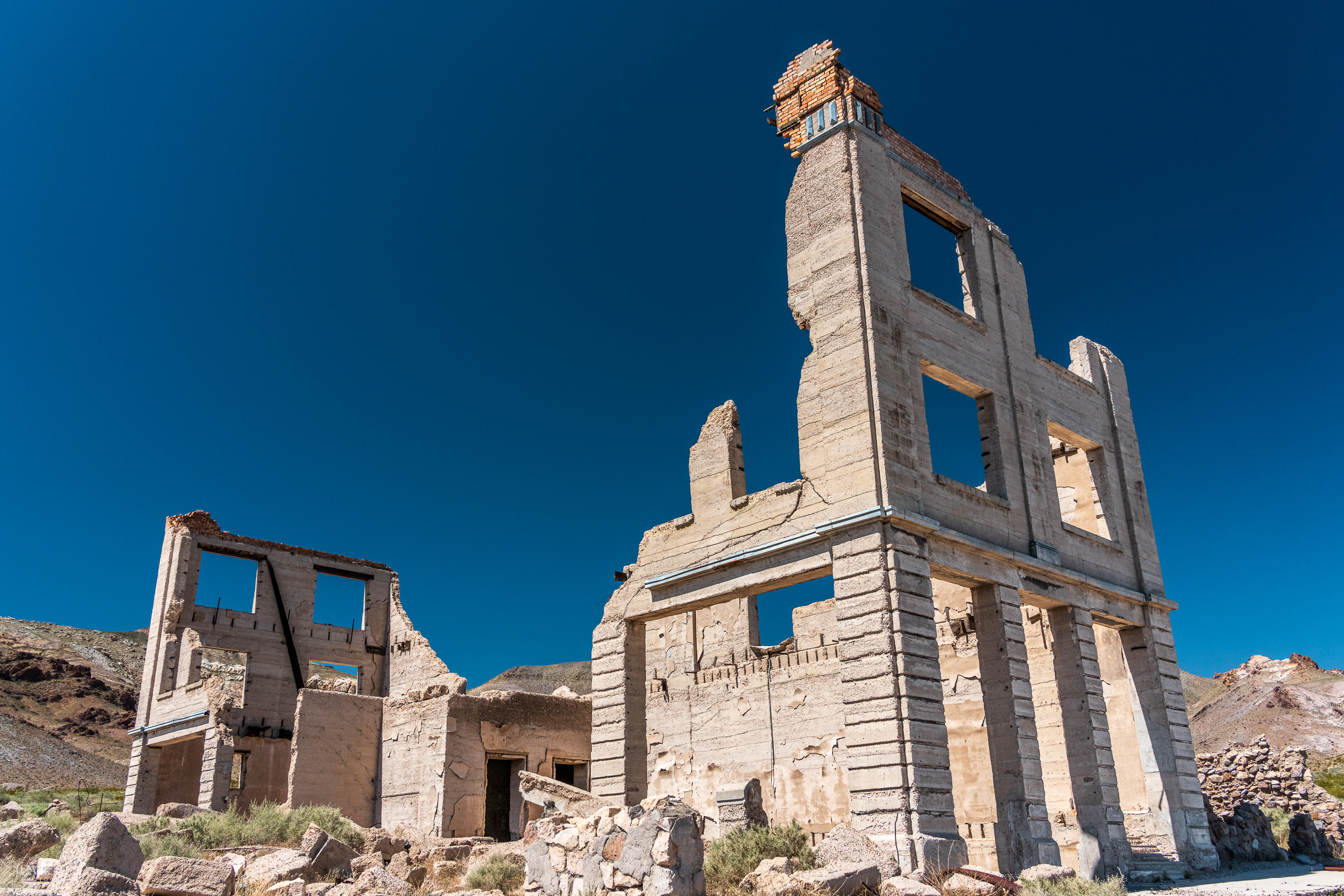
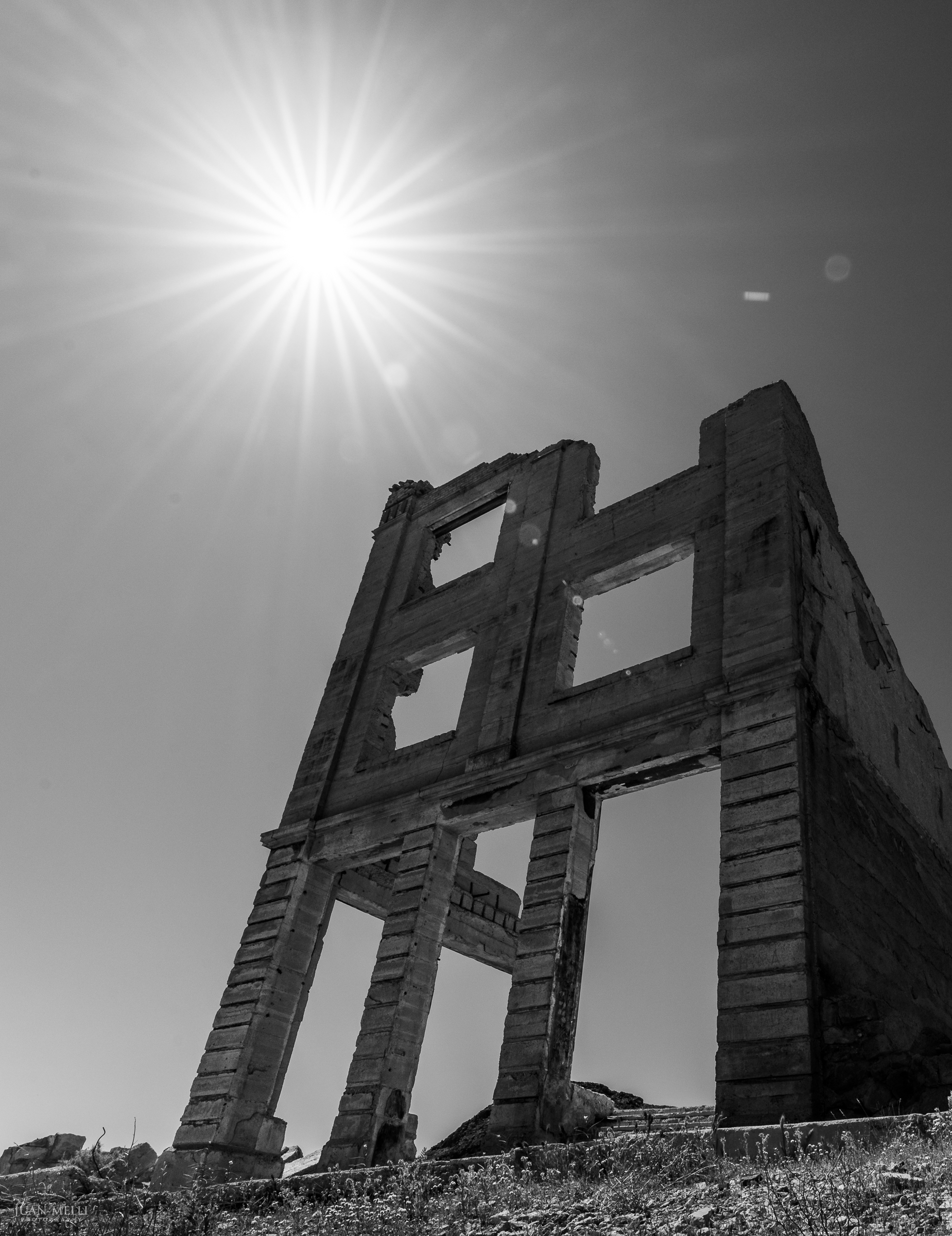
Rhyolite
Just outside of Death Valley is the ghost town of Rhyolite, Nevada. The town sprang up almost overnight during the 1905 Bullfrog gold rush, but by the early 1910s it was effectively abandoned.
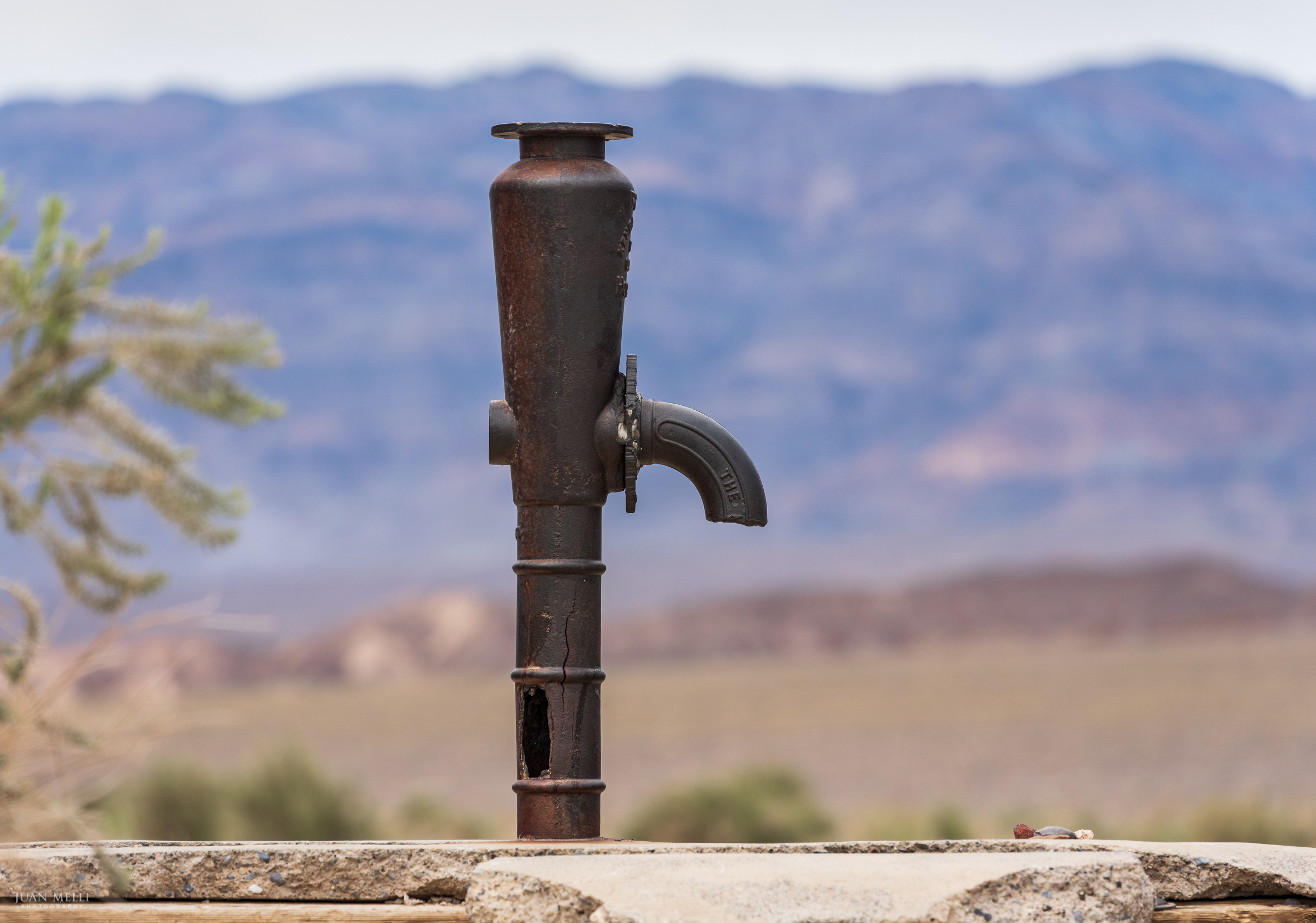
Old Stovepipe Wells
Not a particularly photogenic site, but Old Stovepipe Wells is an interesting bit of history. California Historical Landmark 826 marks a rare water source in the Mesquite Flat dunes, once a critical stop along cross-valley routes during the early mining era. When shifting sands buried the well, a stovepipe was driven into the ground to mark its location – giving the site its name.
Discover more from From My Perspective
Subscribe to get the latest posts sent to your email.