

On August 11-15, 2023, my father, a friend, and I spent 5 days backpacking in the Wind River Range, a combination of on- and off-trail travel that included the famous Cirque of the Towers and the less-visited Desolation Valley.
“The Winds” are part of the Rocky Mountains in Western Wyoming and are part of the Greater Yellowstone Ecosystem, with the Continental Divide running down the crest. Our route spanned two national forests and wilderness areas – Bridger-Teton National Forest to the west of the divide and Shoshone National Forest (the country’s first national forest) on the east in the Bridger and Popo Agie Wilderness Areas.
Trip planning
I found the “Beyond Trails” guide book by Nancy Pallister to be an invaluable resource. For maps, I used both the South Wind River Range map by Earthwalk Press and the Wind River Range South map by Beartooth Publishing. The Earthwalk Press map has more detail at 1:48,000 scale, although it’s folded in a large, bulky format which doesn’t slip into a pocket. The Beartooth Publishing map at 1:60,000 has a little less detail but includes “off-trail” routes, such as between Shadow Lake and over Texas Pass. There’s also a digital version of the Beartooth Publishing map available for Avenza that will use your phone’s GPS to display your location on the map.
Day 1 – Big Sandy TH to Desolation Valley
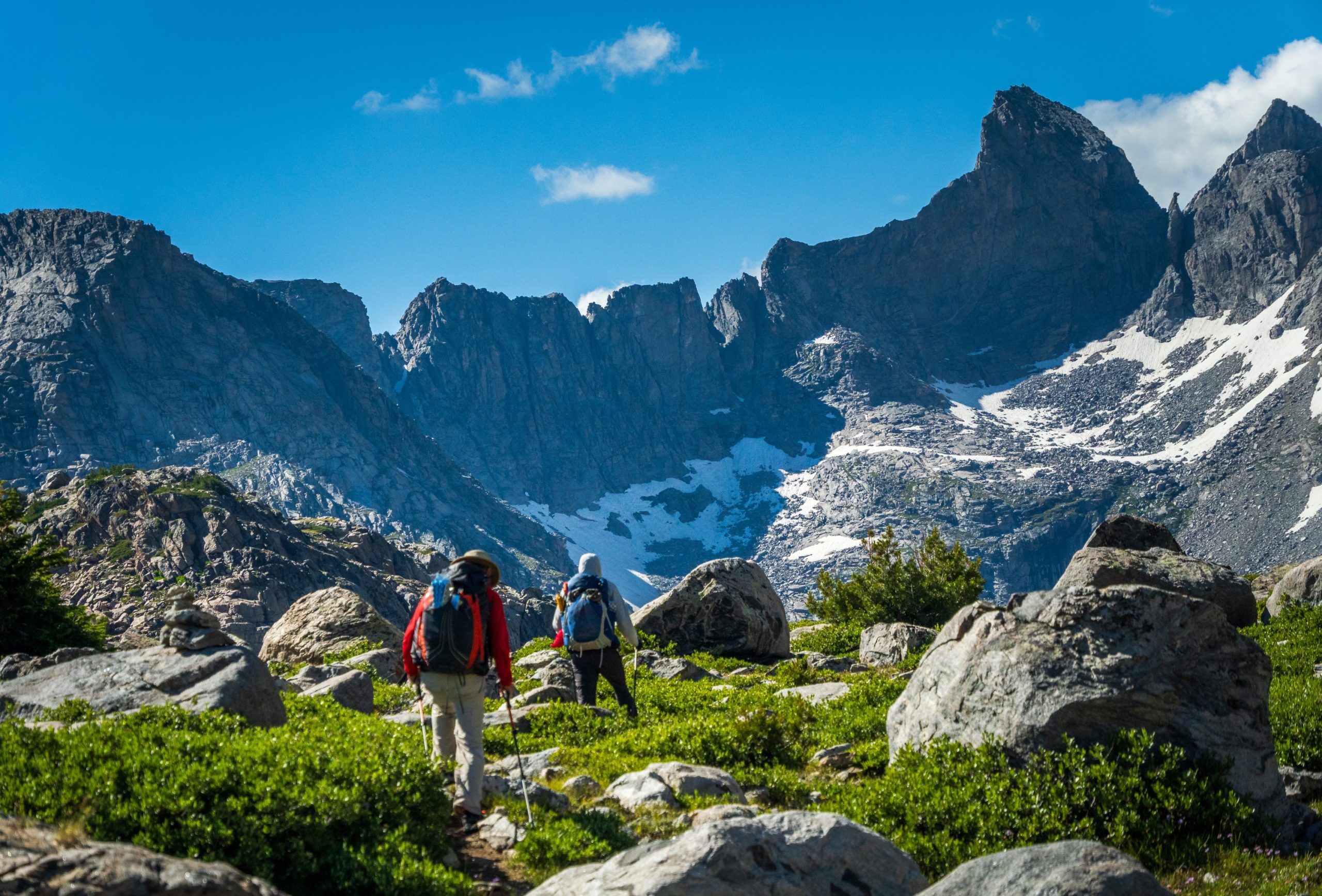
We began at the popular Big Sandy Trailhead, where it seemed about 200 cars were parked. We followed the Fremont Trail – which is part of the Continental Divide Trail – past Mirror, Dads, and Mams Lakes until it crossed the Washakie Creek, passing dozens of people along the way. Here, we went off-trail and headed north, paralleling the East Fork River into Desolation Valley.
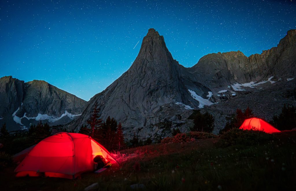
After stepping off-trail, we wouldn’t see another person for a whole day. We continued north for about 4 miles and found an amazing camp site next to East Fork Lake #5 (Lake 10331) with Ambush Peak towering over us.
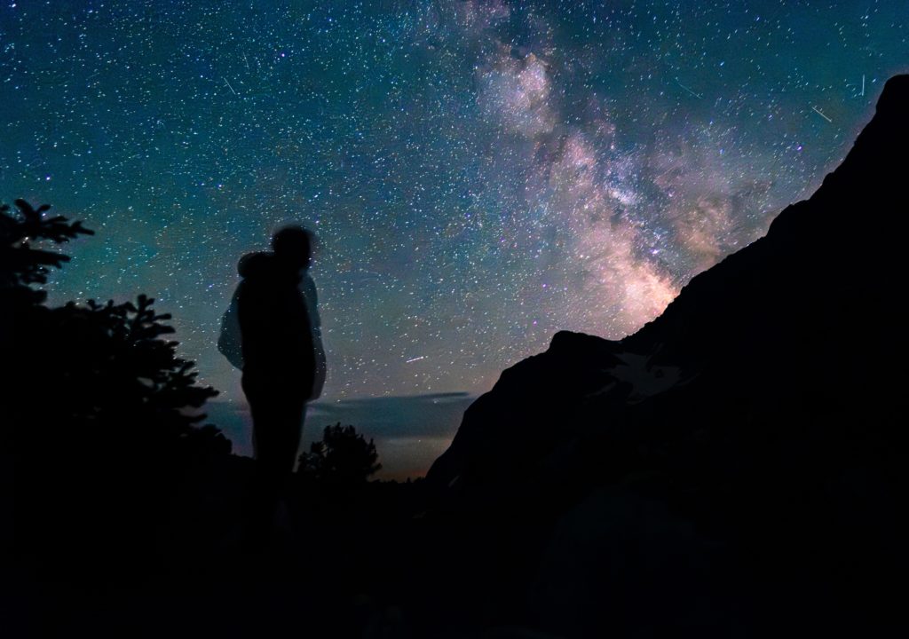
Around midnight, we woke to watch the stars and Milky Way rise behind Mount Geikie.
Day 2 – Desolation Valley to Baptiste Lake
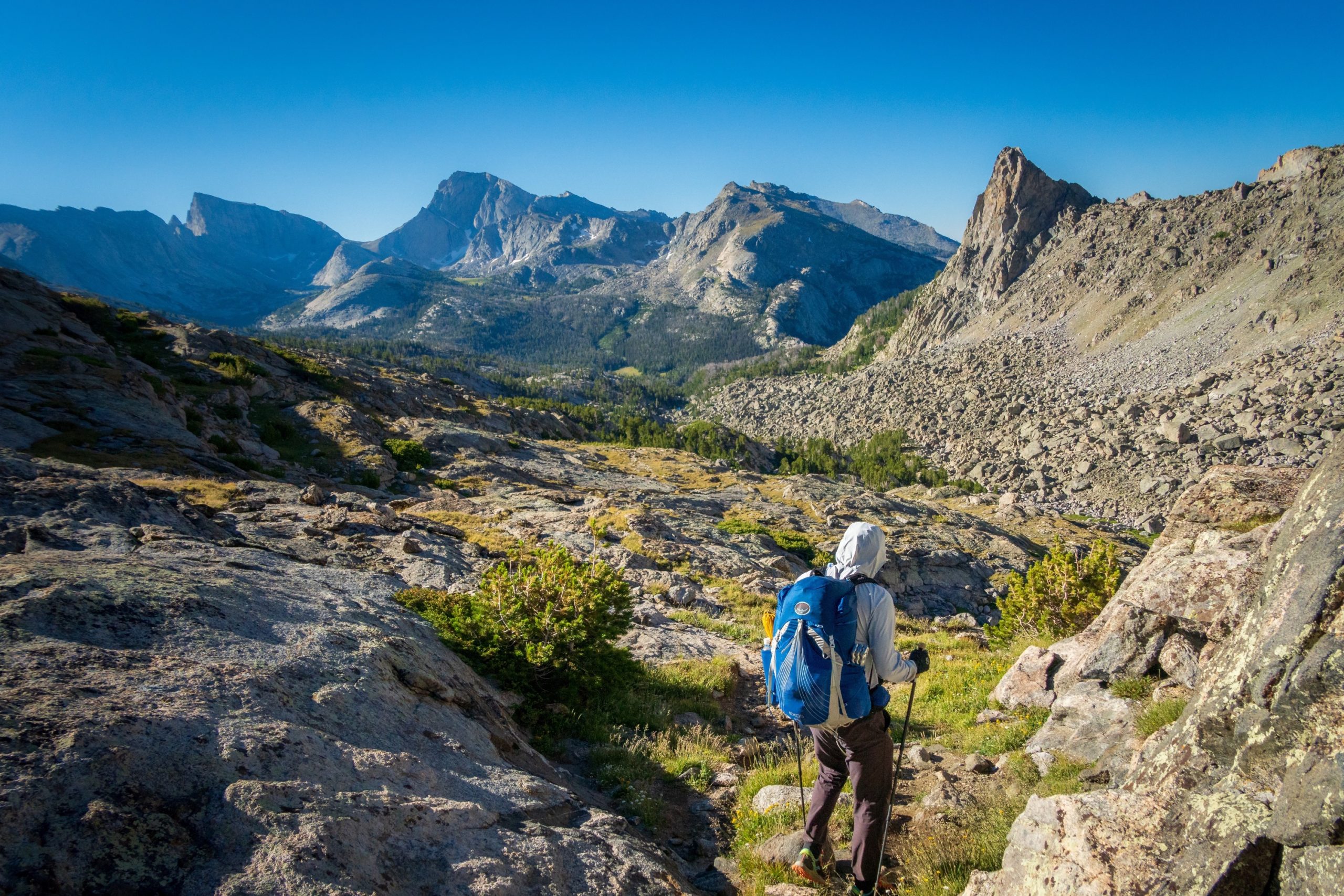
From Lake 10331, we made a steep ascent east towards Midsummer Dome, which required some route-finding, then made our way to the saddle leading to Pyramid Lake. We picked up the Pyramid Lake Trail to the Hailey Pass Trail and over Hailey Pass. The 500-foot descent on the north side of the pass was steep and full of loose rocks and gravel, which was a challenge at times. After wading across a stream, we turned west on the Baptiste Trail and approached Baptiste Lake.
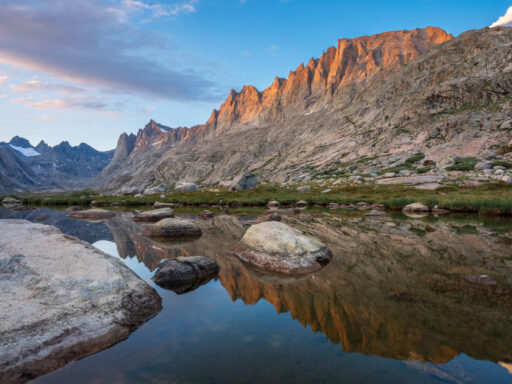
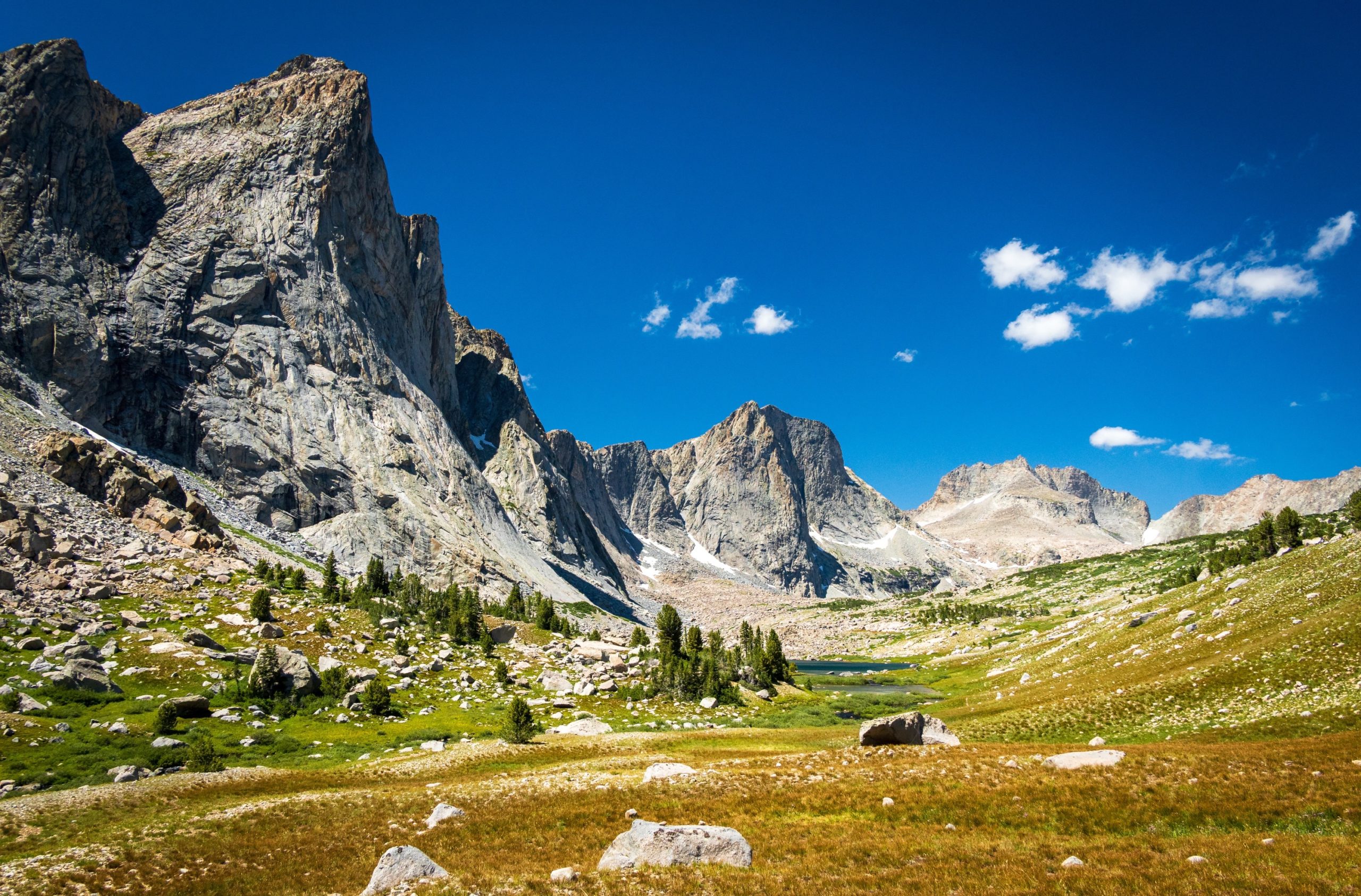
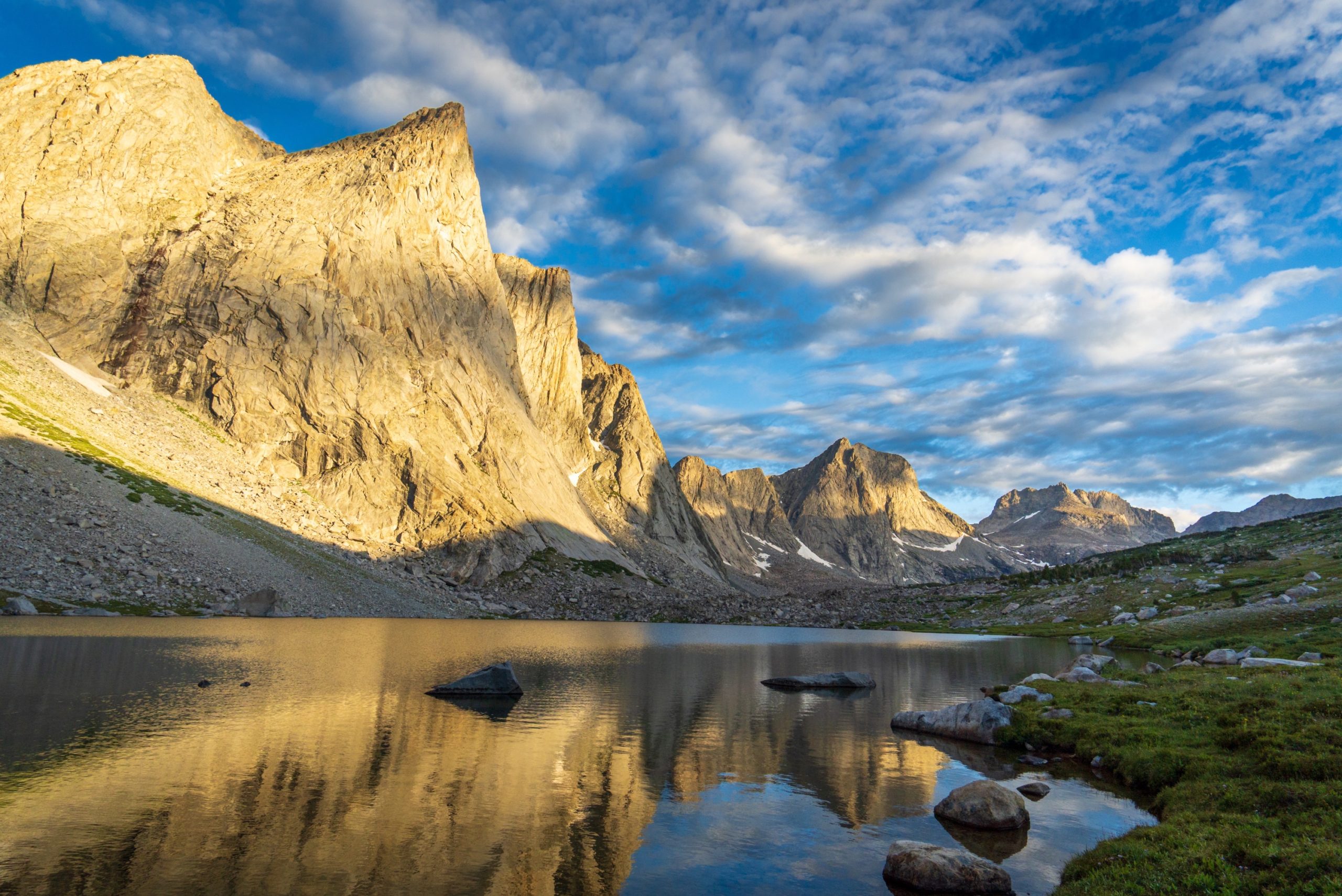
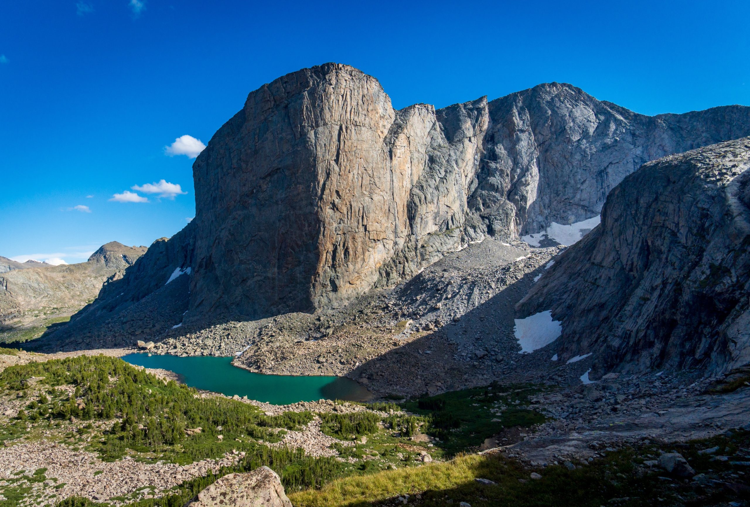
To the southwest of the lake, we climbed a ridge and found spectacular camp sites with broad panoramic views of the dramatic Mount Hooker, the turquoise Lake 10526 and Hooker Glacier at its base, and Baptiste Lake.
Day 3 – Baptiste Lake to Shadow Lake
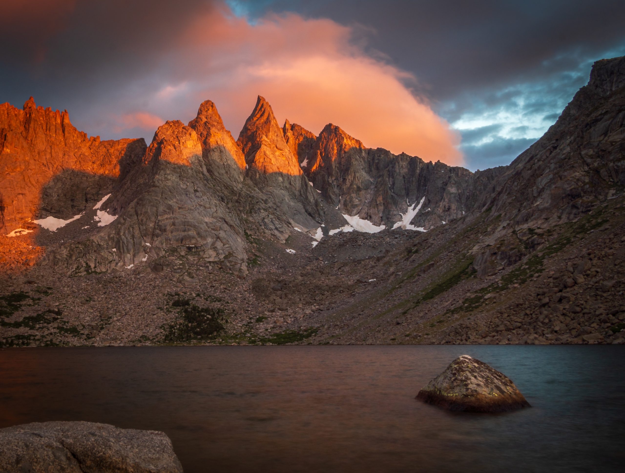
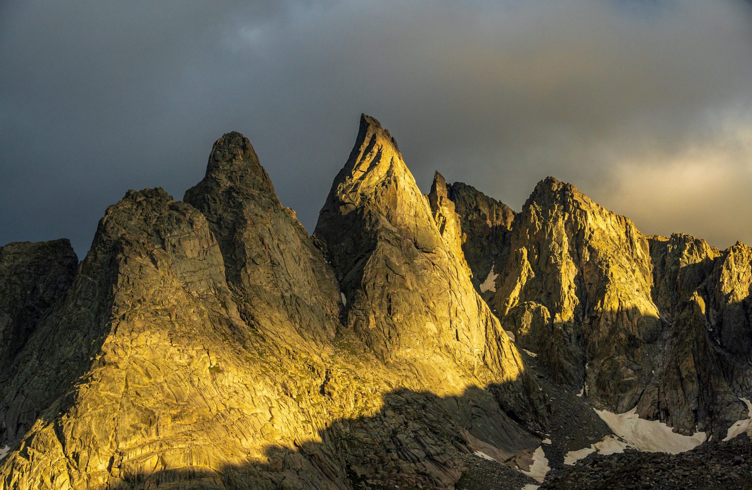
We woke early to watch the 1,800-foot north face of Mount Hooker illuminated a bright orange by the first rays of light. This cliff is apparently the tallest uninterrupted wall east of Yosemite Valley and is popular with rock climbers.
After breakfast, we retraced our way back over Hailey Pass. It was a steep climb, but easier than the way down.
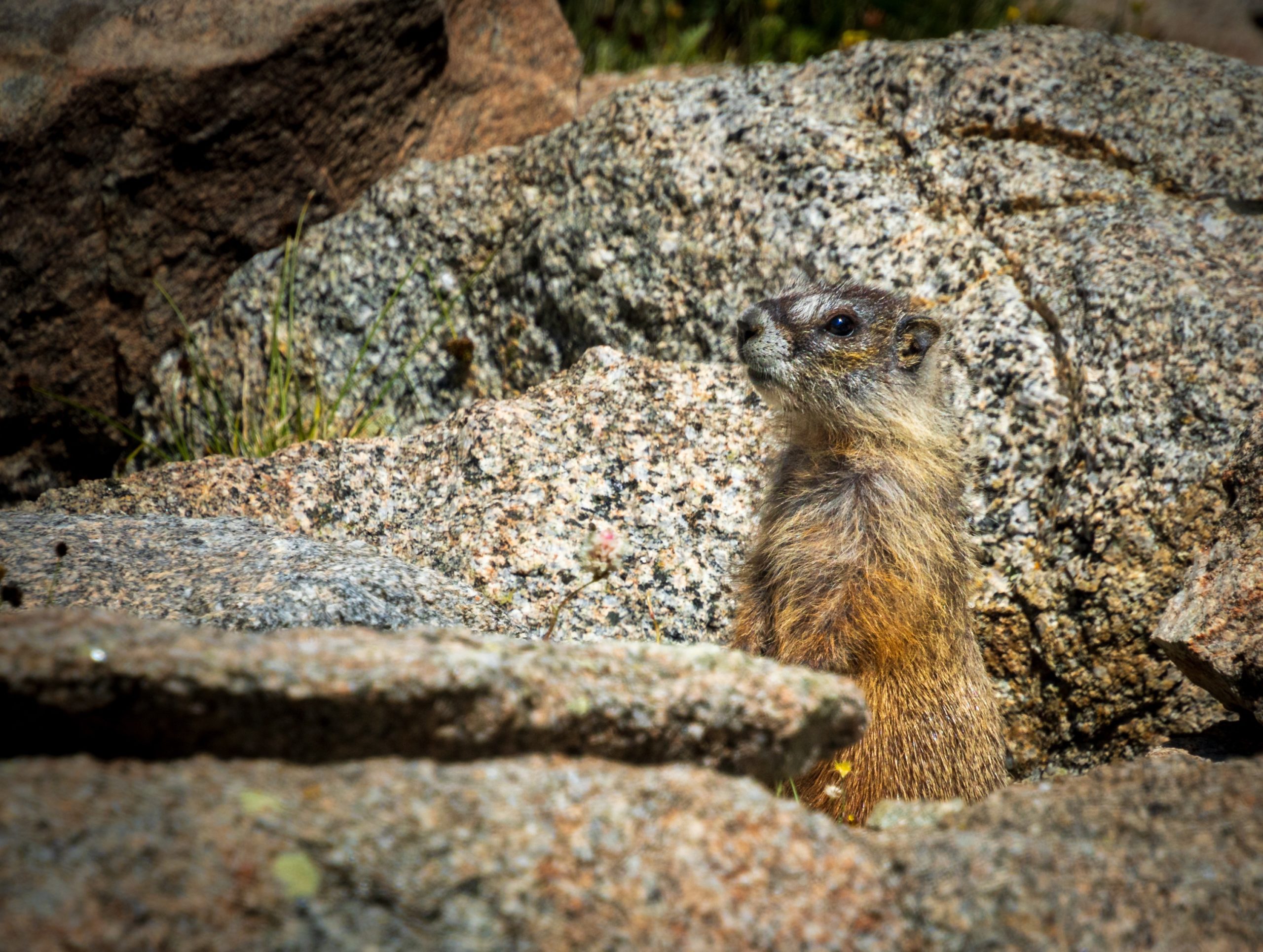
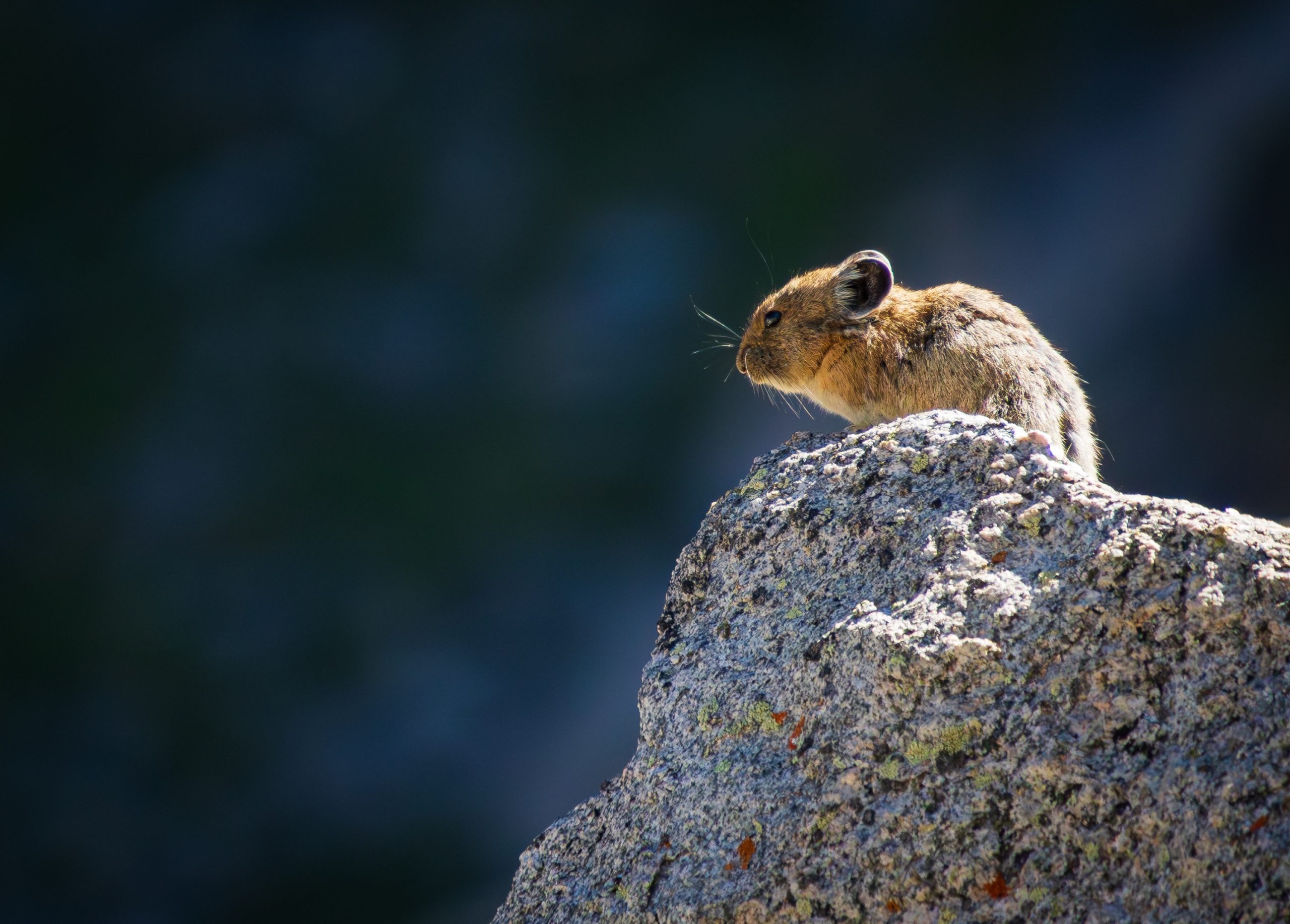
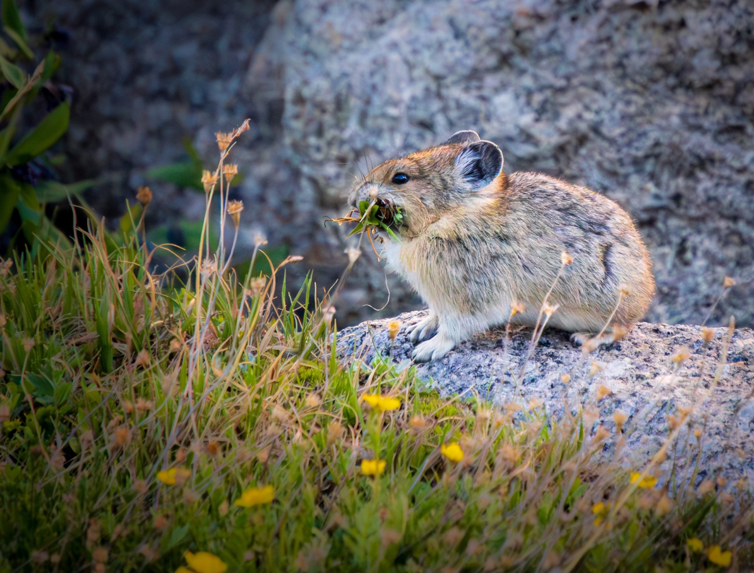
On the descent south from Hailey Pass, the rocky terrain was packed full of marmots and pikas.
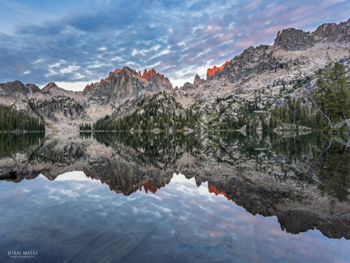
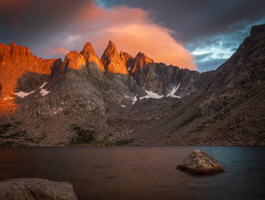
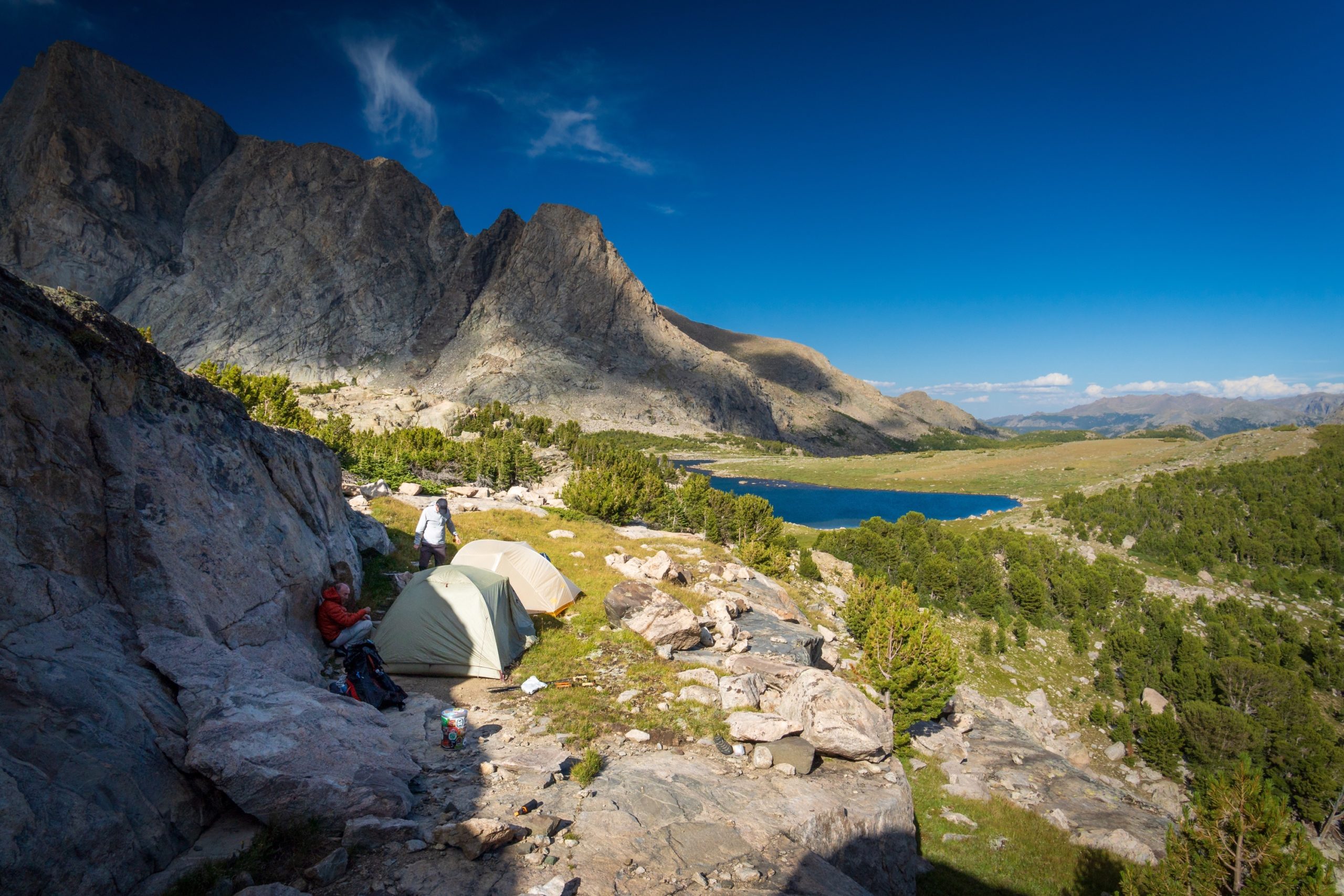
We continued south past Skull Lake until we reached the junction with the Shadow Lake Trail, then turned east for a 2 mile walk to the lake located on the west side of the Cirque of the Towers. We found a large, protected site near the lake and were treated to a colorful sunset that illuminated the peaks behind the lake.
Day 4 – Shadow Lake to Pingora Camp
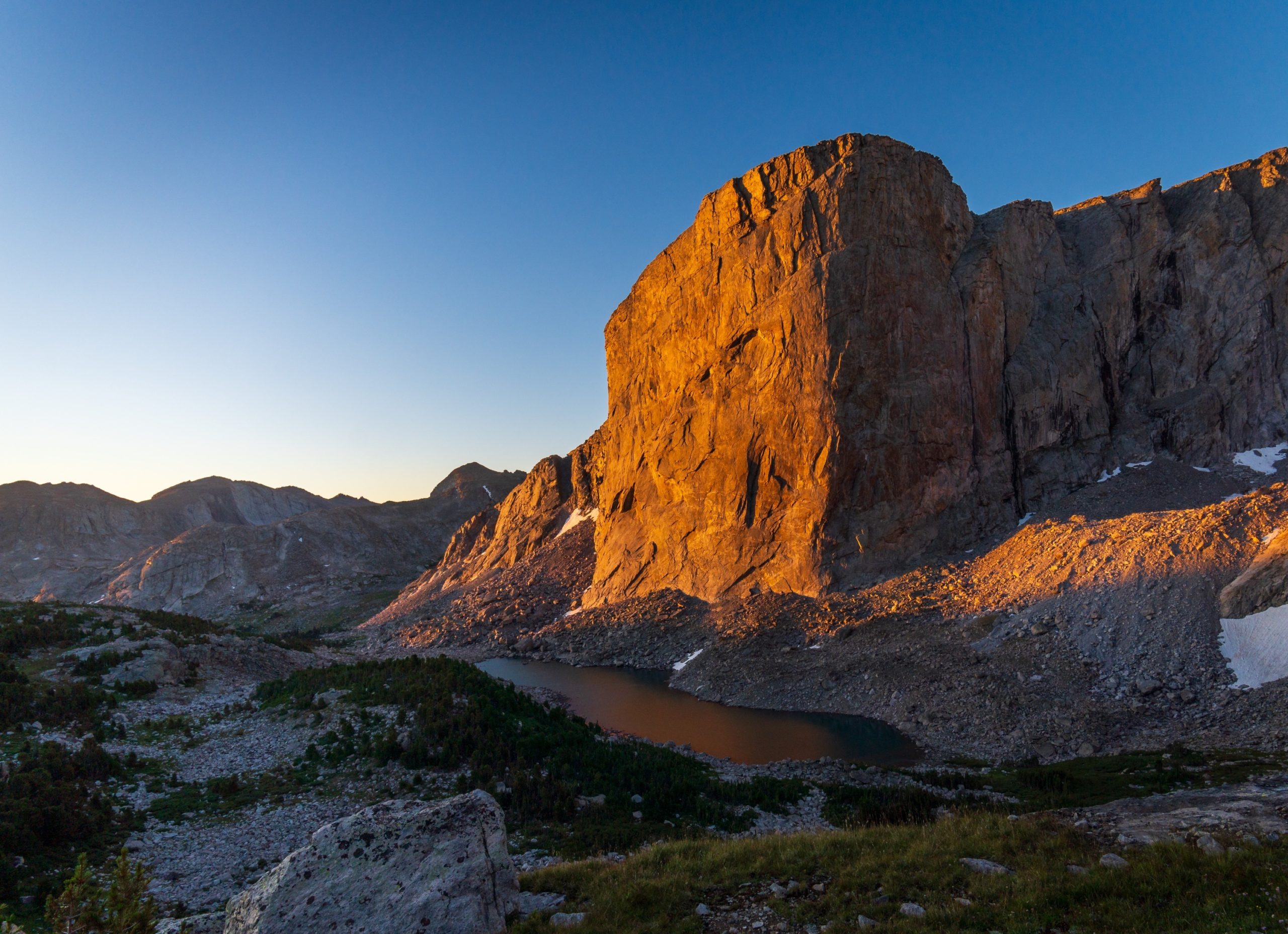
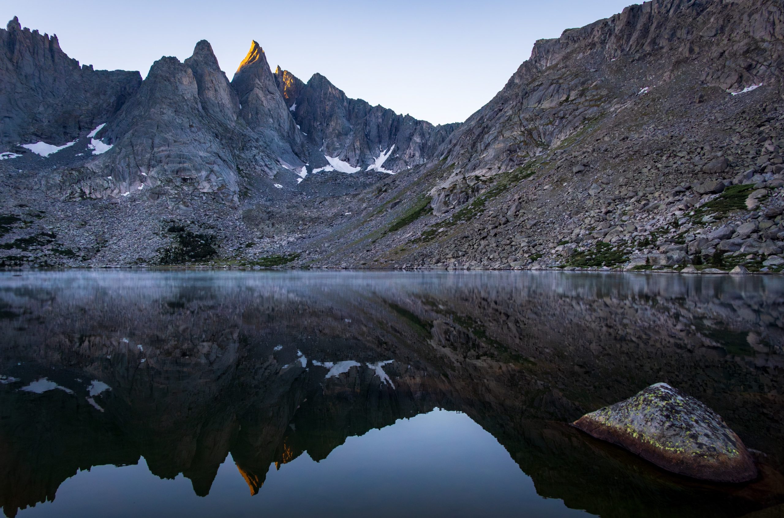
In the morning, Shadow Lake was still and reflected the peaks – some illuminated – as a fog lifted off its surface.
The day would be a short 3-mile hike, but it would involve climbing over the steep Texas Pass. A seemingly endless number of pikas called out to us on the way up.
At the top of Texas Pass, we passed a small snowfield before descending a beautiful grassy slope full of wildflowers, a small stream, and ever more dramatic views of the Cirque of the Towers surrounding us.
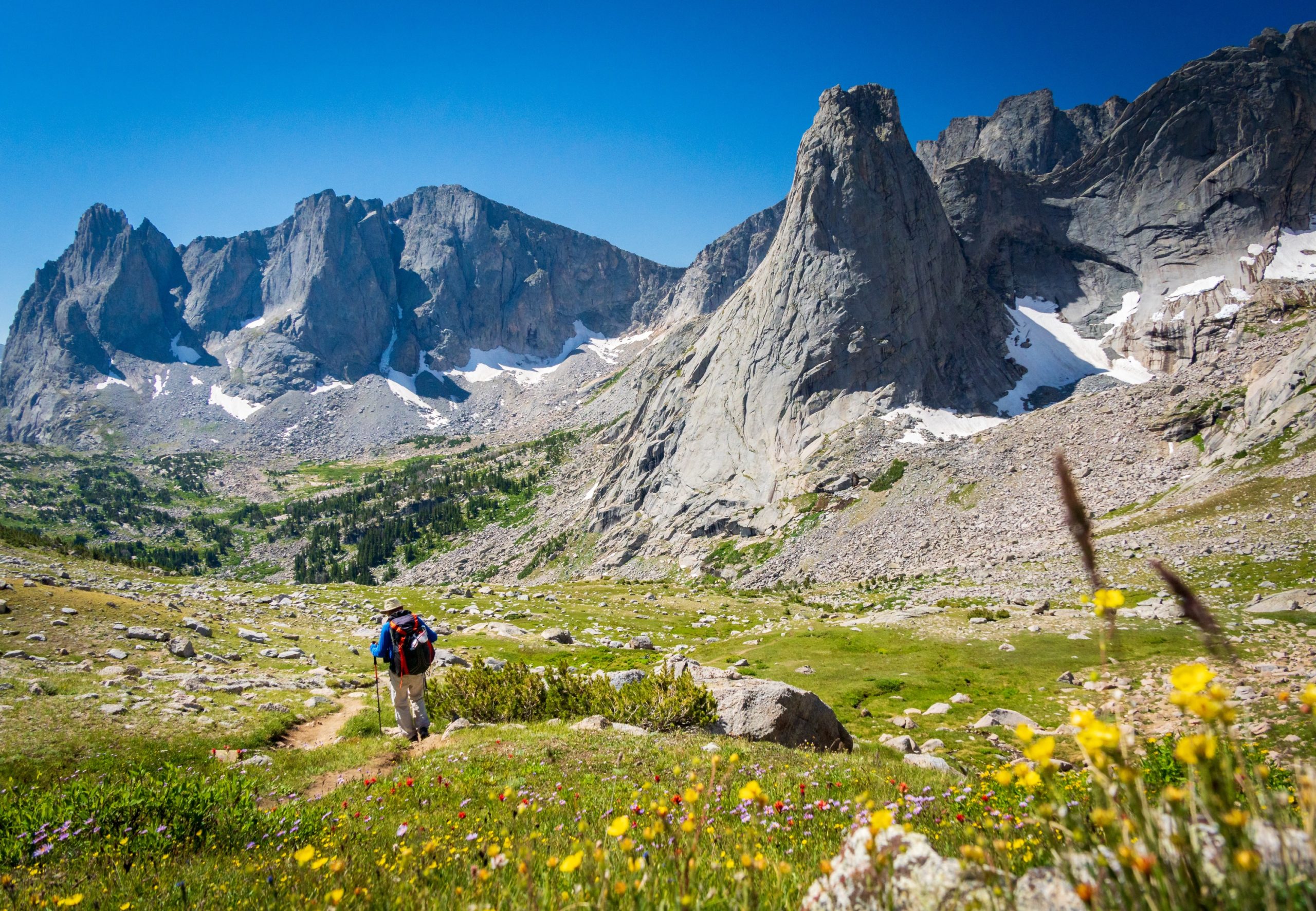
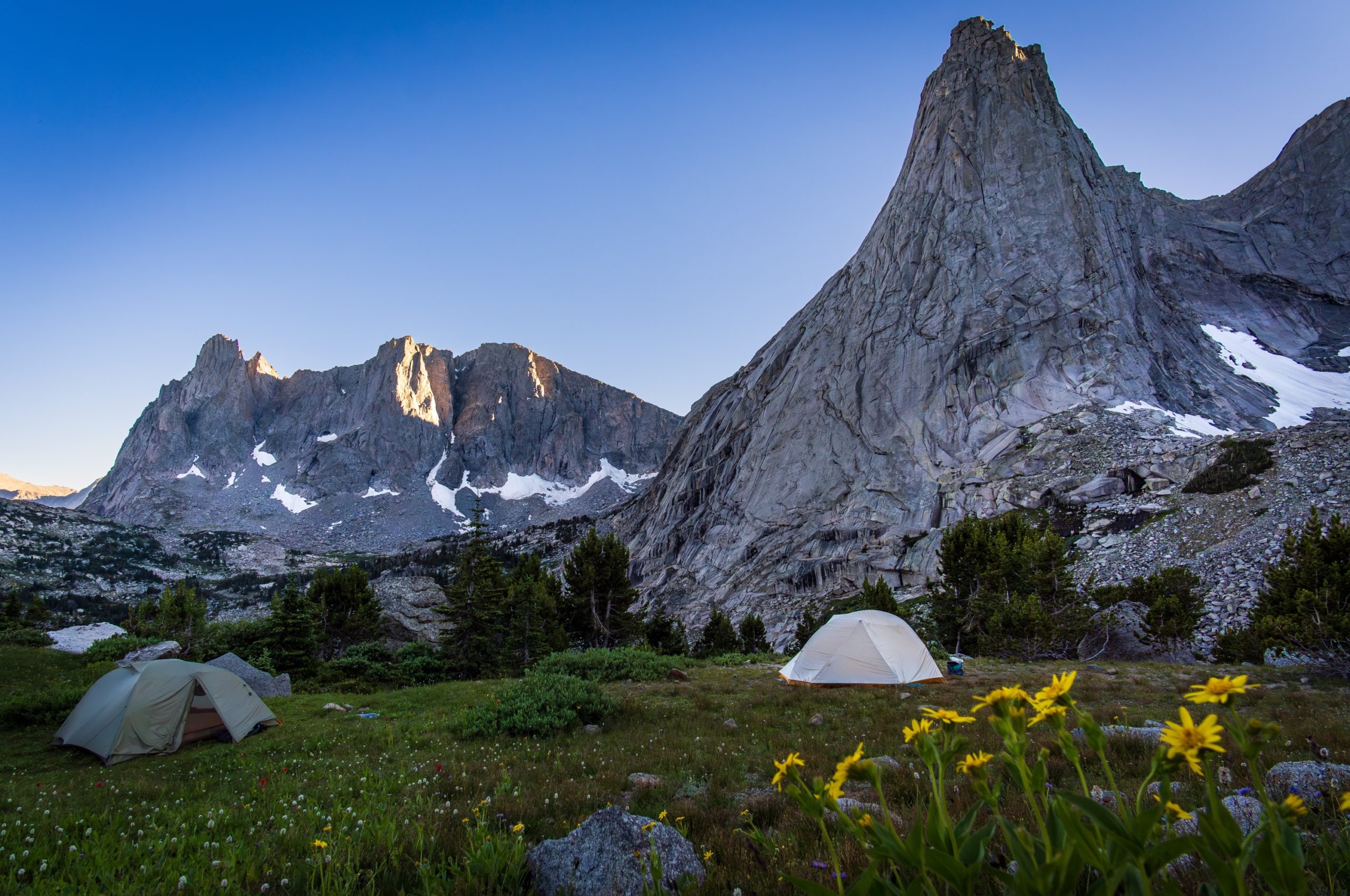
We camped at “Pingora Camp,” where the slope levels off a bit before it makes a steep descent to Lonesome Lake. Towering above us was Pingora Peak.
Day 5 – Pingora Camp to Big Sandy TH
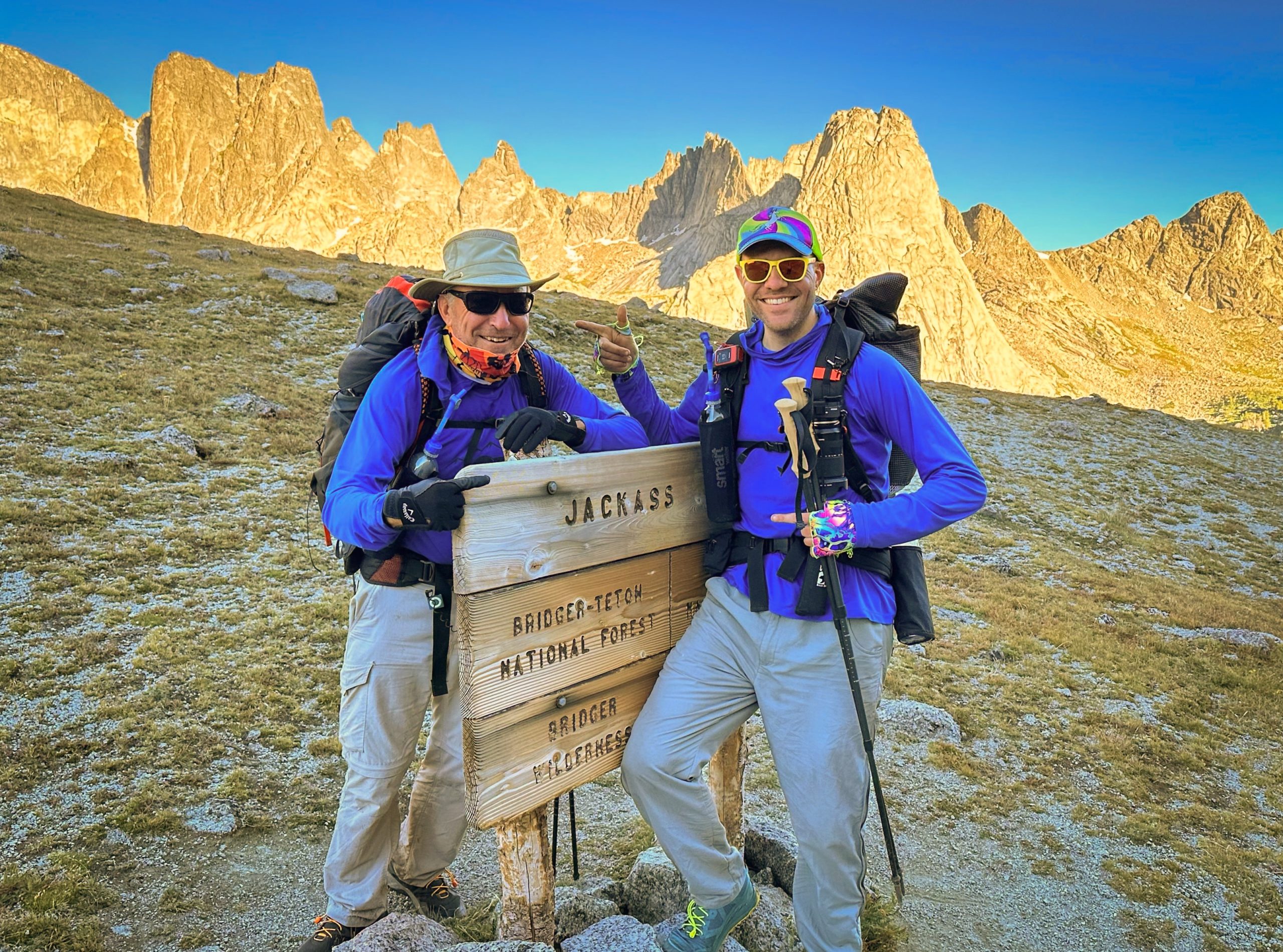
On our last day, we started early to make our way back to the trailhead.
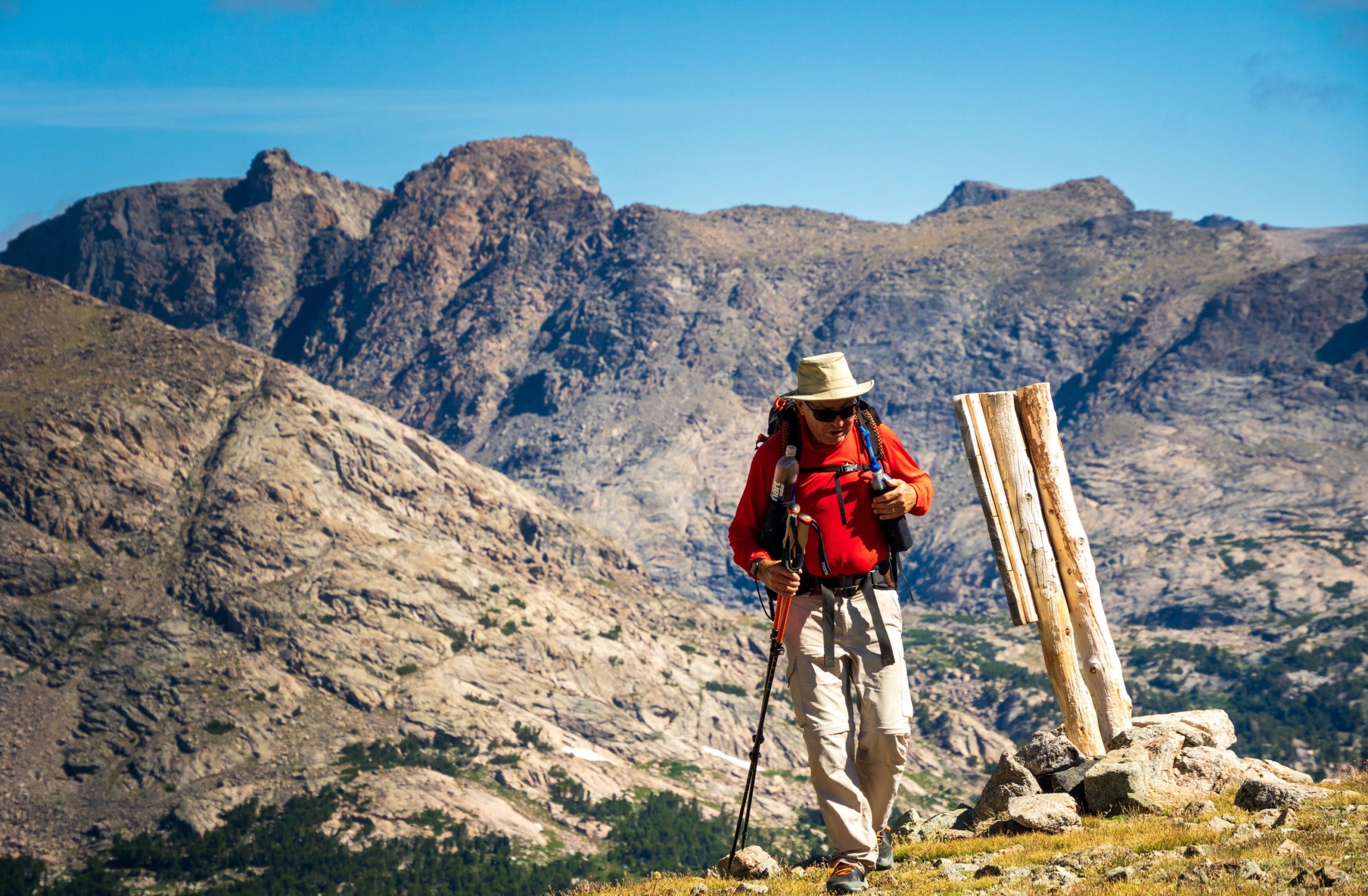
We passed Lonesome Lake and then climbed over Jackass Pass, where my dad and I posed for the obligatory photo.
After Jackass Pass, the Big Sandy Trail follows a relatively steep and then more gradual descent to the trailhead.
We passed Arrowhead Lake, North Lake, and Big Sandy Lake. Along the way, pikas were busy collecting grasses to store in their den to survive the next winter.
After reaching our car at the Big Sandy Trailhead, we made our way to Pinedale, where we enjoyed some burgers and beers.
Discover more from From My Perspective
Subscribe to get the latest posts sent to your email.