

Commuters step off the A train at 175th Street in Washington Heights every day without realizing they are standing at one of the most unusual trailheads in the country. There is no sign to mark it, no plaque, no blaze. Yet from this subway station begins the Long Path, a 358-mile trail that leads from New York City to the foothills of the Adirondacks.
Afoot and light-hearted I take to the open road,
Song of the Open Road, Walt Whitman
Healthy, free, the world before me,
The long brown path before me leading wherever I choose.
A Brief History of a Long Path
The trail — still a work in progress — has evolved both as an idea and in its physical form.
First proposed in 1931 by Paul and Vincent Schaefer of the Mohawk Valley Hiking Club as New York’s answer to Vermont’s Long Trail, the concept was for an unmarked route from New York City to Lake Placid in the Adirondacks. Since the 1920s, Raymond H. Torrey, a founder of the New York-New Jersey Trail Conference, had been writing a weekly New York Post column titled “The Long Brown Path,” inspired by the reference in Walt Whitman’s “Song of the Open Road.” Starting in 1933, Torrey’s column championed the Schaefers’ “Long Path of New York,” featuring descriptions of sections of the route in his Tuesday columns. However, an unmarked route was a difficult concept for the public to grasp, and interest in the route waned after World War II and remained dormant for the next 20 years.
The idea was revived in 1960 by Robert Jessen and Michael Warren, two members of the Ramapo Ramblers — this time as a marked trail from the George Washington Bridge to Mount Whiteface in the Adirondacks. Over the years, sections of trail have been identified, acquired, built, blazed, and sometimes rerouted. The southern and northern termini have changed.
As of 1987, the trail was 216 miles long over 23 sections, growing to 236 miles and 25 sections by 1992, and 358 miles and 35 sections today. A current priority is to eliminate as many of the 60 miles of road walks as possible, work that is actively underway.
For over 50 years, work on the trail has been led by the New York-New Jersey Trail Conference, a volunteer-based organization that builds and maintains 2,000+ miles of trails across New York and New Jersey. Print guides for the Long Path were published in 1982, 1987, 1992, 1997, and 2002, however the Trail Conference now maintains an online guide for the trail. There’s also a helpful Friends of the Long Path Facebook group.
Becoming an “End to Ender”
The New York–New Jersey Trail Conference provides official End-to-End certification to hikers who complete the Long Path, whether as a continuous thru-hike or over time in sections. A tally sheet is available to track progress along the route.
The first known End-to-Ender was Albert “Cap” Field, who completed the trail on an unknown date. The first completion with a recorded date was by Ed Walsh, who finished on July 4, 1991.
Since then, the number of completions has steadily grown. There were 59 in the 1990s, 52 in the 2000s, and 67 in the 2010s. The pace appears to be accelerating further in recent years. During the pandemic-era hiking boom, 23 hikers completed the Long Path in 2021.
The largest group finish occurred on October 9, 2005, when 13 hikers completed the trail on the same day. Today the roster of Long Path End-to-Enders has grown to more than 230 hikers, illustrating the trail’s evolution from a little-known regional route to a recognized long-distance challenge.
Section 1: New York City to the NY/NJ State Line
On March 7, 2026, I decided to begin a section hike of the Long Path, starting with the 14.1 mile Section 1 from Manhattan to the New York-New Jersey State Line.
It was a surprisingly mild and foggy day. Just two weeks after a blizzard dumped over 20 inches of snow on the region, temperatures in the 60s quickly melted the remaining snow, creating a slushy, muddy mess and trails that sometimes looked more like creeks.
The Southern Terminus
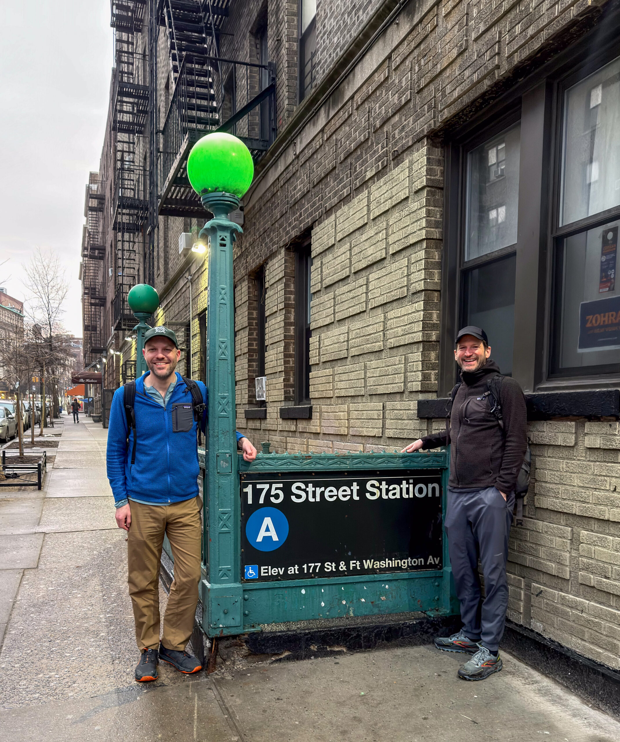
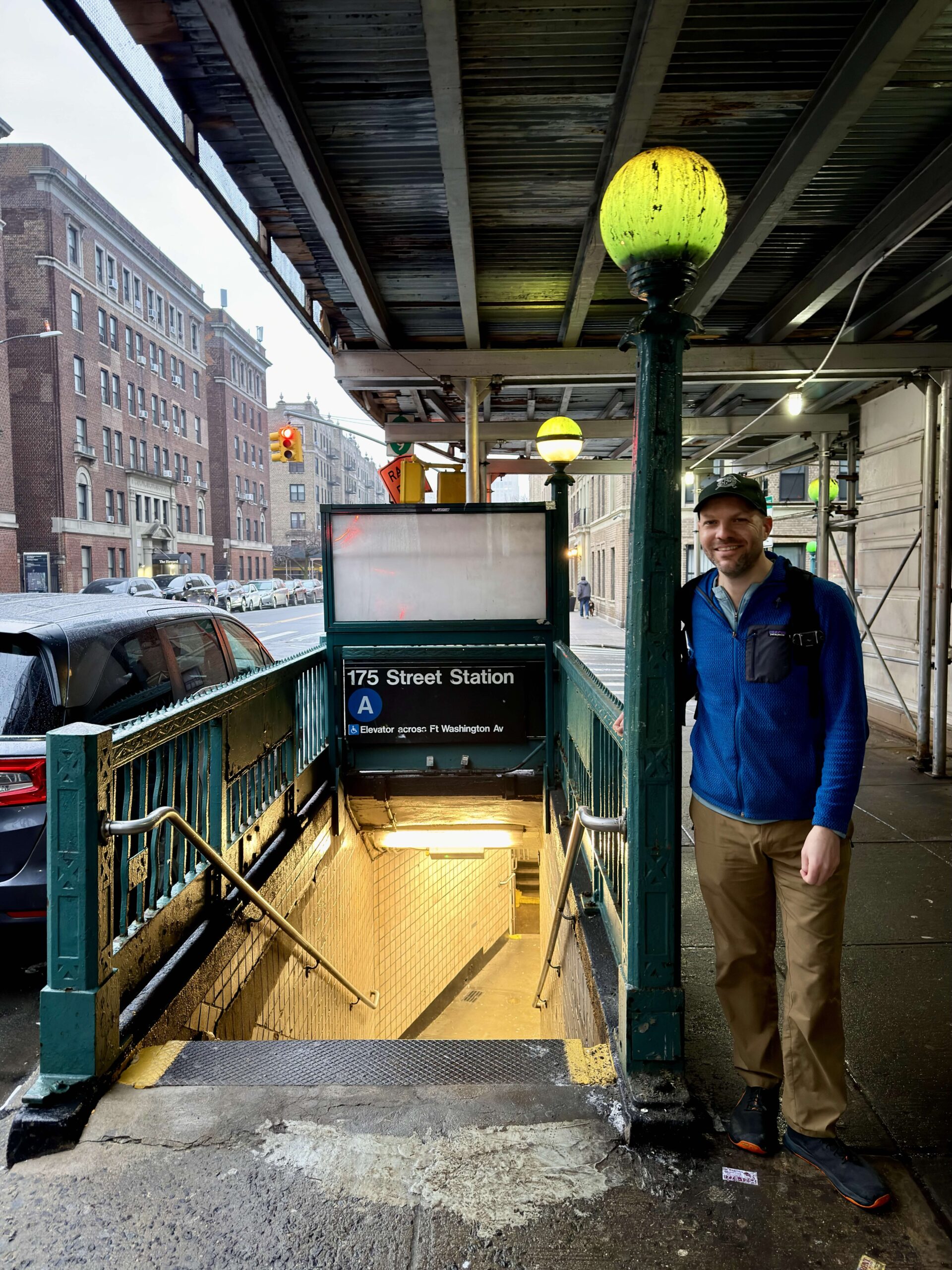
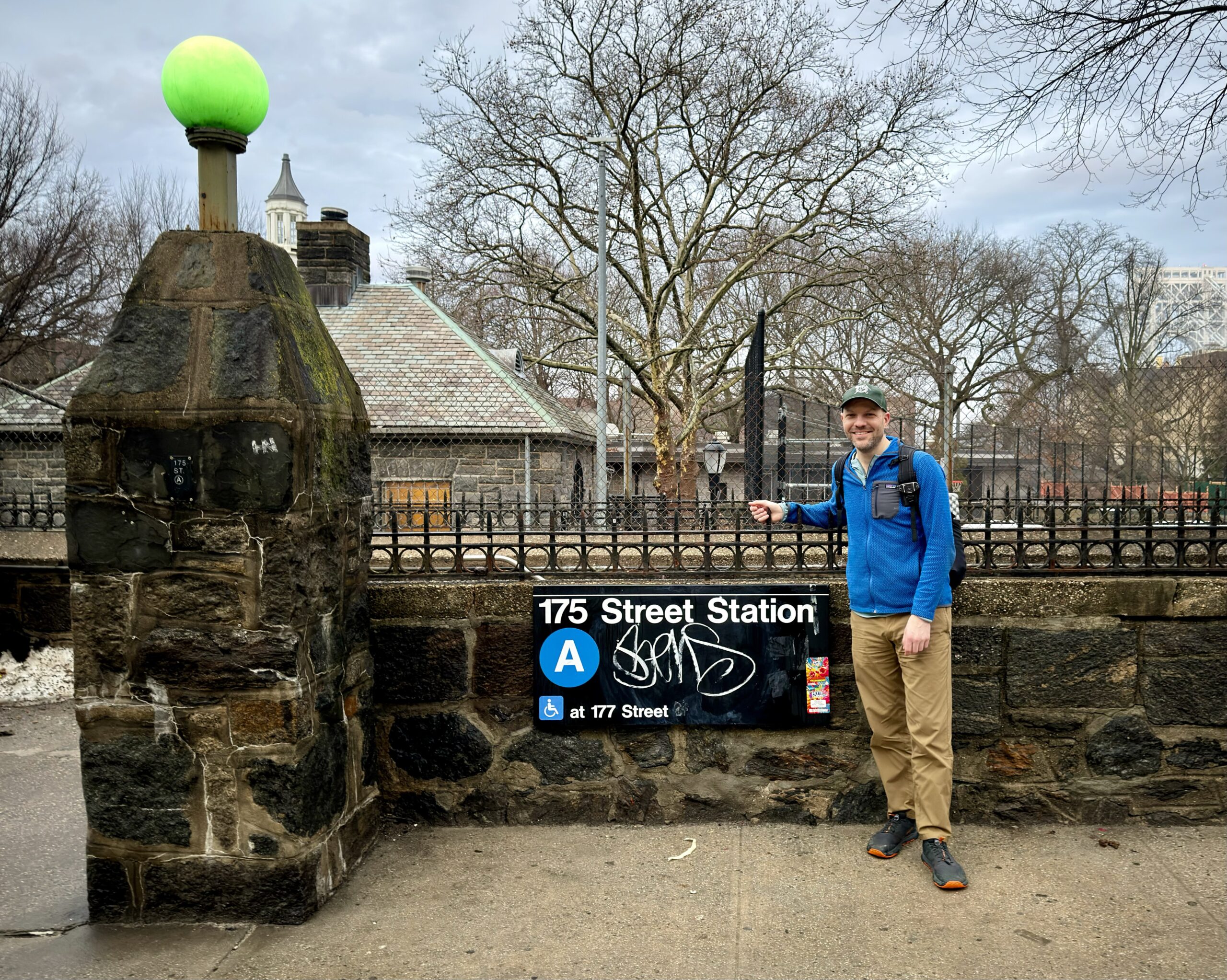
Originally beginning in Fort Lee at the George Washington Bridge, the southern terminus was moved in 2015 to the 175th Street subway station in Manhattan.
We left our cars at State Line Lookout and rather than drive into Manhattan, we took an Uber and were dropped off at W 175th Street and Fort Washington Avenue.
We searched for signs or blazes to mark the trailhead at 175th Street. Finding none, we decided to take ceremonial photos by the subway entrance anyway. But which one was the official starting point? Unsure, we took photos at several to cover our bases.
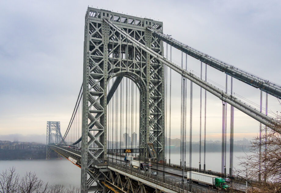
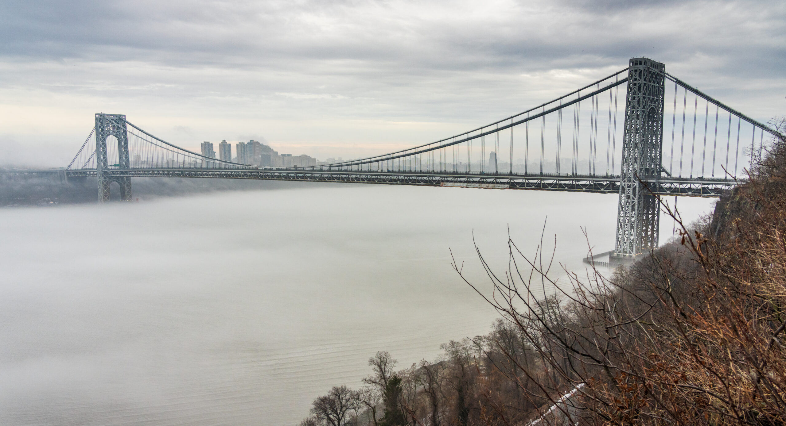
George Washington Bridge
The trail follows the George Washington Bridge (traditionally the Southwalk, but it was closed for construction, so we followed the Northwalk), providing panoramic views across the Hudson River and the basaltic face of the Hudson Palisades on the New Jersey side that lay ahead.

The first blaze we saw was on the Fort Lee side of the GWB walkway, indicating where the trail leaves the bridge and enters the woods.
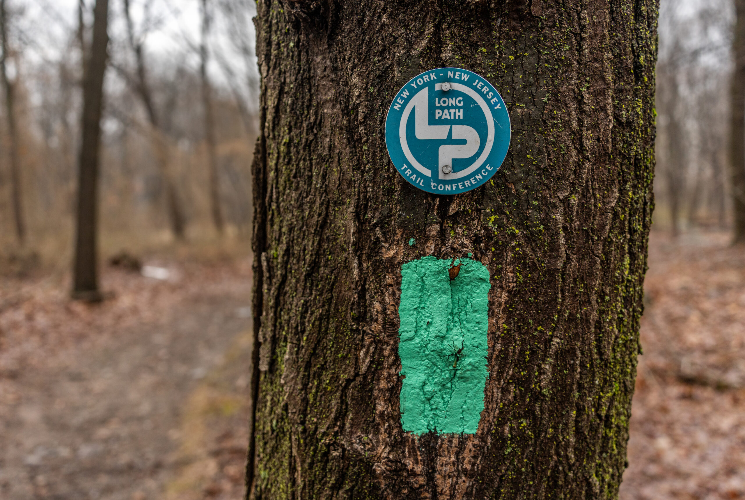
The route is primarily marked with 2″ x 4″ light blue-green blazes. The blaze color, “Long Path Aqua,” is a trade name of the Trail Conference.
For most of the section, the trail is relatively flat, paralleling the Palisades Interstate Parkway. It’s a surprisingly busy section, passing a gas station, Allison Park, the Sisters of St. Joseph of Peace property, the High Tom promontory, Rockefeller Lookout, Greenbrook Sanctuary, Alpine Lookout, and the headquarters of the New Jersey section of Palisades Interstate Park, where we stopped for a break and a snack. We saw three deer and also passed multiple old foundations and ruins from past settlements along the cliffs.
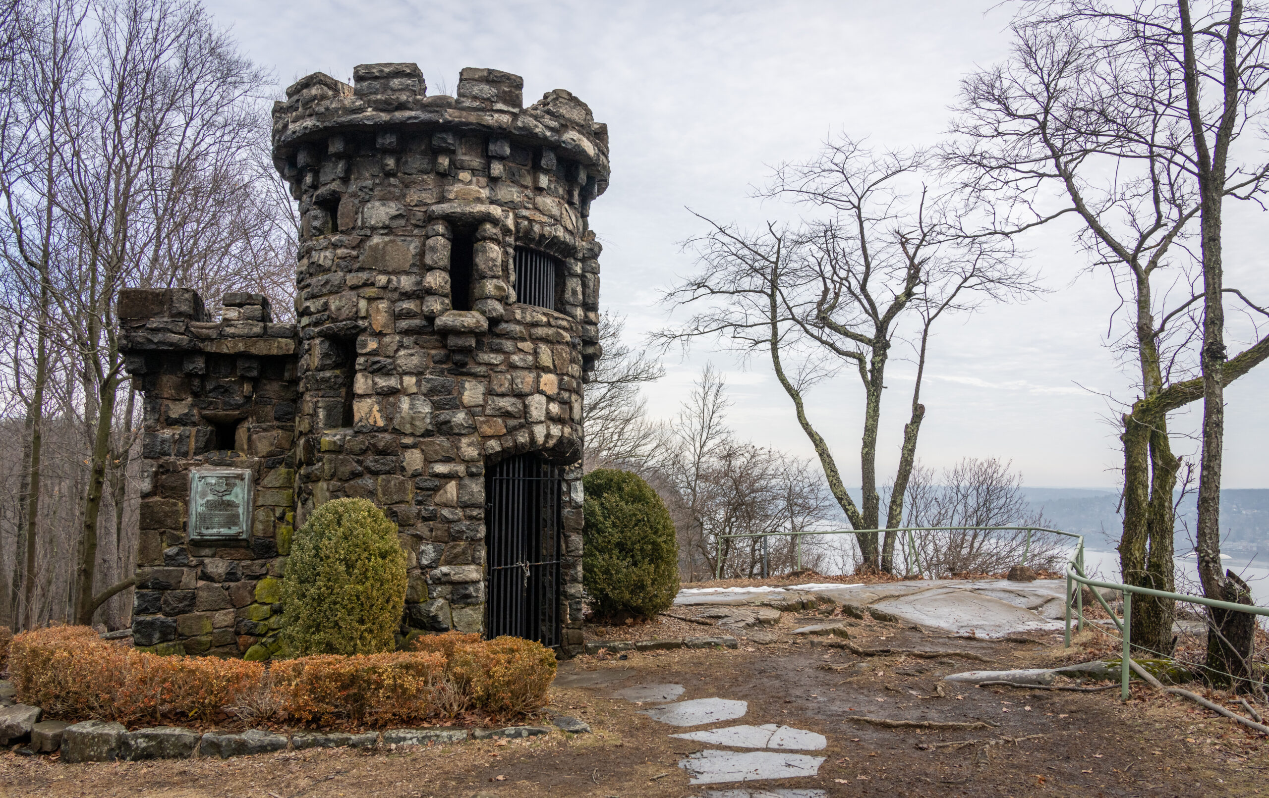
The Women’s Federation Monument
The most unique site along the trail is perhaps the Women’s Federation Monument. In the 1890s, quarries were blasting the Palisades cliffs for stone used in railroad beds and concrete. The Englewood Women’s Club championed the cause of protecting the Palisades and enlisted the New Jersey State Federation of Women’s Clubs, which in 1897 held its annual convention in North Jersey.
By 1900, the governors of New Jersey and New York had signed legislation creating an Interstate Commission to acquire and manage the Palisades. One of the first properties acquired in Alpine was named “Federation Park,” and in 1929 a castle-like monument was dedicated there to honor the New Jersey State Federation of Women’s Clubs, whose advocacy played a critical role in preserving the cliffs.
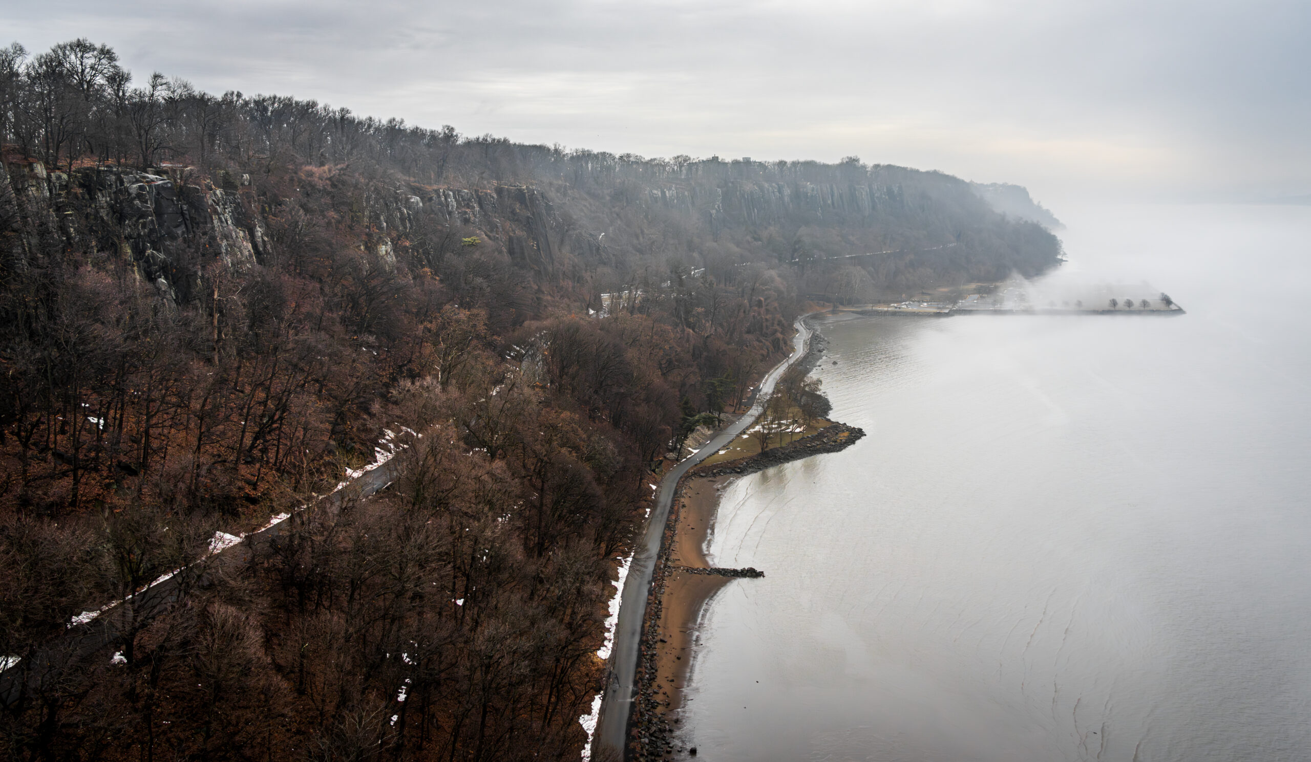
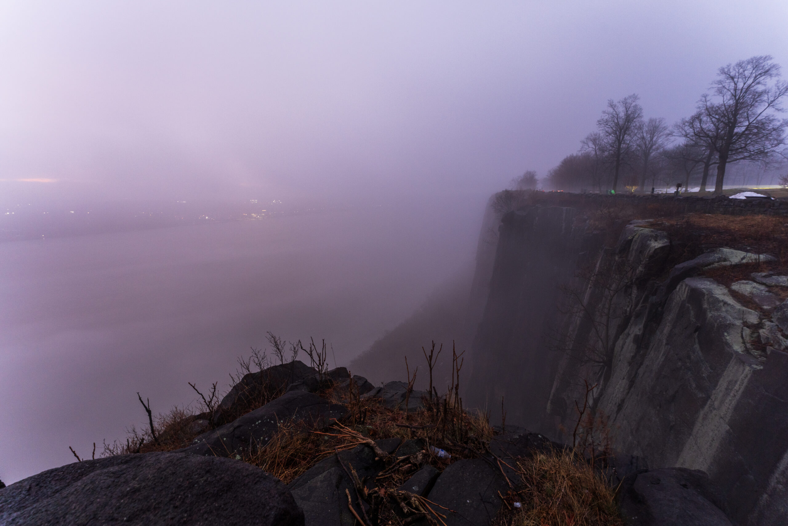
State Line Lookout
The section soon reaches State Line Lookout, a popular bird-watching spot with sweeping views of the Hudson, where a pair of resident peregrine falcons nest.

While the trail technically continues another mile to the New York–New Jersey border, we left that stretch for another day, since it would have required backtracking to the parking lot. We returned to our cars at the overlook, where earlier that morning we had watched dense fog blanket the river before sunrise.
Section 1 was done. Only 34 sections to go.