


A friend and I spent five days backpacking in the Wind River Range in August 2024. While last year we explored the Cirque of the Towers area in the southern Winds, this year we sauntered further north through Titcomb Basin and Indian Basin.
Day 1
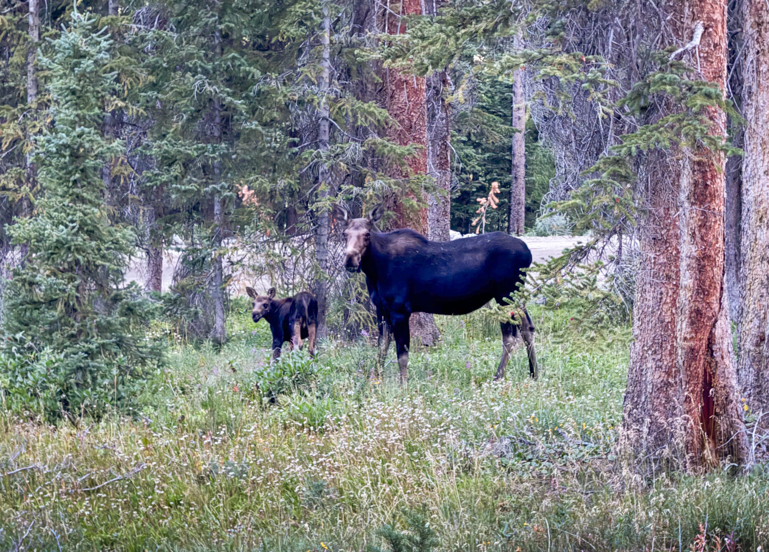
We started at the Pole Creek Trailhead and within 100 feet of the parking lot, we were immediately excited to see a mother and calf moose grazing. It was dark, making it difficult to photograph.
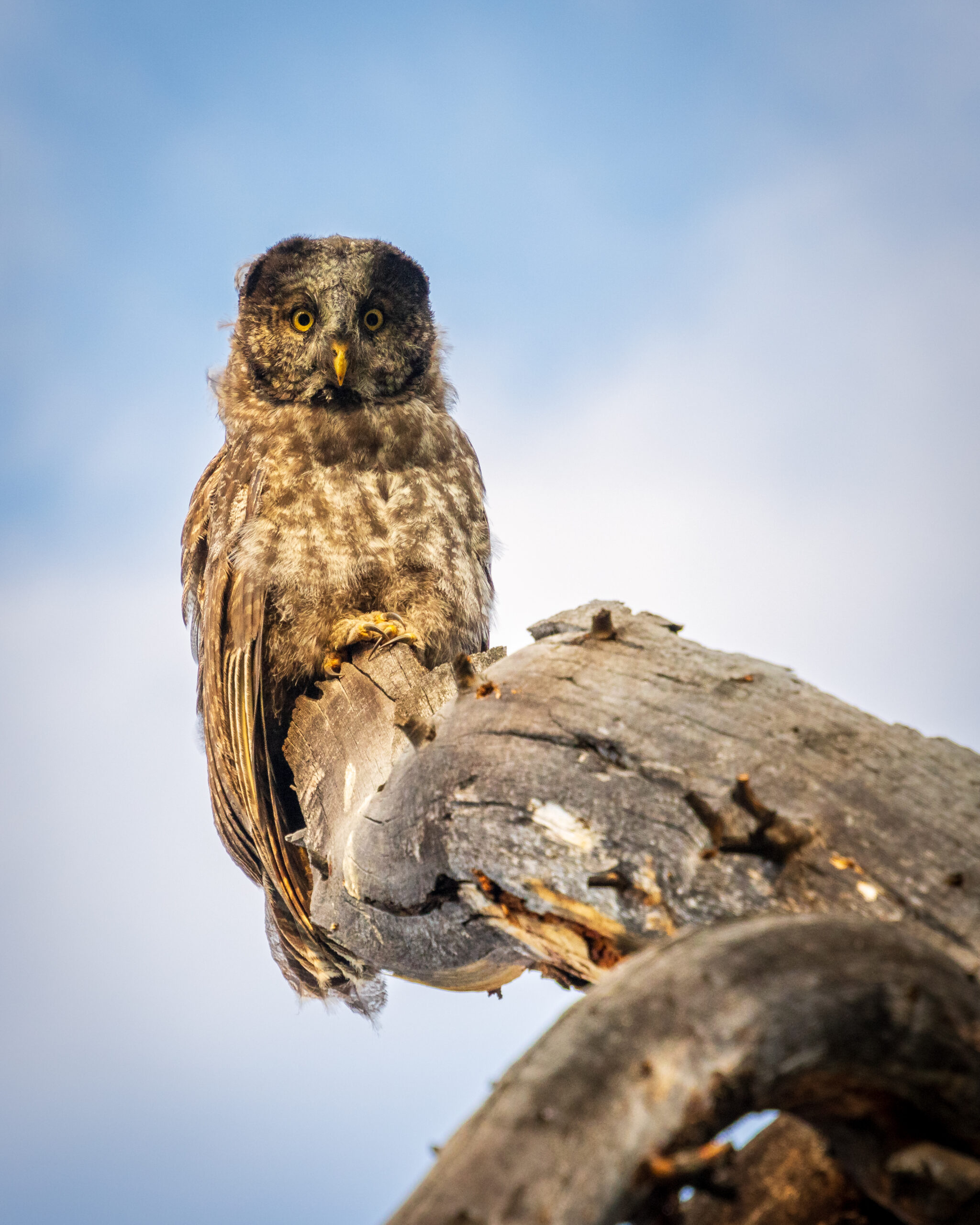
Just after dawn and a few miles from the trailhead, I saw a shadow cross the trail above me from the corner of my eye and heard “whoosh, whoosh.” A bird landed deep in the trees, somewhat at a distance. It was dark, but I could tell it was an owl – the second time I’ve ever seen one not in captivity (the first I’d ever seen in the wild was Flaco, the escaped Central Park owl – RIP Flaco!). The owl watched us for a moment and then took off and flew straight towards us, landing on a tree just to the side of the trail.
I didn’t know it at the time – but we were fortunate to be graced by an elusive, juvenile Great gray owl. He spent about 15 or 20 minutes watching us, bobbing his head around, and calling out to another nearby owl.
We knew it was a unique experience, and in that moment agreed that no matter what happened on the rest of the trip, we already considered it a success.
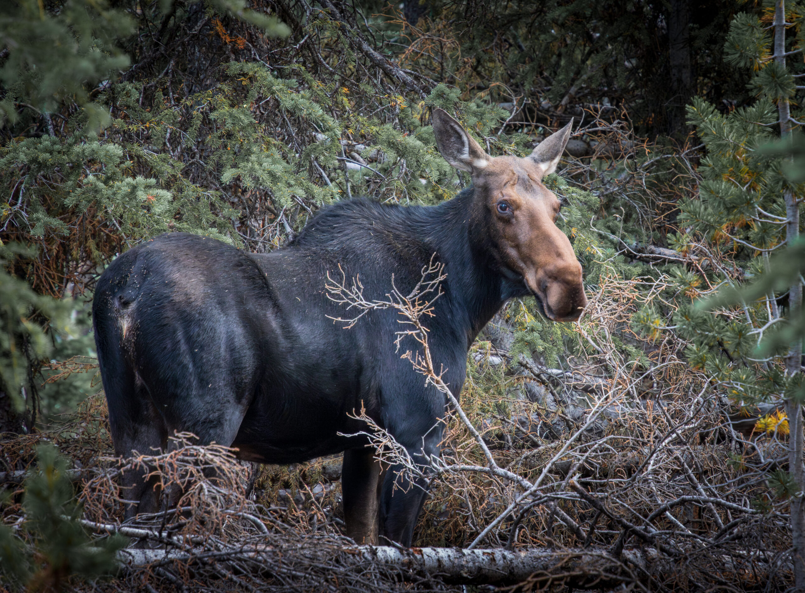
Not too much later, while still in the woods, we passed a third moose.
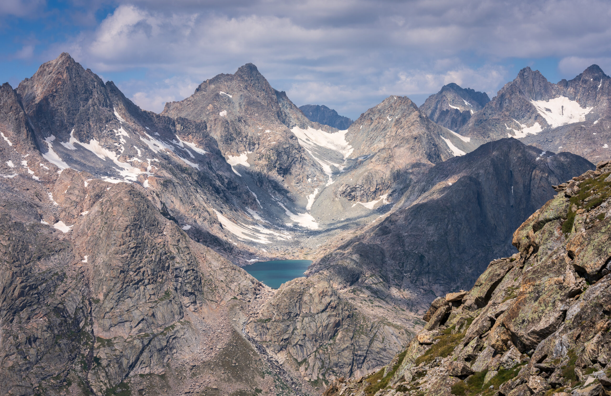
We soon reached Photographers Point, which is the first place you get an expansive view of the mountains and the Continental Divide.
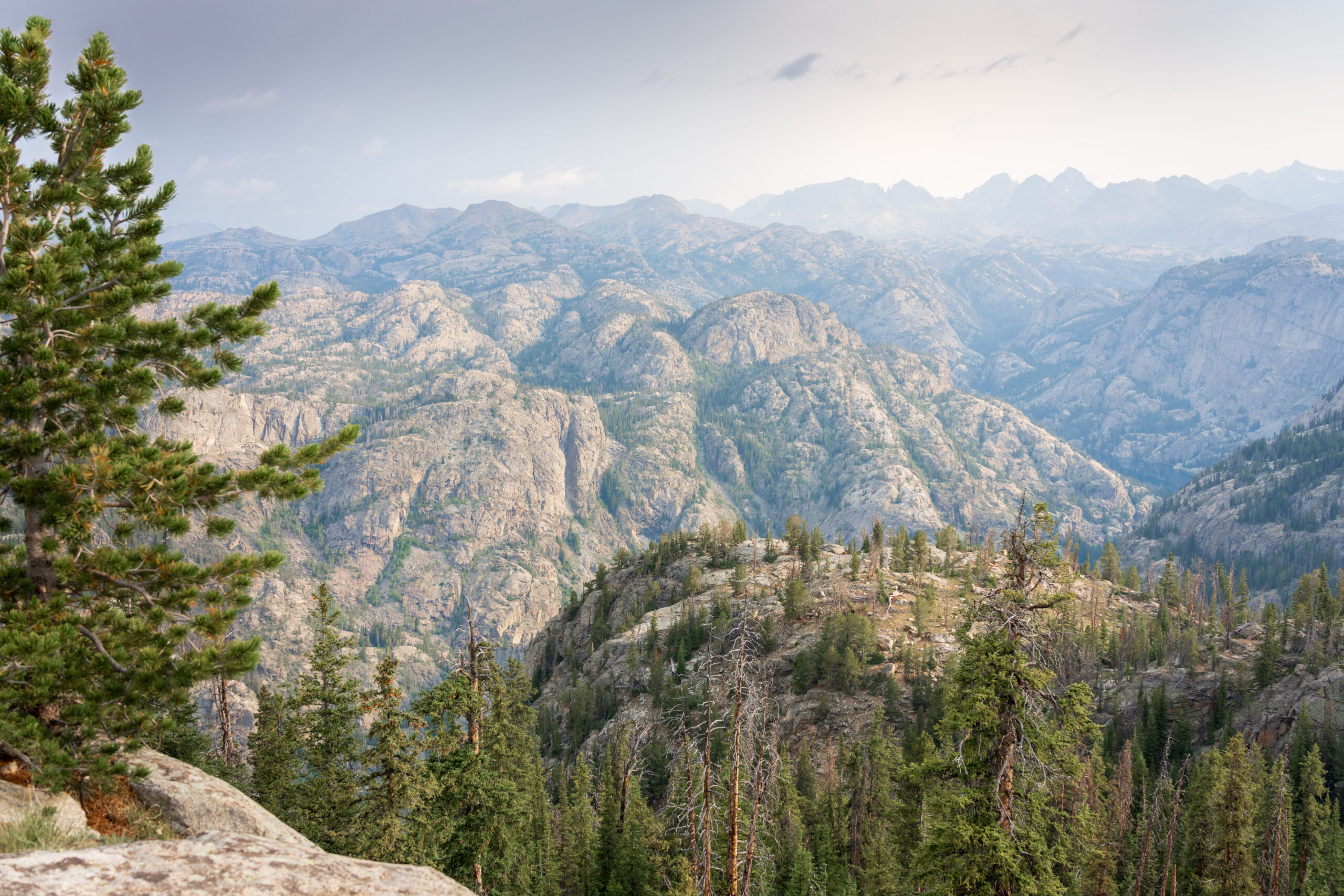
The view is much better from slightly off-trail, following the ridge that juts out a few hundred feet.
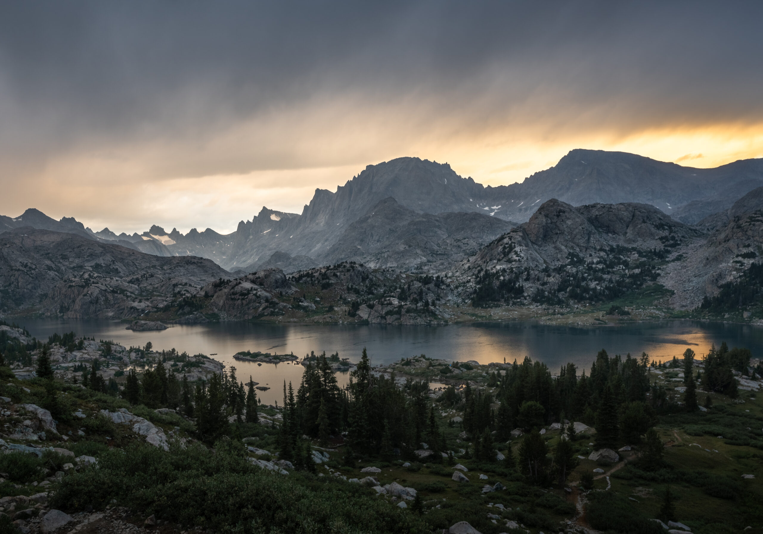
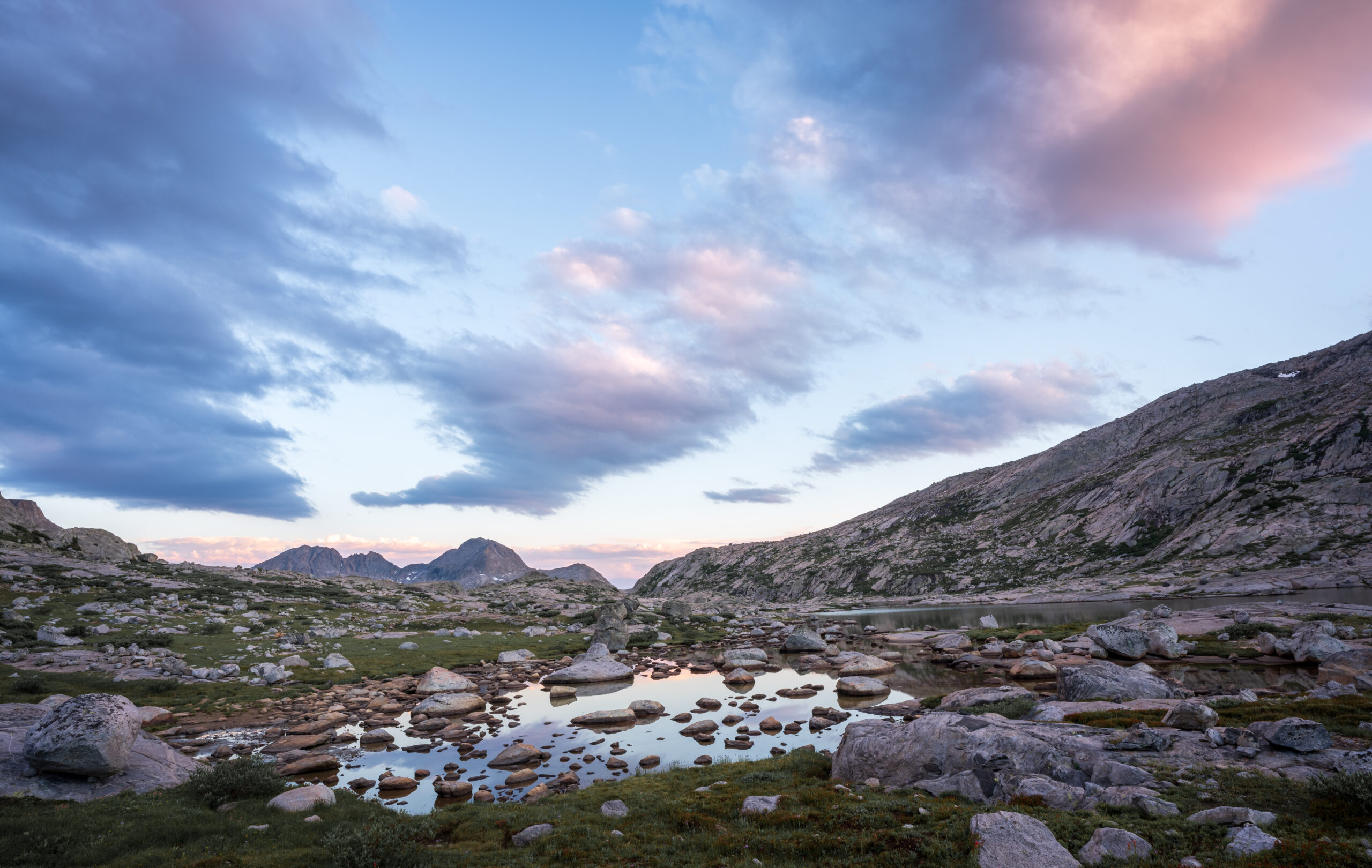
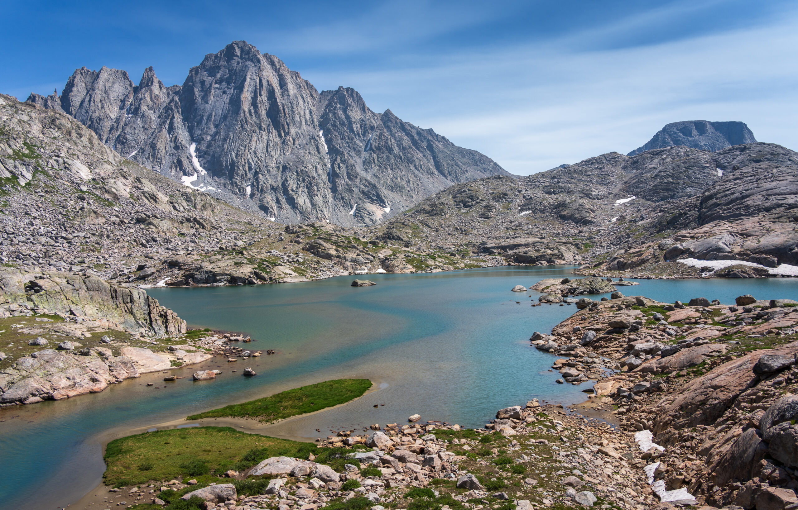
Our destination for the day was the popular Island Lake, just next to Titcomb Basin. Within a half hour of setting up camp, it began to rain, followed by two rounds of hail.
We had a few hours’ window to dry off our gear a bit and have dinner, and then storm clouds came in at sunset and it rained again overnight.
Day 2
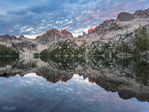
We woke up with wet tents and set them out to dry while we had breakfast and enjoyed the calm sunrise over the mirror-like Island Lake.

We only had about 3.5 miles to walk today towards Titcomb Basin, so we started later than usual. We found a relatively flat tent site to the east side of the trail near Lower Titcomb Lake and set up camp.
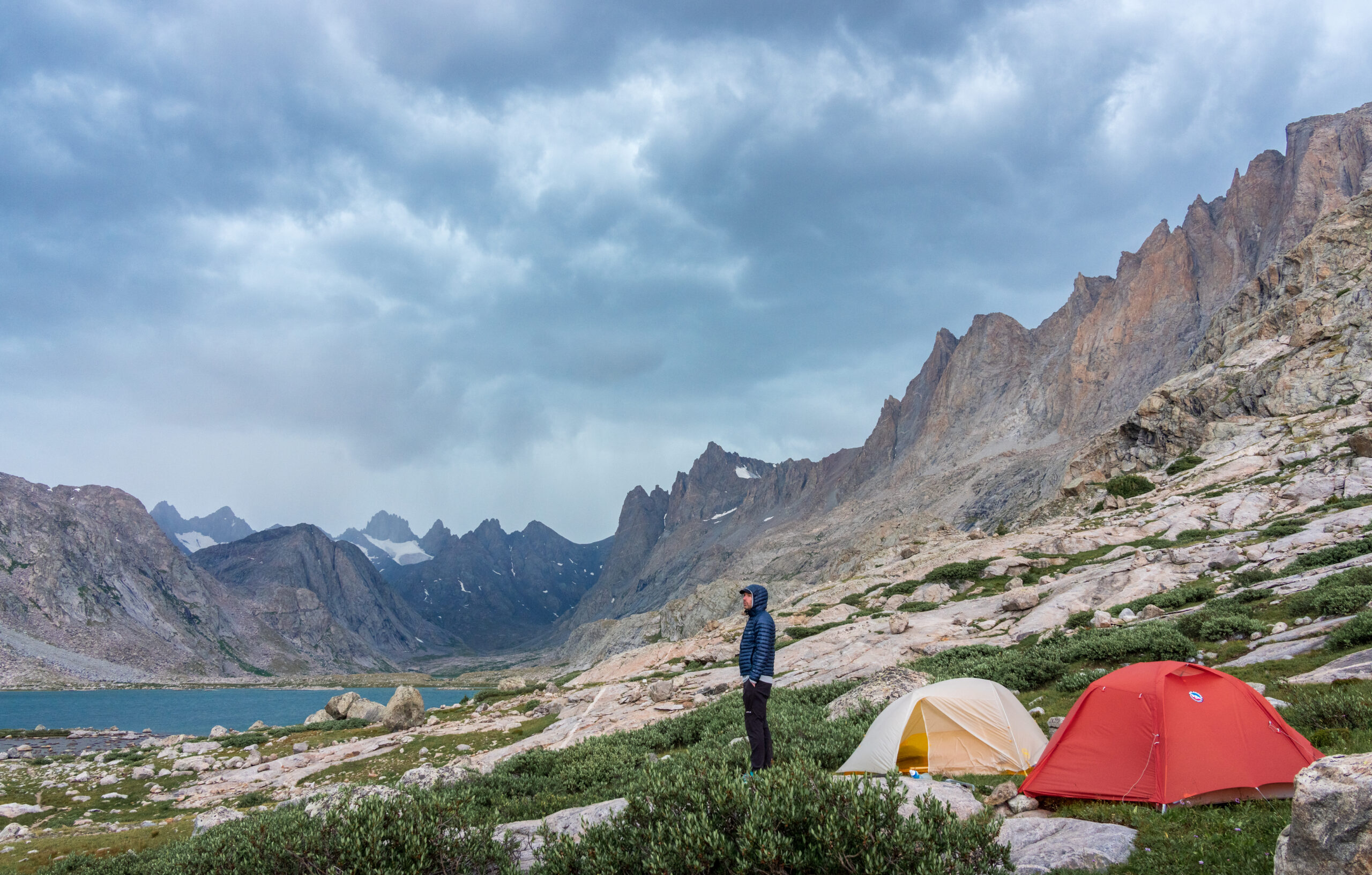
After setting up camp, we day hiked and explored the basin.

Storms chased us, so we hustled back to camp to hunker down in our tents. The wind was pretty intense!
I may have staked out my tent too aggressively because it led to one of my rain fly zippers ripping (zip ties to the rescue!).
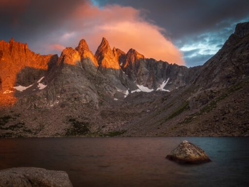
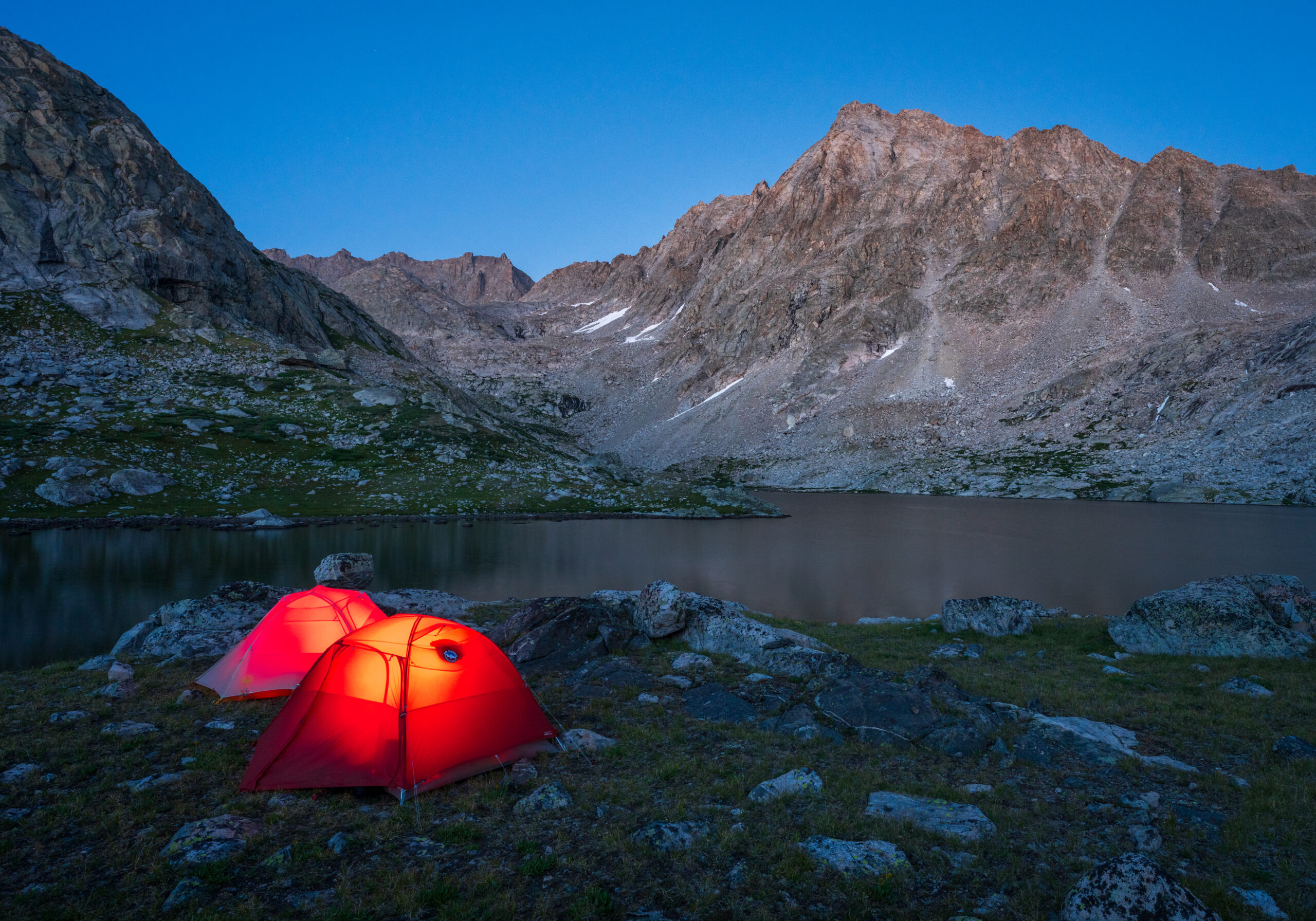
After dinner, we enjoyed photographing the peaks at sunset as the colors changed and reflected in the lakes.

Although the clouds looked potentially menacing, we fortunately had a rain-free night.

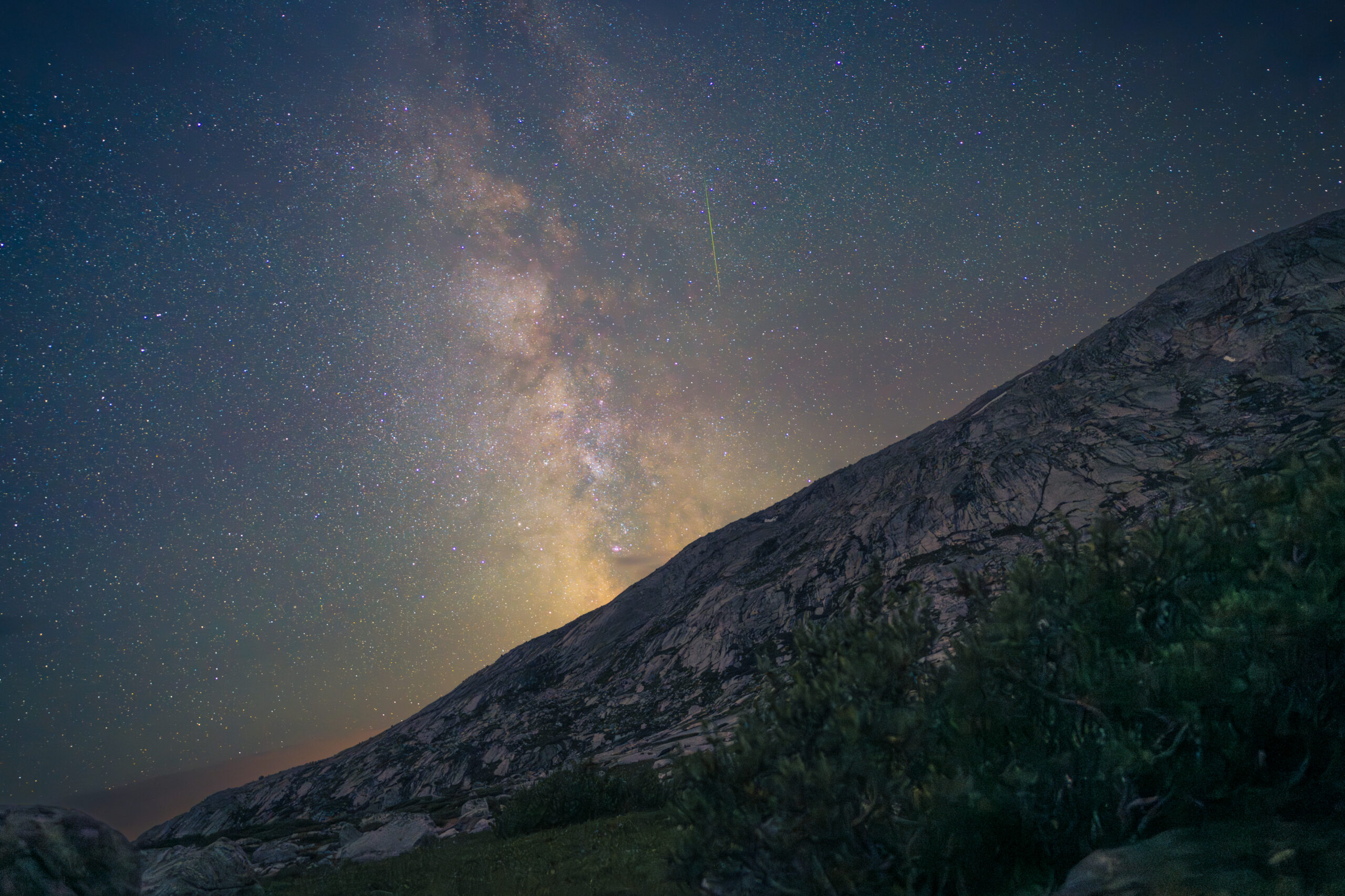
That evening was near the peak of the Perseid meteor shower. Around midnight, I woke up and got a few shots of the Milky Way rising over the basin. One of the photos also captured one of the Perseid meteors, which are famous for their half-pink/half-green trails caused by calcium and magnesium.
Day 3
On our third day, we were treated to some beautiful light over the nearby peaks.
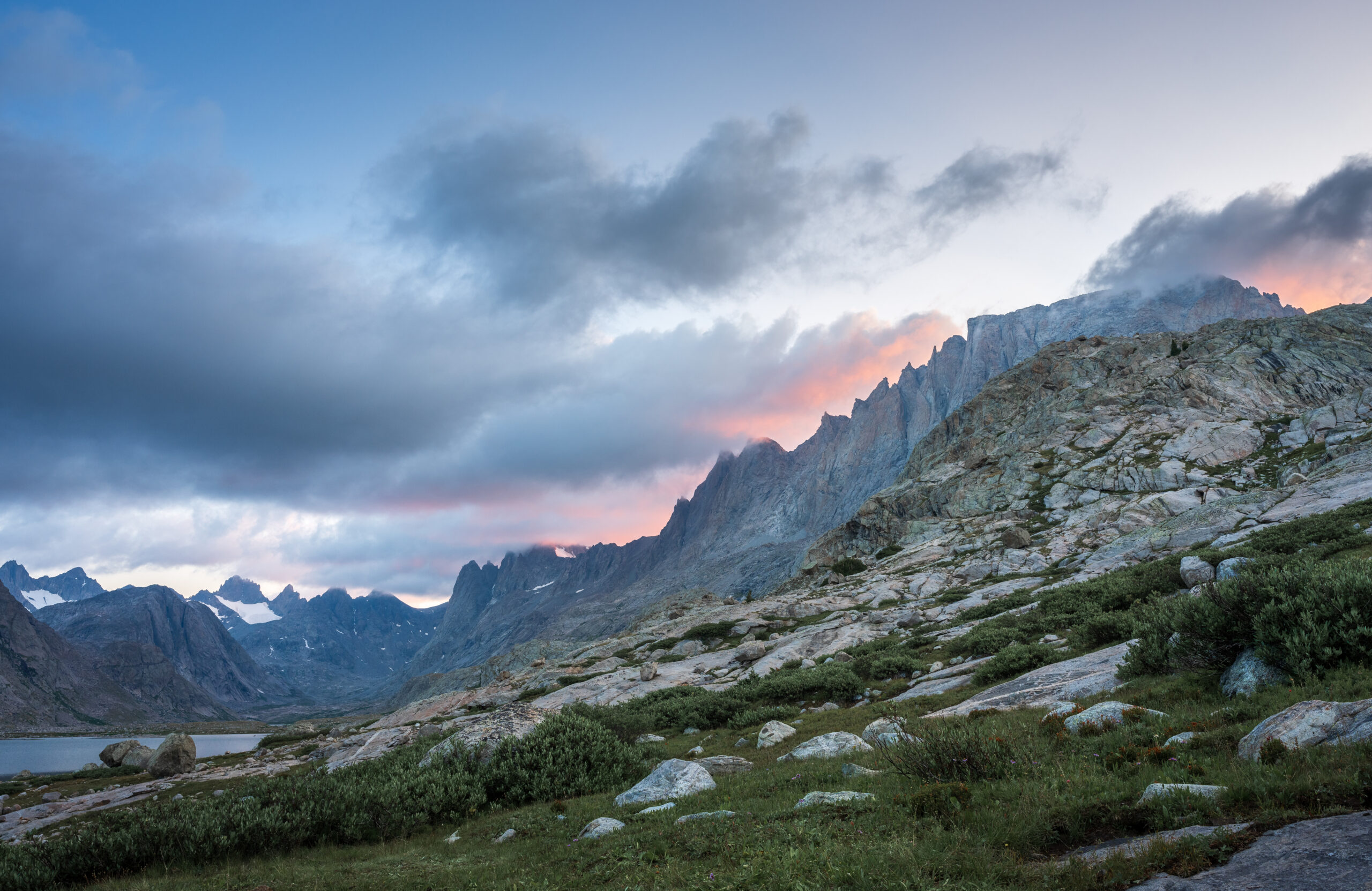
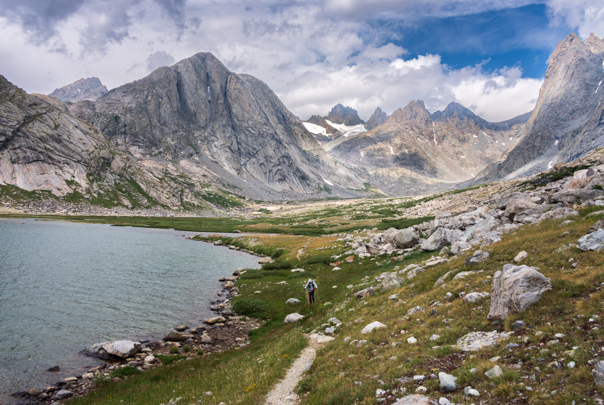
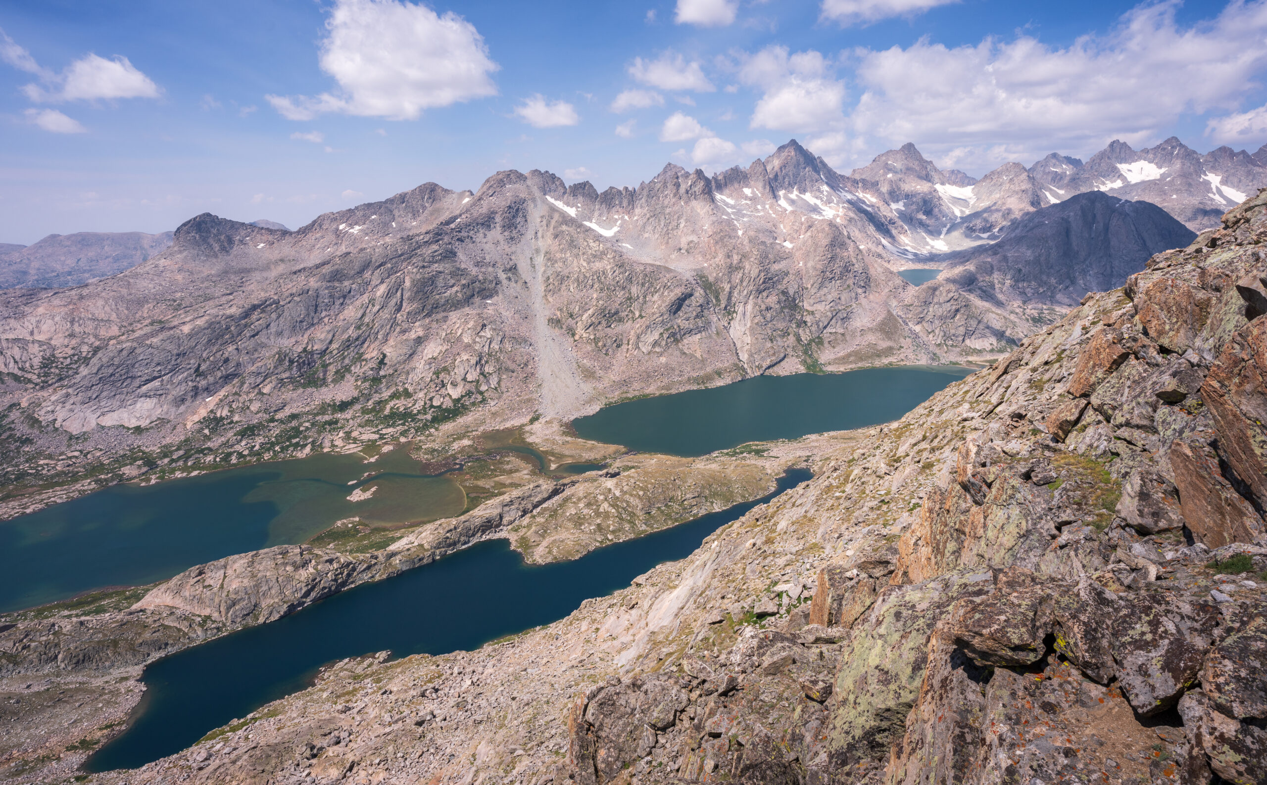
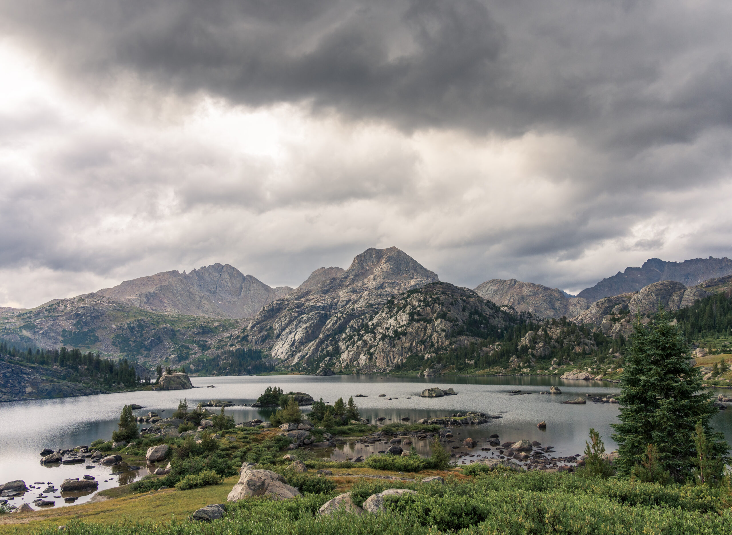
We packed up, hit the trail early, and made our way towards Indian Basin. Once in the basin, we passed the first of several lakes, perfectly still and reflecting the soft morning light on the mountains.

We headed towards Lake 10813 to set up camp at one of many lakes with unoriginal names identified them by their elevation in feet. On our way there, the sun broke through the clouds with a crepuscular ray (aka “god ray”) shining a spotlight on our destination.

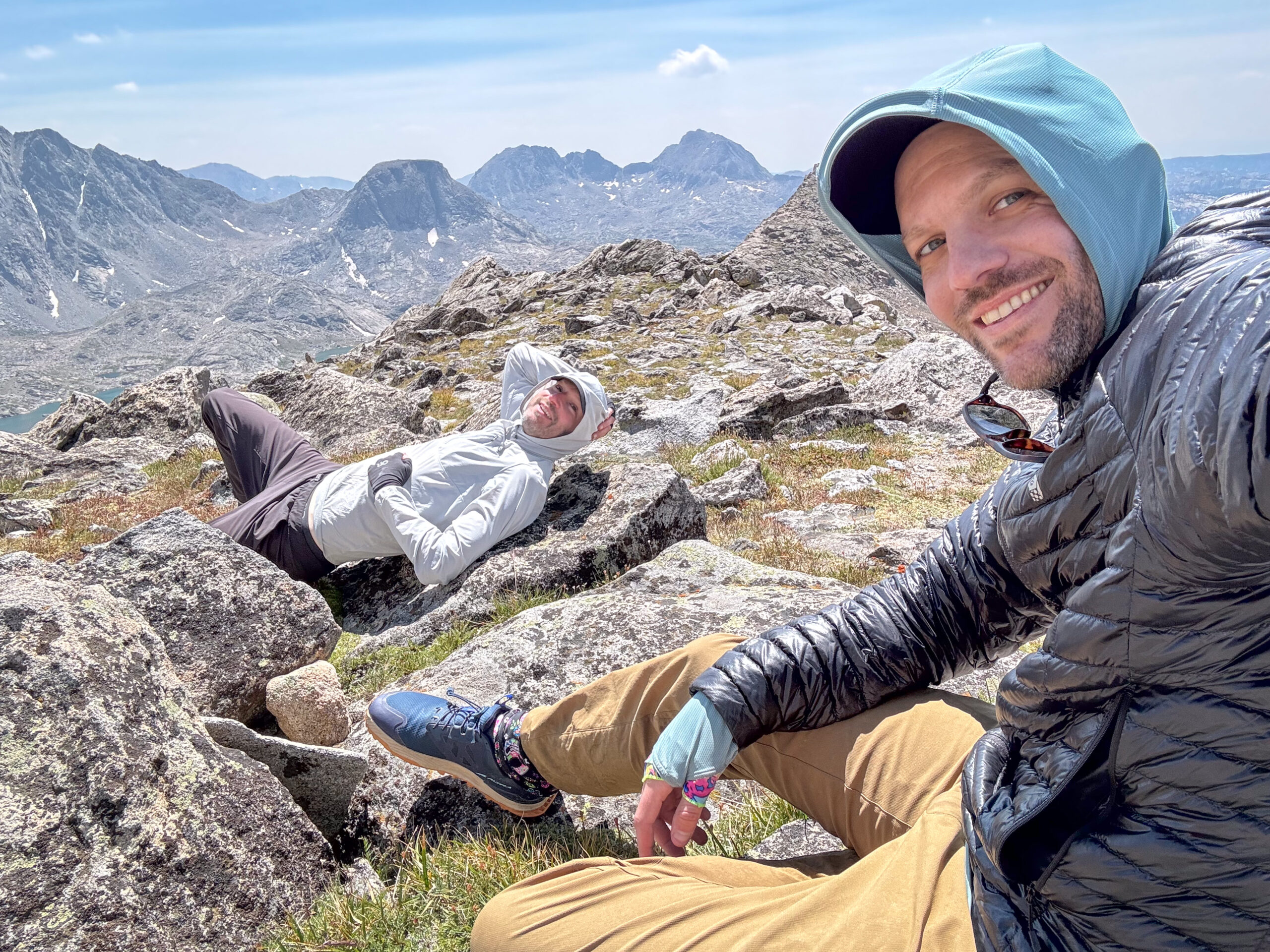
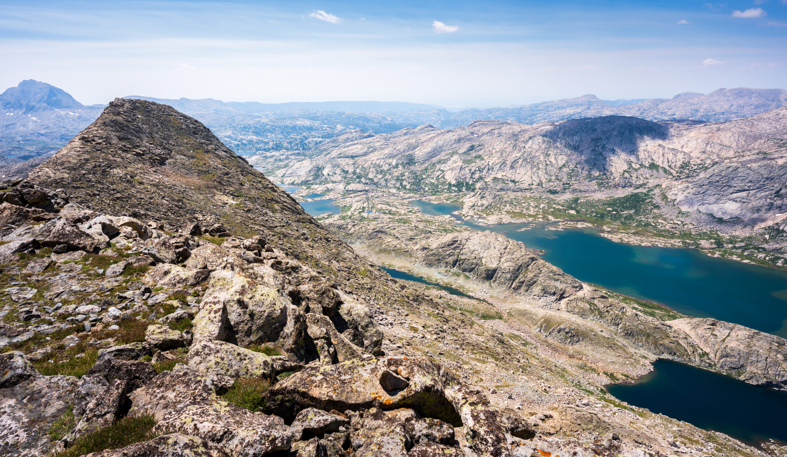
After setting up camp, we made our way towards Fremont Peak (13,751′) – the 2nd highest peak in the Winds 3rd and 3rd highest in Wyoming. It can be done as a steep Class 3 scramble. While our destination was the peak, we stopped at the saddle – elevation 12,020′ – which divides Titcomb Basin from Indian Basin.
From this saddle, the views were incredible. To the west, Summer Ice Lake was visible tucked between Henderson Peak, American Legion Peak, and Winifred Peak.
Immediately below to the west of the ridge were the Titcomb Lakes and Mistake Lake.

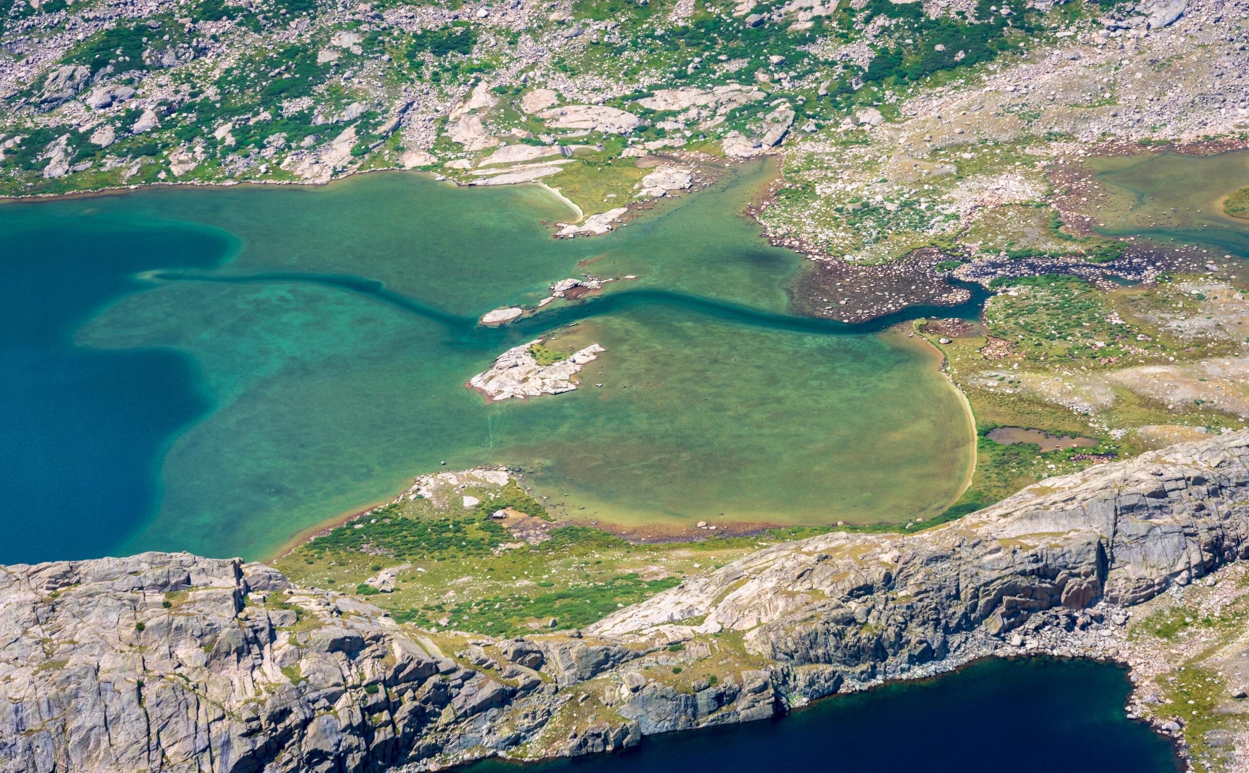
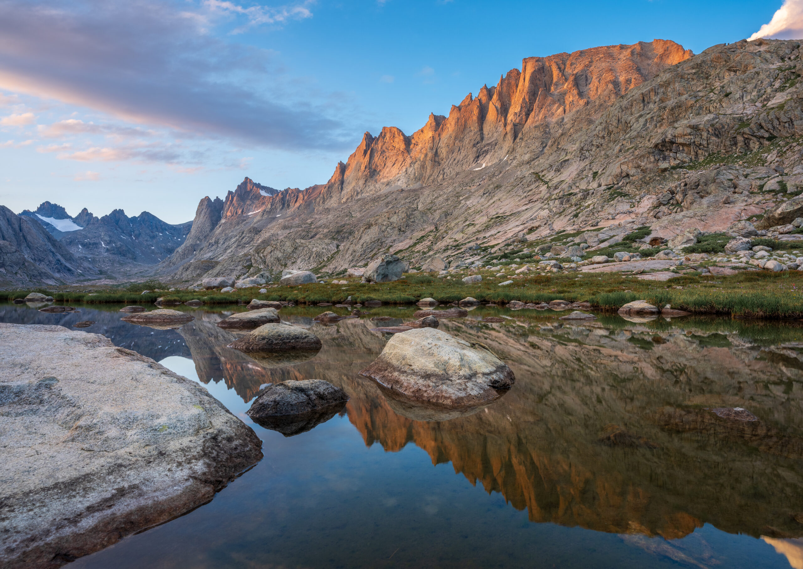
We turned around and headed back to camp. On the way there, we passed Lake 11008 flanked by Harrower Peak.
Back at camp at Lake 10813, we enjoyed watching Harrower Peak glow as the sun set.

Day 4
Today was an off-trail day, following a route described in Nancy Palliser’s Beyond Trails in the Wind River Mountains. Again, it rained overnight and we woke up to a few snow flakes, sleet, and a cold, rainy morning. We head out with a destination of Upper Cook Lake. Early on, we made a wrong turn (I’ll blame it on the rain) and ended up at Island Lake, so we had to backtrack.
Eventually, we made our way to Island-Wall Pass, which had a small snow field on the north side. Around this time, the rain finally stopped.

We continued past Wall Lake – including the crux requiring following cairns up a cliff and along a steep slope – and eventually reached Upper Cook Lake, where we found a great camp site near the shore.
While we had a bit of rain at camp and ominous clouds hovered above, fortunately we had a dry night.
Day 5
Our final day involved heading back to the Pole Creek Trailhead. We woke up early and hit the trail by 6:00am.
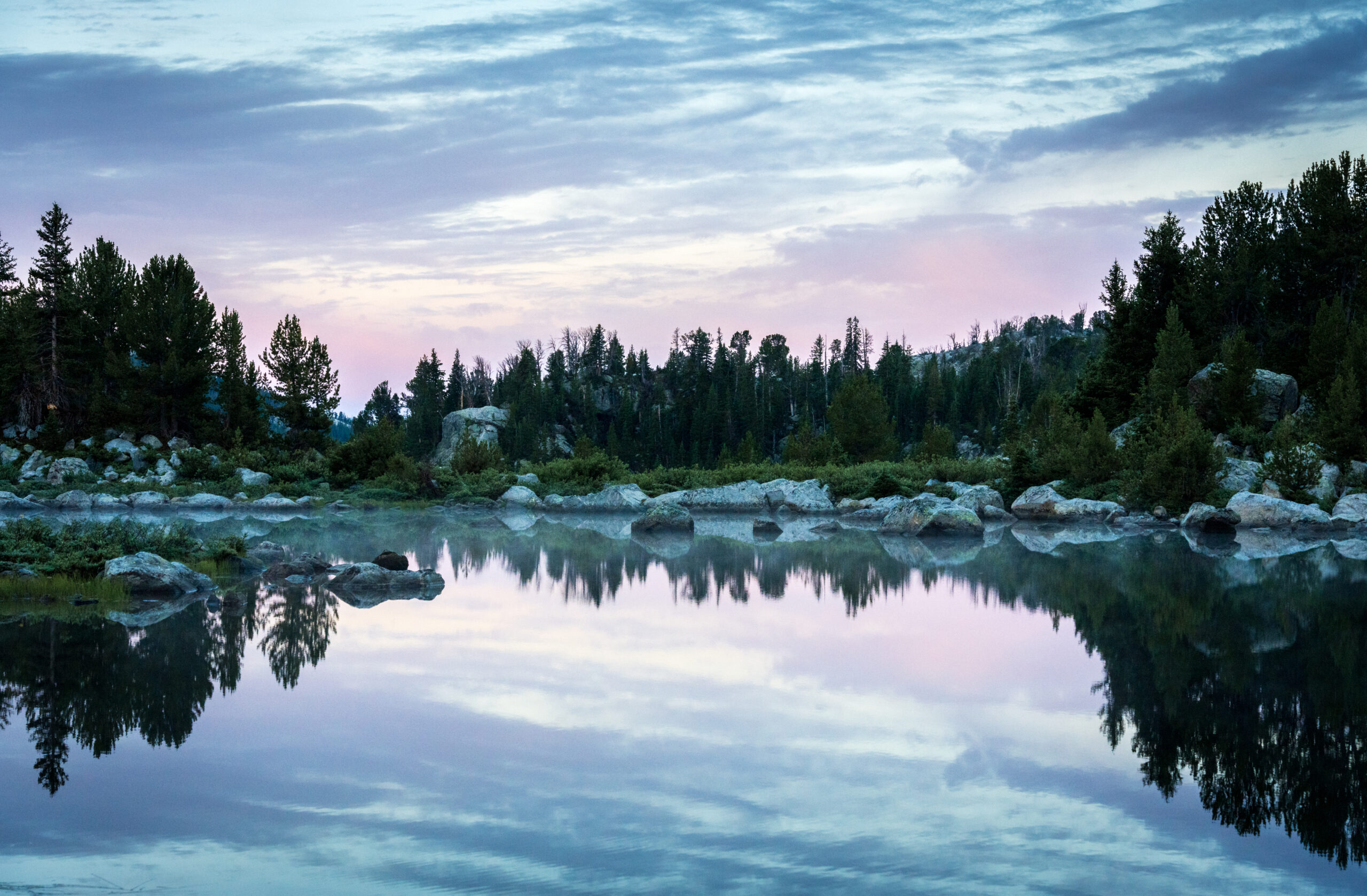
Sunrise was colorful and made for some nice morning reflections.
We waded across Pole Creek, which can be much deeper but was only about calf-deep.
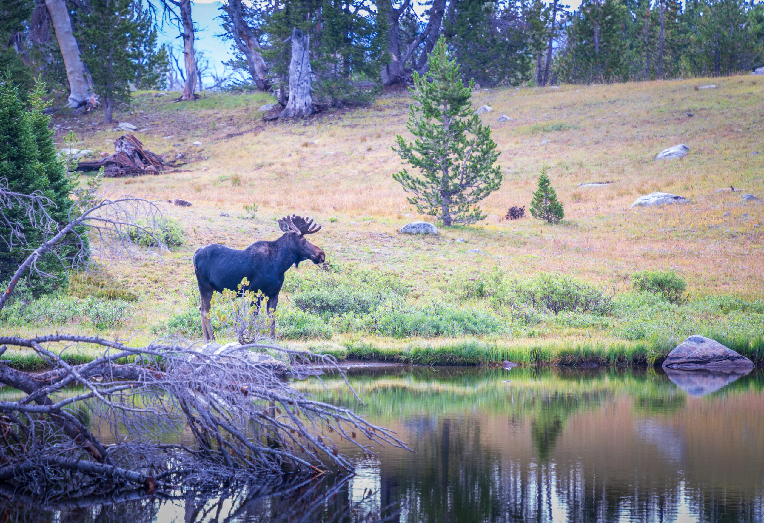
We then came across “Ghost,” a CDT SOBO thru-hiker who wanted to get off-trail for the day due to an incoming storm. Right at that moment, we saw a 4th moose next to a nearby pond.
Ghost was heading to the same trailhead we were going to, so we hiked back together and gave him and another thru-hiker a ride back to Pinedale. We dropped them off at the Jackalope, a great place to stay if you’re exploring the area. The owner was immensely helpful to us with some of the logistics we had to figure out. Thank you, Tyler!
We enjoyed beers and delicious lunch at the Wind River Brewing Company, where the logo looks similar to the view from our Indian Basin camp site (although perhaps from the other direction) – an observation I first saw made here.
After lunch, we drove north to spend a few days in Yellowstone.